
Payl:Agelaius phoeniceus 0123.JPG
Gidak-on ning maong paunang tan-aw: 800 x 533 ka mga piksel. Uban pang mga resoluyon: 320 x 213 ka mga piksel | 640 x 427 ka mga piksel | 1,024 x 683 ka mga piksel | 1,280 x 853 ka mga piksel | 2,560 x 1,707 ka mga piksel | 4,272 x 2,848 ka mga piksel.
Tibuok resolusyon (4,272 × 2,848 pixels, size sa payl: 3.29 MB, MIME type: image/jpeg)
Mubong sugid:
| Deskripsyon |
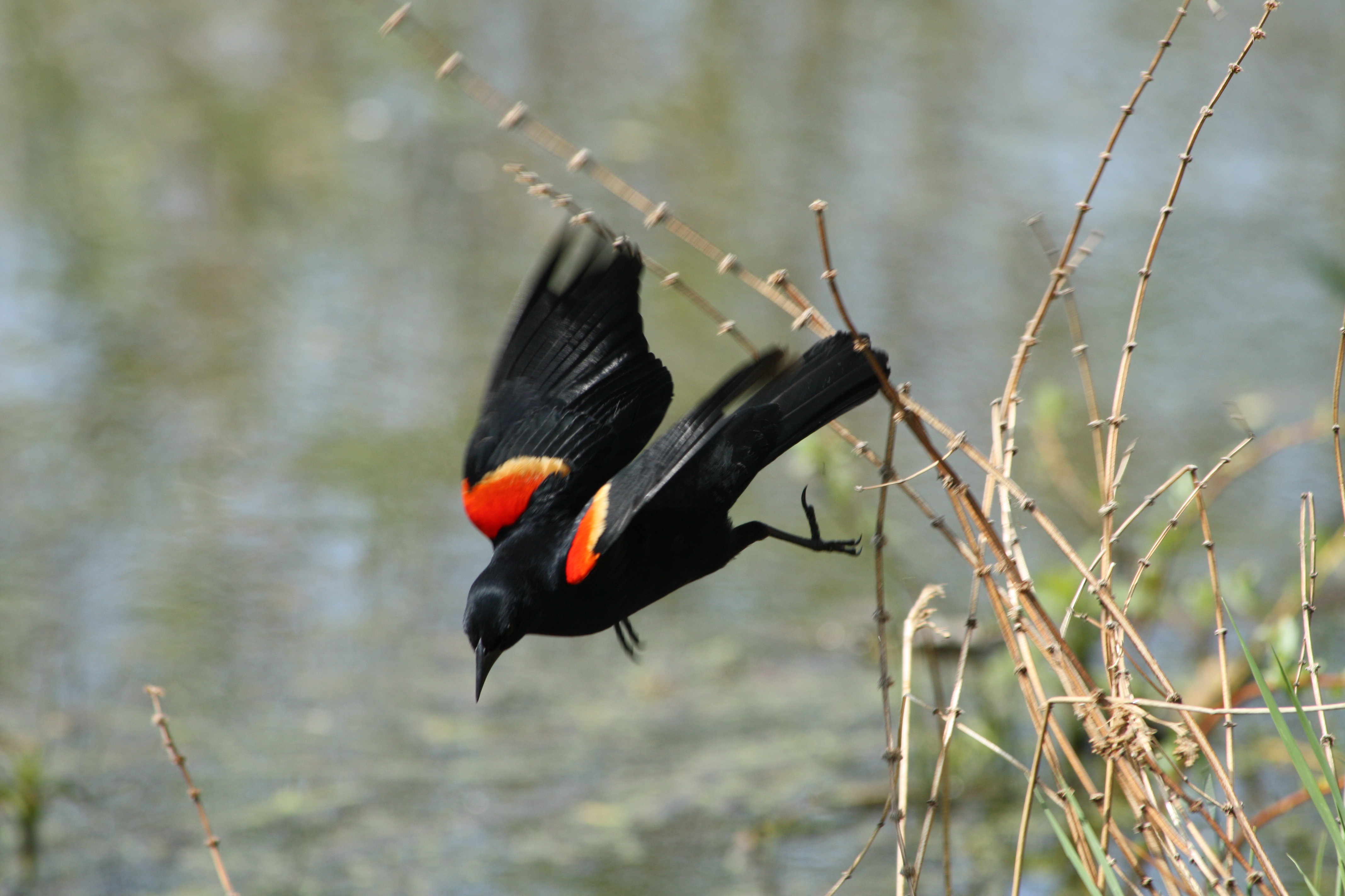
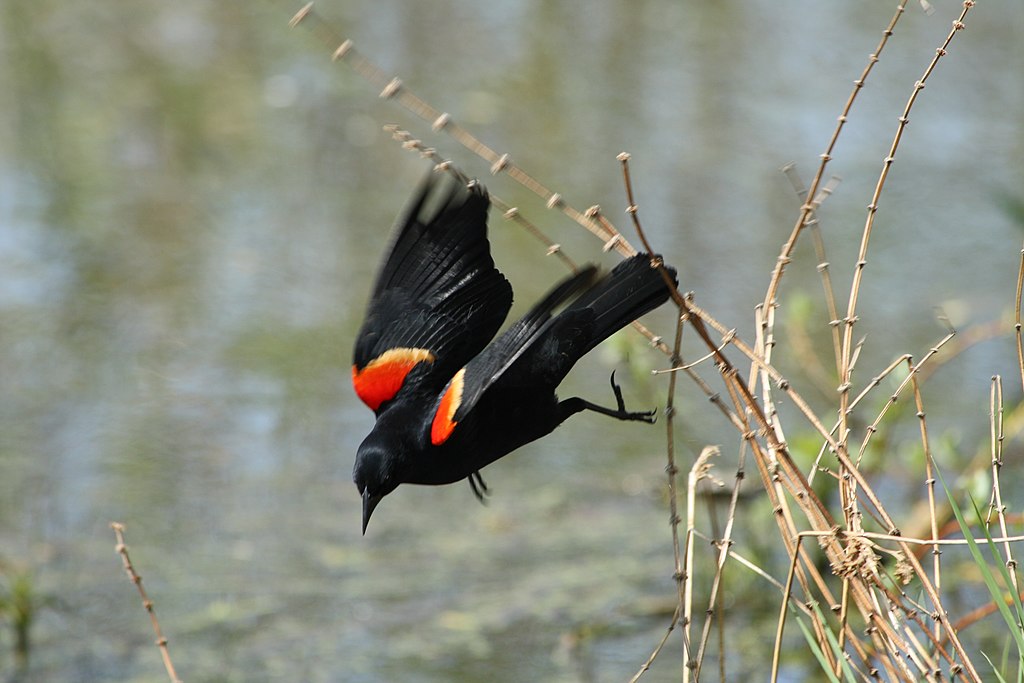
Agelaius phoeniceus English: Red-winged Blackbird male |
| Petsa | 25 Mayo 2008, 10:50:33 −07:00 |
| Gigikanan | Kaugalingong trabaho |
| Tagsulat | Walter Siegmund (talk) |
| Other versions |
|


| Camera location | | View this and other nearby images on: OpenStreetMap |
|---|
- Location source: Google Earth
- Location Datum: WGS84
- Viewpoint location: nature trail, Union Bay Natural Area
- Viewpoint elevation: 7 meter (23 ft)
- Camera: Canon EOS DIGITAL REBEL XSi
- Exposure Time: 1/400
- F Number: f/7.1
- Focal Length: 300.0
- ISO Speed Rating: 200
©2008 Walter Siegmund
Pagtugot
I, the copyright holder of this work, hereby publish it under the following licenses:

|
Gitugot ang pagkopya, pag-apud-apod o/ug pag-usab ning maong dokumento ubos sa mga termino sa GNU Free Documentation License, Version 1.2 o mas bag-ong bersiyon nga gimantala sa Free Software Foundation; nga walay Invariant Sections, walay Front-Cover Texts, ug walay Back-Cover Texts. Ang kopya sa lisensiya gilakip sa bahin nga giulohang GNU Free Documentation License. |
This file is licensed under the Creative Commons Attribution-Share Alike 3.0 Unported, 2.5 Generic, 2.0 Generic and 1.0 Generic license.
- Libre ka:
- sa pagsabwag – sa pagkopya, pag-apod-apod ug pagsabwag sa hinimo
- sa pag-remix – sa pag-adap sa binuhat
- Ubos sa mosunod nga mga kondisyon:
- atribusyon – Kinahanglan nimo nga hatagan ang angay nga kredito, maghatag usa ka link sa lisensya, ug ipakita kung adunay mga pagbag-o. Mahimo nimo kini buhaton sa bisan unsang makatarunganon nga paagi, apan dili sa bisan unsang paagi nga nagsugyot nga gi-endorso ka sa licensor o ang imong paggamit.
- share parehas – Kung imong gi-remix, gibag-o, o gibase sa materyal, kinahanglan nimo nga iapod-apod ang imong mga kontribusyon sa ilawom sa parehas o katugma nga lisensya sama sa orihinal.
You may select the license of your choice.
Kaagi sa payl
I-klik ang petsa/oras aron makit-an ang hulagway sa payl niadtong panahona.
| Petsa/Takna | Thumbnail | Mga dimensyon | Tiggamit | Komento | |
|---|---|---|---|---|---|
| kasamtangan | 03:21, 8 Hunyo 2008 | | 4,272 × 2,848 (3.29 MB) | Wsiegmund | {{Information |Description=nature trail, Union Bay Natural Area |Source=Own work |Date=2008:05:25 |Author=Walter Siegmund (talk) |Permission=Own work, attribution required (Multi-license with |
Mga paggamit sa payl
Ang mosunod nga mga panid misumpay niining payl:
Global nga paggamit sa payl
Kining ubang wiki naggamit ning maong payl:
- Paggamit sa en.wikipedia.org
- Paggamit sa en.wikibooks.org
- Paggamit sa en.wikinews.org
- Paggamit sa en.wikiquote.org
- Paggamit sa en.wikiversity.org
- Paggamit sa eo.wikipedia.org
- Paggamit sa es.wikipedia.org
- Paggamit sa fr.wikipedia.org
- Paggamit sa fr.wiktionary.org
- Paggamit sa hu.wikipedia.org
- Paggamit sa it.wikipedia.org
- Paggamit sa ku.wikipedia.org
- Paggamit sa pt.wikipedia.org
- Paggamit sa uk.wikipedia.org