
Payl:Belmont Ohio Historic District.jpg

Gidak-on ning maong paunang tan-aw: 800 x 571 ka mga piksel. Uban pang mga resoluyon: 320 x 228 ka mga piksel | 640 x 457 ka mga piksel | 1,024 x 731 ka mga piksel | 1,340 x 956 ka mga piksel.
Tibuok resolusyon (1,340 × 956 pixels, size sa payl: 172 KB, MIME type: image/jpeg)
|
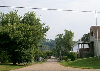
This is an image of a place or building that is listed on the National Register of Historic Places in the United States of America. Its reference number is 87000422. |
| Deskripsyon |
English: The Belmont Historic District as viewed from SR 147 |
| Petsa | (UTC) |
| Gigikanan | Kaugalingong trabaho (Original text: I (Bwsmith84 (talk)) created this work entirely by myself.) |
| Tagsulat | Bwsmith84 (talk) |
| Pagtugot (Paggamit pag-usab niini nga file) |
Bwsmith84 at English Wikipedya, the copyright holder of this work, hereby publishes it under the following license: This file is licensed under the Creative Commons Attribution 3.0 Unported license. Attribution: Bwsmith84 at English Wikipedya
|
| Object location | | View this and other nearby images on: OpenStreetMap |
|---|
Original upload log
Transferred from en.wikipedia to Commons by Sreejithk2000 using CommonsHelper.
The original description page was here. All following user names refer to en.wikipedia.
- 2009-08-28 01:16 Bwsmith84 1340×956× (176613 bytes) {{Information |Description = The Belmont Historic District as viewed from SR 147 |Source = I (~~~) created this work entirely by myself. |Date = ~~~~~ |Author = ~~~ |other_versions = }}
Kaagi sa payl
I-klik ang petsa/oras aron makit-an ang hulagway sa payl niadtong panahona.
| Petsa/Takna | Thumbnail | Mga dimensyon | Tiggamit | Komento | |
|---|---|---|---|---|---|
| kasamtangan | 09:35, 1 Hunyo 2010 | | 1,340 × 956 (172 KB) | File Upload Bot (Magnus Manske) | {{BotMoveToCommons|en.wikipedia|year={{subst:CURRENTYEAR}}|month={{subst:CURRENTMONTHNAME}}|day={{subst:CURRENTDAY}}}} {{Information |Description={{en|The Belmont Historic District as viewed from SR 147}} |Source=Transferred from [http://en.wikipedia.org |
Mga paggamit sa payl
Ang mosunod nga 2 panid misumpay niining payl:
Global nga paggamit sa payl
Kining ubang wiki naggamit ning maong payl:
- Paggamit sa ar.wikipedia.org
- Paggamit sa ca.wikipedia.org
- Paggamit sa cy.wikipedia.org
- Paggamit sa en.wikipedia.org
- Paggamit sa es.wikipedia.org
- Paggamit sa eu.wikipedia.org
- Paggamit sa fr.wikipedia.org
- Paggamit sa ht.wikipedia.org
- Paggamit sa it.wikipedia.org
- Paggamit sa lld.wikipedia.org
- Paggamit sa pl.wikipedia.org
- Paggamit sa pt.wikipedia.org
- Paggamit sa sr.wikipedia.org
- Paggamit sa sv.wikipedia.org
- Paggamit sa uk.wikipedia.org
- Paggamit sa vi.wikipedia.org
- Paggamit sa www.wikidata.org
- Paggamit sa zh-min-nan.wikipedia.org