
Payl:Relief Map of Latvia.jpg

Gidak-on ning maong paunang tan-aw: 800 x 504 ka mga piksel. Uban pang mga resoluyon: 320 x 202 ka mga piksel | 640 x 403 ka mga piksel | 1,200 x 756 ka mga piksel.
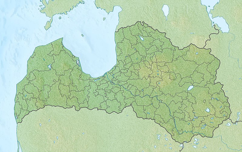
Tibuok resolusyon (1,200 × 756 pixels, size sa payl: 309 KB, MIME type: image/jpeg)
Mubong sugid:
| Deskripsyon |
English: Location map of Latvia Equirectangular projection, N/S stretching 170 %. Geographic limits of the map:
|
| Petsa | (UTC) |
| Gigikanan |
|
| Tagsulat |
|
| This is a retouched picture, which means that it has been digitally altered from its original version. The original can be viewed here: Latvia location map.svg:
|
Pagtugot
I, the copyright holder of this work, hereby publish it under the following licenses:
This file is licensed under the Creative Commons Attribution-Share Alike 3.0 Unported license.
- Libre ka:
- sa pagsabwag – sa pagkopya, pag-apod-apod ug pagsabwag sa hinimo
- sa pag-remix – sa pag-adap sa binuhat
- Ubos sa mosunod nga mga kondisyon:
- atribusyon – Kinahanglan nimo nga hatagan ang angay nga kredito, maghatag usa ka link sa lisensya, ug ipakita kung adunay mga pagbag-o. Mahimo nimo kini buhaton sa bisan unsang makatarunganon nga paagi, apan dili sa bisan unsang paagi nga nagsugyot nga gi-endorso ka sa licensor o ang imong paggamit.
- share parehas – Kung imong gi-remix, gibag-o, o gibase sa materyal, kinahanglan nimo nga iapod-apod ang imong mga kontribusyon sa ilawom sa parehas o katugma nga lisensya sama sa orihinal.

|
Gitugot ang pagkopya, pag-apud-apod o/ug pag-usab ning maong dokumento ubos sa mga termino sa GNU Free Documentation License, Version 1.2 o mas bag-ong bersiyon nga gimantala sa Free Software Foundation; nga walay Invariant Sections, walay Front-Cover Texts, ug walay Back-Cover Texts. Ang kopya sa lisensiya gilakip sa bahin nga giulohang GNU Free Documentation License. |
You may select the license of your choice.
Original upload log
This image is a derivative work of the following images:
- File:Latvia_location_map.svg licensed with Cc-by-sa-3.0, GFDL
- 2009-07-04T13:16:32Z Gleb Borisov 1305x822 (367838 Bytes) from July 1 the political map of Latvia is like that
- 2009-02-12T10:14:18Z NordNordWest 1305x822 (256639 Bytes) boundaries stay the same until July 2009
- 2008-12-31T17:54:15Z NordNordWest 1305x822 (367838 Bytes)
- 2008-08-29T08:07:14Z NordNordWest 1305x822 (256639 Bytes)
- 2008-07-17T21:18:06Z NordNordWest 652x411 (254520 Bytes) {{Information |Description= {{de|Positionskarte von [[:de:Lettland|Lettland]]}} Quadratische Plattkarte, N-S-Streckung 170 %. Geographische Begrenzung der Karte: * N: 58.5° N * S: 55.5° N * W: 20.5° O * O: 28.6° O {{en|Lo
Uploaded with derivativeFX
Kaagi sa payl
I-klik ang petsa/oras aron makit-an ang hulagway sa payl niadtong panahona.
| Petsa/Takna | Thumbnail | Mga dimensyon | Tiggamit | Komento | |
|---|---|---|---|---|---|
| kasamtangan | 17:32, 27 Nobiyembre 2010 | | 1,200 × 756 (309 KB) | Виктор В | {{Information |Description={{en|Location map of Latvia}} Equirectangular projection, N/S stretching 170 %. Geographic limits of the map: * N: 58.5° N * S: 55.5° N * W: 20.5° E * E: 28.6° E |Source=*[[:File:Latvia_location_map.svg|] |
Mga paggamit sa payl
Ang mosunod nga mga panid misumpay niining payl:
Global nga paggamit sa payl
Kining ubang wiki naggamit ning maong payl:
- Paggamit sa an.wikipedia.org
- Paggamit sa ar.wikipedia.org
- Paggamit sa ast.wikipedia.org
- Paggamit sa az.wikipedia.org
- Qauya Milli Parkı
- Şablon:Yer xəritəsi Latviya
- Kemeri Milli Parkı
- Doles yarımadası
- Kolkasraqs burnu
- Teyçi qoruğu
- Venta şəlaləsi
- Slitere Milli Parkı
- Lusavsala
- Latviyanın Milli Botanika Bağı
- Raznas Milli Parkı
- Şimali Vidzeme Biosfer Qoruğu
- Qutman mağarası
- Ventspils Beynəlxalq Radioastronomiya Mərkəzi
- Riqa SES
- Paggamit sa bn.wikipedia.org
- Paggamit sa bs.wikipedia.org
- Paggamit sa ca.wikipedia.org
- Paggamit sa ce.wikipedia.org
- Paggamit sa ckb.wikipedia.org
- Paggamit sa cs.wikipedia.org
- Paggamit sa da.wikipedia.org
- Paggamit sa el.wikipedia.org
- Paggamit sa en.wikipedia.org
View more global usage of this file.