
Payl:Saint-Martin collectivity location map.svg

Size of this PNG preview of this SVG file: 800 x 578 ka mga piksel. Uban pang mga resoluyon: 320 x 231 ka mga piksel | 640 x 462 ka mga piksel | 1,024 x 740 ka mga piksel | 1,280 x 925 ka mga piksel | 2,560 x 1,850 ka mga piksel | 1,175 x 849 ka mga piksel.
Tibuok resolusyon (SVG nga payl, nominally 1,175 × 849 pixels, size sa payl: 182 KB)
Mubong sugid:
| Camera location | | View this and other nearby images on: OpenStreetMap |
|---|
| Deskripsyon |
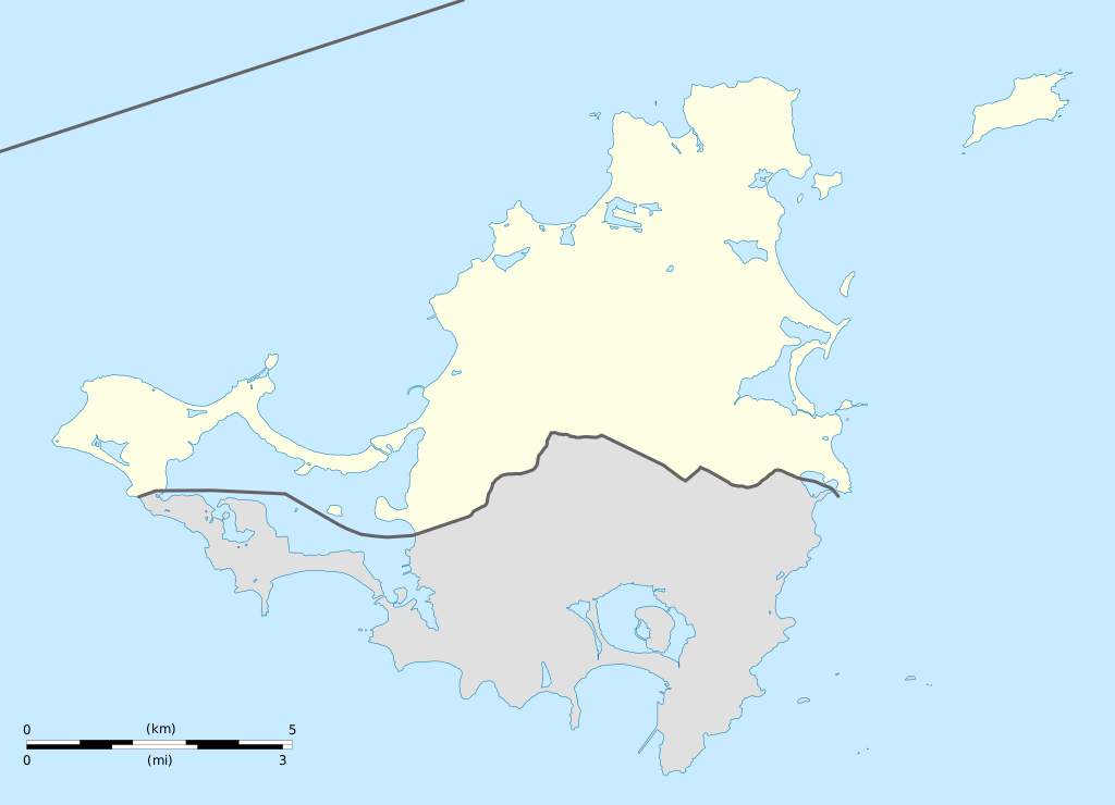
English: Blank administrative map of the overseas collectivity of Saint Martin, France, for geo-location purpose.
Français : Carte administrative vierge de la collectivité d'outre-mer de Saint-Martin, France, destinée à la géolocalisation. Estimated scale: 1:200,000 (precision: 50 m)
Geographic limits of the map:
|
||
| Petsa | |||
| Gigikanan |
Kaugalingong trabaho
|
||
| Tagsulat | Eric Gaba (Sting - fr:Sting) | ||
| Pagtugot (Paggamit pag-usab niini nga file) |
|
||
| Other versions |
|


Pagtugot
I, the copyright holder of this work, hereby publish it under the following licenses:
This file is licensed under the Creative Commons Attribution-Share Alike 3.0 Unported license.
- Libre ka:
- sa pagsabwag – sa pagkopya, pag-apod-apod ug pagsabwag sa hinimo
- sa pag-remix – sa pag-adap sa binuhat
- Ubos sa mosunod nga mga kondisyon:
- atribusyon – Kinahanglan nimo nga hatagan ang angay nga kredito, maghatag usa ka link sa lisensya, ug ipakita kung adunay mga pagbag-o. Mahimo nimo kini buhaton sa bisan unsang makatarunganon nga paagi, apan dili sa bisan unsang paagi nga nagsugyot nga gi-endorso ka sa licensor o ang imong paggamit.
- share parehas – Kung imong gi-remix, gibag-o, o gibase sa materyal, kinahanglan nimo nga iapod-apod ang imong mga kontribusyon sa ilawom sa parehas o katugma nga lisensya sama sa orihinal.

|
Gitugot ang pagkopya, pag-apud-apod o/ug pag-usab ning maong dokumento ubos sa mga termino sa GNU Free Documentation License, Version 1.2 o mas bag-ong bersiyon nga gimantala sa Free Software Foundation; nga walay Invariant Sections, walay Front-Cover Texts, ug walay Back-Cover Texts. Ang kopya sa lisensiya gilakip sa bahin nga giulohang GNU Free Documentation License. |
You may select the license of your choice.
Kaagi sa payl
I-klik ang petsa/oras aron makit-an ang hulagway sa payl niadtong panahona.
| Petsa/Takna | Thumbnail | Mga dimensyon | Tiggamit | Komento | |
|---|---|---|---|---|---|
| kasamtangan | 19:42, 17 Enero 2009 | | 1,175 × 849 (182 KB) | Sting | == Summary == {{Location|18|04|07|N|63|03|45|W|scale:100000}} <br/> {{Information |Description={{en|Blank administrative map of the overseas collectivity of Saint Martin, France, f |
Mga paggamit sa payl
More than 100 pages use this file. The following list shows the first 100 pages that use this file only. A full list is available.
- Babit Point
- Baie Blanche
- Baie Blanche (luuk sa San Martin)
- Baie Flamand
- Baie Grande Case
- Baie Lucas
- Baie Maria
- Baie Nettlé
- Baie Orientale
- Baie Rouge
- Baie Rouge (luuk sa San Martin)
- Baie de la Potence
- Baie du Marigot
- Baie du Marigot (luuk sa San Martin)
- Basse Espagnole
- Bell Hill
- Bell Hill (bungtod sa San Martin)
- Bell Point
- Bell Point (punta sa San Martin)
- Caye Verte
- Coconut Grove
- Colline Nettlé
- Concordia Hill
- Concordia Hill (bungtod)
- Crocus Hill
- Diamant
- Eastern Point
- Eastern Point (punta sa San Martin)
- Falaise des Oiseaux
- First-Stick Hill
- Flagstaff
- Flagstaff (bukid sa San Martin)
- Grand Îlet
- Grand Îlet (pulo sa San Martin)
- Grandes Cayes
- Green Cay
- Hope Hill
- La Batterie
- La Selle
- Lac Simpson
- Lac Simson
- Le Paradis
- Le Selle
- Marigot
- Marigot (ulohang dakbayan)
- Marigot Hill
- Mont Chambord
- Mont Fortune
- Mont Fortune (bungtod sa San Martin)
- Mont O'Reilly
- Mont Vernon
- Mont de Lake
- Mont de Marigot
- Mont des Accords
- Mont des Accords (bungtod sa San Martin)
- Montagne Caréta
- Montagne France
- Montagne Ronde
- Morne Rond
- Morne Valois
- Morne aux Cabris
- Mount Rouge
- Mount Rouge (bungtod sa San Martin)
- Orient Beach
- Petite Plage
- Petites Cayes
- Pic du Paradis
- Pointe Arago
- Pointe Bluff
- Pointe Falaise
- Pointe Falaise (punta sa San Martin)
- Pointe La Cale
- Pointe Molly Smith
- Pointe Noire
- Pointe Noire (punta sa San Martin)
- Pointe Nord
- Pointe Nord (punta sa San Martin)
- Pointe Plum
- Pointe de la Coste
- Pointe des Froussards
- Pointe des Pierres à Chaux
- Pointe du Bluff
- Pointe du Bluff (punta sa San Martin)
- Pointe du Canonnier
- Port de Galisbay
- Péninsule des Terres Basses
- Red Hill
- Red Rock
- Red Rock (bungtod sa San Martin)
- Saint-Martin (pagklaro)
- Saint Martin (pagklaro)
- Salines d'Orient
- Salines de Grand'Case
- Simson Baai Lagoen
- Sint Maarten (pagklaro)
- Spaniard Rock
- Île Charlotte
- Île Frégate
- Île Tintamarre
- Îlet Pinel
View more links to this file.
Global nga paggamit sa payl
Kining ubang wiki naggamit ning maong payl:
- Paggamit sa af.wikipedia.org
- Paggamit sa als.wikipedia.org
- Paggamit sa an.wikipedia.org
- Paggamit sa ar.wikipedia.org
- Paggamit sa ast.wikipedia.org
- Paggamit sa be-tarask.wikipedia.org
- Paggamit sa bg.wikipedia.org
- Paggamit sa bn.wikipedia.org
- Paggamit sa bs.wikipedia.org
- Paggamit sa ckb.wikipedia.org
- Paggamit sa cs.wikipedia.org
- Paggamit sa da.wikipedia.org
- Paggamit sa de.wikipedia.org
- Paggamit sa de.wikivoyage.org
- Paggamit sa el.wikipedia.org
- Paggamit sa en.wikipedia.org
- Paggamit sa eo.wikipedia.org
- Paggamit sa es.wikipedia.org
- Paggamit sa fa.wikipedia.org
- Paggamit sa frr.wikipedia.org
- Paggamit sa fr.wikipedia.org
View more global usage of this file.