
Payl:Strathoykel at Tuiteam Tarbhach.jpg

Gidak-on ning maong paunang tan-aw: 800 x 598 ka mga piksel. Uban pang mga resoluyon: 320 x 239 ka mga piksel | 640 x 479 ka mga piksel | 1,024 x 766 ka mga piksel | 1,280 x 958 ka mga piksel | 2,560 x 1,915 ka mga piksel | 2,866 x 2,144 ka mga piksel.
Tibuok resolusyon (2,866 × 2,144 pixels, size sa payl: 2.66 MB, MIME type: image/jpeg)
Mubong sugid:
| Deskripsyon |
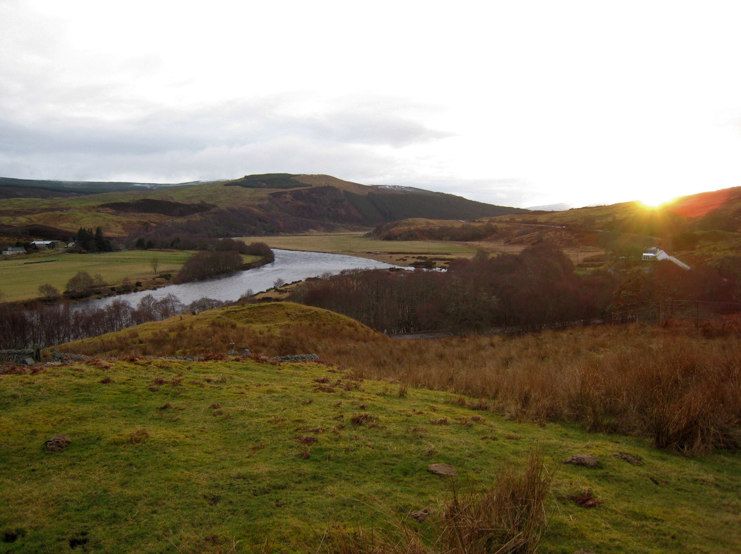
English: View of Strathoykel in northern Scotland looking west (upstream) from Tutim cemetery at sunset. The cemetery wall is in the foreground, Brae farm on the left of the photo, and Tuiteam house on the right. The mouth of the Tutim Burn can be seen entering the River Oykel roughly level with Tuiteam house. The hill is Ben Chreagach. The site is notable for the en:Battle of Tuiteam Tarbhach which took place around Tuiteam house in about 1406. |
| Petsa | |
| Gigikanan | Kaugalingong trabaho |
| Tagsulat | Le Deluge |
| Camera location | | View this and other nearby images on: OpenStreetMap |
|---|
Pagtugot
I, the copyright holder of this work, hereby publish it under the following license:
This file is licensed under the Creative Commons Attribution-Share Alike 3.0 Unported license.
- Libre ka:
- sa pagsabwag – sa pagkopya, pag-apod-apod ug pagsabwag sa hinimo
- sa pag-remix – sa pag-adap sa binuhat
- Ubos sa mosunod nga mga kondisyon:
- atribusyon – Kinahanglan nimo nga hatagan ang angay nga kredito, maghatag usa ka link sa lisensya, ug ipakita kung adunay mga pagbag-o. Mahimo nimo kini buhaton sa bisan unsang makatarunganon nga paagi, apan dili sa bisan unsang paagi nga nagsugyot nga gi-endorso ka sa licensor o ang imong paggamit.
- share parehas – Kung imong gi-remix, gibag-o, o gibase sa materyal, kinahanglan nimo nga iapod-apod ang imong mga kontribusyon sa ilawom sa parehas o katugma nga lisensya sama sa orihinal.
Kaagi sa payl
I-klik ang petsa/oras aron makit-an ang hulagway sa payl niadtong panahona.
| Petsa/Takna | Thumbnail | Mga dimensyon | Tiggamit | Komento | |
|---|---|---|---|---|---|
| kasamtangan | 03:31, 15 Marso 2009 | | 2,866 × 2,144 (2.66 MB) | Le Deluge | {{Information |Description={{en|1=View of Strathoykel in northern Scotland looking west (upstream) from Tutim cemetery at sunset. The cemetery wall is in the foreground, Brae farm on the left of the photo, and Tuiteam house on the right. The mouth of the |
Mga paggamit sa payl
Ang mosunod nga mga panid misumpay niining payl:
Global nga paggamit sa payl
Kining ubang wiki naggamit ning maong payl:
- Paggamit sa ca.wikipedia.org
- Paggamit sa en.wikipedia.org
- Paggamit sa gd.wikipedia.org
- Paggamit sa www.wikidata.org