
Payl:Txu-oclc-224571178-se19-10 (Condoriri).jpg

Gidak-on ning maong paunang tan-aw: 800 x 494 ka mga piksel. Uban pang mga resoluyon: 320 x 197 ka mga piksel | 640 x 395 ka mga piksel | 851 x 525 ka mga piksel.
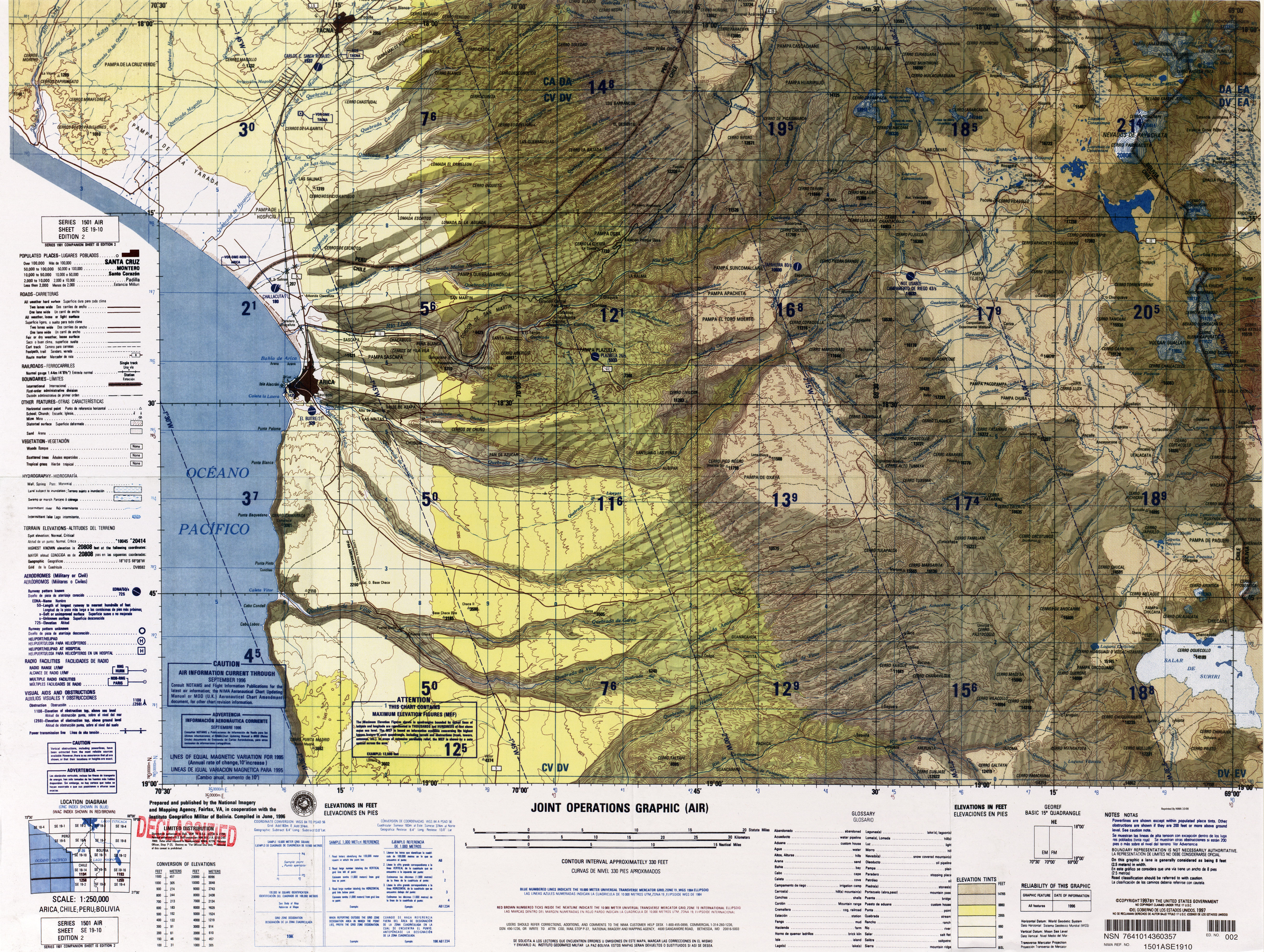
Tibuok resolusyon (851 × 525 pixels, size sa payl: 257 KB, MIME type: image/jpeg)
Mubong sugid:
| Deskripsyon |
English: Arica, Tacna |
|||
| Gigikanan | http://www.lib.utexas.edu/maps/jog/latin_america/txu-oclc-224571178-se19-10.jpg | |||
| Tagsulat | This work is in the public domain in the United States because it is a work of the United States Federal Government under the terms of 17 U.S.C. § 105. See Copyright. | |||
| Pagtugot (Paggamit pag-usab niini nga file) |
|
|||
| Other versions | Derivative works of this file: Canal-lauca.jpg |


.jpg)
Kaagi sa payl
I-klik ang petsa/oras aron makit-an ang hulagway sa payl niadtong panahona.
| Petsa/Takna | Thumbnail | Mga dimensyon | Tiggamit | Komento | |
|---|---|---|---|---|---|
| kasamtangan | 20:05, 11 Nobiyembre 2018 | | 851 × 525 (257 KB) | Jo-Jo Eumerus | File:Txu-oclc-224571178-se19-10.jpg cropped 84 % horizontally, 87 % vertically using CropTool with precise mode. |
Mga paggamit sa payl
Ang mosunod nga mga panid misumpay niining payl:
Global nga paggamit sa payl
Kining ubang wiki naggamit ning maong payl:
- Paggamit sa arz.wikipedia.org
- Paggamit sa en.wikipedia.org
- Paggamit sa es.wikipedia.org
- Paggamit sa eu.wikipedia.org
- Paggamit sa www.wikidata.org
.jpg)