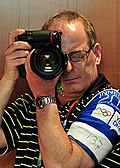
Payl:15-08-14-Tallinn-RalfR-107.jpg

Page contents not supported in other languages.
Gikan sa Wikipedia, ang gawasnong ensiklopedya

Tibuok resolusyon(4,288 × 2,848 pixels, size sa payl: 9.9 MB, MIME type: image/jpeg)

Kining maong payl gikan sa Wikimedia Commons ug mahimong gigamit sa ubang proyekto. Ang deskripsyon niini didto gipakita sa ubos.

Mubong sugid:

Deskripsyon
Deutsch: Tallinn
Wikimedia Österreich

The making of this work was supported by Wikimedia Austria.

For other files made with the support of Wikimedia Austria, please see the category Supported by Wikimedia Österreich.

Petsa
Gigikanan Kaugalingong trabaho
Tagsulat

© Ralf Roletschek

Ralf Roletschek  (1963–)  wikidata:Q15080600
 
Ralf Roletschek
Description German civil engineer ug photographer
Date of birth 1963 Edit this at Wikidata
Location of birth Eberswalde (kapital sa distrito)
Work period from 1979
date QS:P,+1979-00-00T00:00:00Z/7,P580,+1979-00-00T00:00:00Z/9
Work location
Barcelona, Wien, Eberswalde
Authority file
creator QS:P170,Q15080600
Pagtugot
(Paggamit pag-usab niini nga file)
Ralf Roletschek  (1963–)  wikidata:Q15080600
 
Ralf Roletschek
Description German civil engineer ug photographer
Date of birth 1963 Edit this at Wikidata
Location of birth Eberswalde (kapital sa distrito)
Work period from 1979
date QS:P,+1979-00-00T00:00:00Z/7,P580,+1979-00-00T00:00:00Z/9
Work location
Barcelona, Wien, Eberswalde
Authority file
creator QS:P170,Q15080600
GNU head Permission is granted to copy, distribute and/or modify this document under the terms of the GNU Free Documentation License, Version 1.2 only as published by the Free Software Foundation; with no Invariant Sections, no Front-Cover Texts, and no Back-Cover Texts. A copy of the license is included in the section entitled GNU Free Documentation License. 1.2 only
Camera location59° 22′ 30.66″ N, 24° 47′ 11.56″ E Kartographer map based on OpenStreetMap.View this and other nearby images on: OpenStreetMapinfo

Captions

Add a one-line explanation of what this file represents

Items portrayed in this file

depicts English

copyrighted English

59°22'30.65999"N, 24°47'11.56200"E

15 Agosto 2014

captured with English

Nikon D300S English

media type English

image/jpeg

checksum English

a3c81271e4f1368eb1167ba770ca0dd9680e9f30

determination method English: SHA-1 English

data size English

10,382,063 byte

height English

2,848 pixel

width English

4,288 pixel

Kaagi sa payl

I-klik ang petsa/oras aron makit-an ang hulagway sa payl niadtong panahona.

Petsa/TaknaThumbnailMga dimensyonTiggamitKomento
kasamtangan19:12, 15 Nobiyembre 2014Thumbnail sa bersyon sa 19:12, 15 Nobiyembre 20144,288 × 2,848 (9.9 MB)Ralf Roletschek

Ang mosunod nga mga panid misumpay niining payl:

Global nga paggamit sa payl

Kining ubang wiki naggamit ning maong payl:

  • Paggamit sa en.wikipedia.org
  • Paggamit sa es.wikipedia.org
  • Paggamit sa et.wikipedia.org
  • Paggamit sa fr.wikipedia.org
  • Paggamit sa hy.wikipedia.org
  • Paggamit sa pl.wikipedia.org
  • Paggamit sa sv.wikipedia.org
  • Paggamit sa www.wikidata.org

Metadata