
Payl:2013-10-06 Stone Bridge, Prizren, Kosovo 8649.jpg

Gidak-on ning maong paunang tan-aw: 800 x 531 ka mga piksel. Uban pang mga resoluyon: 320 x 212 ka mga piksel | 640 x 424 ka mga piksel | 1,024 x 679 ka mga piksel | 1,280 x 849 ka mga piksel | 2,560 x 1,698 ka mga piksel | 5,038 x 3,341 ka mga piksel.
Tibuok resolusyon (5,038 × 3,341 pixels, size sa payl: 4.29 MB, MIME type: image/jpeg)
Mubong sugid:
| Deskripsyon |
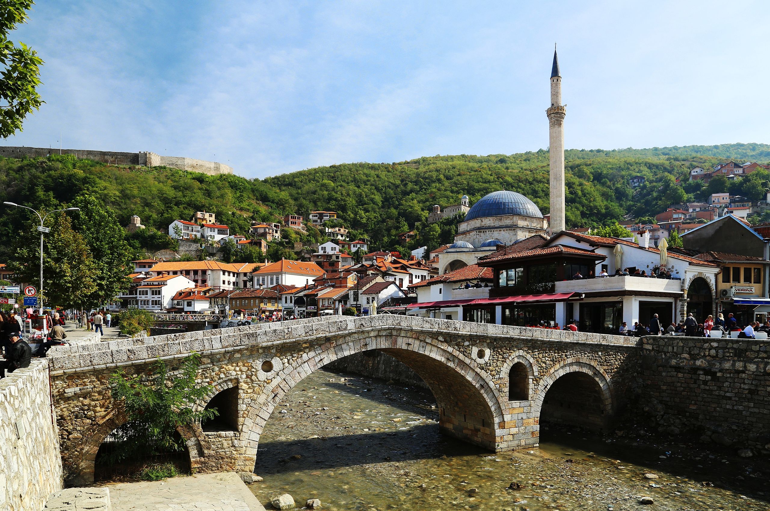
English: The Old Stone Bridge (alb. Ura e gurit; serb. Камеңи мост/Kameni most; turk. Taş köprüsu) is an Ottoman bridge and one of the landmarks of Prizren, Kosovo. It crosses the Prizrenska Bistrica (alb. Lumëbardh) river and is suspected to be from the late fifteenth century, although there are only few historical sources. The photograph displays the bridge, with the Sinan Pasha Mosque clearly being visible in the background. On the left side of the photo, the outer wall of Kaljaja, Prizren's Fortress can be seen. |
| Petsa | |
| Gigikanan | Kaugalingong trabaho |
| Tagsulat |
Tobias Klenze Deutsch: Weiterverwendung gemäß Lizenz mit dem folgenden Hinweis möglich:
Bild: Wikipedia / Tobias Klenze / CC-BY-SA 4.0. Die Lizenz muss verlinkt werden!English: You may re-use this image under the terms of the license using the following reference: Image: Wikipedia / Tobias Klenze / CC-BY-SA 4.0. The license must be a link! |
| Camera location | | View this and other nearby images on: OpenStreetMap |
|---|
Pagtugot
I, the copyright holder of this work, hereby publish it under the following licenses:

|
Gitugot ang pagkopya, pag-apud-apod o/ug pag-usab ning maong dokumento ubos sa mga termino sa GNU Free Documentation License, Version 1.2 o mas bag-ong bersiyon nga gimantala sa Free Software Foundation; nga walay Invariant Sections, walay Front-Cover Texts, ug walay Back-Cover Texts. Ang kopya sa lisensiya gilakip sa bahin nga giulohang GNU Free Documentation License. |
This file is licensed under the Creative Commons Attribution 3.0 Unported license.
- Libre ka:
- sa pagsabwag – sa pagkopya, pag-apod-apod ug pagsabwag sa hinimo
- sa pag-remix – sa pag-adap sa binuhat
- Ubos sa mosunod nga mga kondisyon:
- atribusyon – Kinahanglan nimo nga hatagan ang angay nga kredito, maghatag usa ka link sa lisensya, ug ipakita kung adunay mga pagbag-o. Mahimo nimo kini buhaton sa bisan unsang makatarunganon nga paagi, apan dili sa bisan unsang paagi nga nagsugyot nga gi-endorso ka sa licensor o ang imong paggamit.
You may select the license of your choice.
Kaagi sa payl
I-klik ang petsa/oras aron makit-an ang hulagway sa payl niadtong panahona.
| Petsa/Takna | Thumbnail | Mga dimensyon | Tiggamit | Komento | |
|---|---|---|---|---|---|
| kasamtangan | 11:36, 25 Enero 2014 | | 5,038 × 3,341 (4.29 MB) | Church of emacs | cropped just a tiny bit at the bottom; + a tiny bit of JPG compression to get the filesize down |
| 11:07, 25 Enero 2014 |  | 5,040 × 3,423 (12 MB) | Church of emacs | perspective correction | |
| 10:45, 25 Enero 2014 |  | 5,427 × 3,537 (11.15 MB) | Church of emacs | sharpened a bit | |
| 10:39, 25 Enero 2014 |  | 5,427 × 3,537 (4.4 MB) | Church of emacs |
Mga paggamit sa payl
Ang mosunod nga 2 panid misumpay niining payl:
Global nga paggamit sa payl
Kining ubang wiki naggamit ning maong payl:
- Paggamit sa arz.wikipedia.org
- Paggamit sa ba.wikipedia.org
- Paggamit sa be.wikipedia.org
- Paggamit sa br.wikipedia.org
- Paggamit sa cs.wikipedia.org
- Paggamit sa da.wikipedia.org
- Paggamit sa de.wikipedia.org
- Paggamit sa de.wikivoyage.org
- Paggamit sa en.wikipedia.org
- Paggamit sa en.wikivoyage.org
- Paggamit sa eo.wikipedia.org
- Paggamit sa gl.wikipedia.org
- Paggamit sa hr.wikipedia.org
- Paggamit sa lb.wikipedia.org
- Paggamit sa lt.wiktionary.org
- Paggamit sa lv.wikipedia.org
- Paggamit sa pl.wikipedia.org
- Paggamit sa pl.wikivoyage.org
- Paggamit sa ru.wikipedia.org
- Paggamit sa sq.wikipedia.org
- Paggamit sa sr.wikipedia.org
- Paggamit sa vo.wikipedia.org
- Paggamit sa www.wikidata.org