
Payl:Bedfordshire UK location map.svg

Size of this PNG preview of this SVG file: 530 x 599 ka mga piksel. Uban pang mga resoluyon: 212 x 240 ka mga piksel | 425 x 480 ka mga piksel | 679 x 768 ka mga piksel | 906 x 1,024 ka mga piksel | 1,812 x 2,048 ka mga piksel | 1,120 x 1,266 ka mga piksel.
Tibuok resolusyon (SVG nga payl, nominally 1,120 × 1,266 pixels, size sa payl: 1.34 MB)
| Deskripsyon |
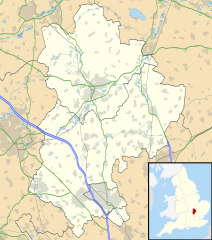
Map of Bedfordshire, UK with the following information shown:
Equirectangular map projection on WGS 84 datum, with N/S stretched 160% Geographic limits:
|
| Petsa | |
| Gigikanan |
|
| Tagsulat | Nilfanion, created using Ordnance Survey data |
| Pagtugot (Paggamit pag-usab niini nga file) |
This file is licensed under the Creative Commons Attribution-Share Alike 3.0 Unported license. Attribution: Contains Ordnance Survey data © Crown copyright and database right
|
| Other versions | File:Bedfordshire UK district map (blank).svg - Blank map with administrative borders only. |
.svg)
Kaagi sa payl
I-klik ang petsa/oras aron makit-an ang hulagway sa payl niadtong panahona.
| Petsa/Takna | Thumbnail | Mga dimensyon | Tiggamit | Komento | |
|---|---|---|---|---|---|
| kasamtangan | 17:56, 26 Septiyembre 2010 | | 1,120 × 1,266 (1.34 MB) | Nilfanion | Tweak m-ways .. again.. |
| 23:56, 6 Septiyembre 2010 |  | 1,120 × 1,266 (1.34 MB) | Nilfanion | Tweaking urban areas, road colours and boundary lines | |
| 20:36, 4 Septiyembre 2010 |  | 1,120 × 1,266 (1.29 MB) | Nilfanion | {{Information |Description=Map of Bedfordshire, UK with the following information shown: *Administrative borders *Coastline, lakes and rivers *Motorways, primary routes and A-roads *Urban areas Equirectangular map projection on WGS 84 |
Mga paggamit sa payl
Ang mosunod nga mga panid misumpay niining payl:
Global nga paggamit sa payl
Kining ubang wiki naggamit ning maong payl:
- Paggamit sa af.wikipedia.org
- Paggamit sa ar.wikipedia.org
- Paggamit sa bg.wikipedia.org
- Paggamit sa bn.wikipedia.org
- Paggamit sa en.wikipedia.org
- Bedford
- Bushmead Priory
- Beeston, Bedfordshire
- Luton Airport
- Flitwick
- Kempston
- Biggleswade
- Sandy, Bedfordshire
- Little Barford
- Ampthill
- Leighton Buzzard
- Woburn, Bedfordshire
- Eaton Bray
- Linslade
- Southcote, Bedfordshire
- Woburn Sands
- Studham
- Potton
- Old Warden
- Billington, Bedfordshire
- Eversholt
- RAF Chicksands
- RAF Henlow
- Bromham, Bedfordshire
- Everton, Bedfordshire
- List of places in Bedfordshire
- Stagsden
- Clapham, Bedfordshire
- Pertenhall
- RAE Bedford
- Hockliffe
- Houghton House
- Luton Hoo
- Campton, Bedfordshire
- Haynes, Bedfordshire
- Civil parishes in Bedfordshire
- Wootton, Bedfordshire
- Cranfield
- Hundred of Biggleswade
- Cockayne Hatley
- Odell, Bedfordshire
- Wrest Park
- Cardington, Bedfordshire
- Forest of Marston Vale
View more global usage of this file.