
Payl:CTS airport diagram.png
Gidak-on ning maong paunang tan-aw: 390 x 598 ka mga piksel. Uban pang mga resoluyon: 156 x 240 ka mga piksel | 313 x 480 ka mga piksel | 500 x 768 ka mga piksel | 1,042 x 1,599 ka mga piksel.
Tibuok resolusyon (1,042 × 1,599 pixels, size sa payl: 98 KB, MIME type: image/png)
Mubong sugid:
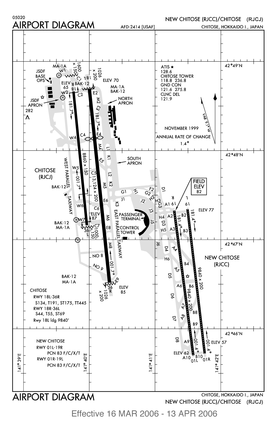
FAA diagram of New Chitose Airport. Converted from AirNav PDF.
Pagtugot
This work is in the public domain in the United States because it is a work prepared by an officer or employee of the United States Government as part of that person’s official duties under the terms of Title 17, Chapter 1, Section 105 of the US Code.
Note: This only applies to original works of the Federal Government and not to the work of any individual U.S. state, territory, commonwealth, county, municipality, or any other subdivision. This template also does not apply to postage stamp designs published by the United States Postal Service since 1978. (See § 313.6(C)(1) of Compendium of U.S. Copyright Office Practices). It also does not apply to certain US coins; see The US Mint Terms of Use.
|
 | |
| This file has been identified as being free of known restrictions under copyright law, including all related and neighboring rights. | ||
Kaagi sa payl
I-klik ang petsa/oras aron makit-an ang hulagway sa payl niadtong panahona.
| Petsa/Takna | Thumbnail | Mga dimensyon | Tiggamit | Komento | |
|---|---|---|---|---|---|
| kasamtangan | 15:32, 1 Abril 2006 | | 1,042 × 1,599 (98 KB) | Sekicho | White background. |
| 15:30, 1 Abril 2006 |  | 1,042 × 1,599 (97 KB) | Sekicho | FAA diagram of New Chitose Airport. Converted from AirNav PDF. |
Mga paggamit sa payl
Ang mosunod nga mga panid misumpay niining payl:
Global nga paggamit sa payl
Kining ubang wiki naggamit ning maong payl:
- Paggamit sa ca.wikipedia.org
- Paggamit sa en.wikipedia.org
- Paggamit sa en.wikivoyage.org
- Paggamit sa es.wikipedia.org
- Paggamit sa et.wikipedia.org
- Paggamit sa id.wikipedia.org
- Paggamit sa ja.wikipedia.org
- Paggamit sa nl.wikipedia.org
- Paggamit sa pl.wikipedia.org
- Paggamit sa th.wikipedia.org
- Paggamit sa vi.wikipedia.org
- Paggamit sa www.wikidata.org
- Paggamit sa zh-yue.wikipedia.org
- Paggamit sa zh.wikipedia.org