
Payl:Dam on BaiShuiJiang (Gansu).jpg
Gidak-on ning maong paunang tan-aw: 750 x 600 ka mga piksel. Uban pang mga resoluyon: 300 x 240 ka mga piksel | 600 x 480 ka mga piksel | 960 x 768 ka mga piksel | 1,024 x 819 ka mga piksel.
Tibuok resolusyon (1,024 × 819 pixels, size sa payl: 653 KB, MIME type: image/jpeg)
.jpg)
| Deskripsyon |
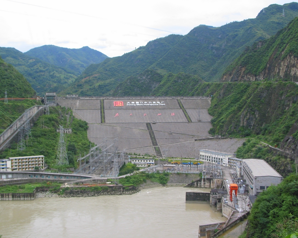
English: The following is the author's description of the photograph quoted directly from the photograph's Flickr page.
"See where the photo was taken at Yuan.CC Maps. " 中文:大唐碧口水力发电站 |
||
| Petsa | |||
| Gigikanan |
originally posted to Flickr as Dam on BaiShuiJiang (Gansu)
|
||
| Tagsulat | Philippe Semanaz | ||
| Pagtugot (Paggamit pag-usab niini nga file) |
This file is licensed under the Creative Commons Attribution-Share Alike 2.0 Generic license.
|
| Camera location | | View this and other nearby images on: OpenStreetMap |
|---|
.jpg¶ms=032.768440_N_0105.242071_E_globe:Earth_type:camera__&language=ceb)
Kaagi sa payl
I-klik ang petsa/oras aron makit-an ang hulagway sa payl niadtong panahona.
| Petsa/Takna | Thumbnail | Mga dimensyon | Tiggamit | Komento | |
|---|---|---|---|---|---|
| kasamtangan | 07:22, 17 Pebrero 2010 | | 1,024 × 819 (653 KB) | Geo Swan | {{Information |Description=The following is the author's description of the photograph quoted directly from the photograph's Flickr page.<br/>"See where the photo was taken at [http://maps.yuan.cc/ Yuan.CC Maps]. " |Source=originally posted to '''[[Flickr |
Mga paggamit sa payl
Ang mosunod nga mga panid misumpay niining payl:
Global nga paggamit sa payl
Kining ubang wiki naggamit ning maong payl:
- Paggamit sa en.wikipedia.org
- Paggamit sa es.wikipedia.org
- Paggamit sa fa.wikipedia.org
- Paggamit sa fr.wikipedia.org
- Paggamit sa ja.wikipedia.org
- Paggamit sa ko.wikipedia.org
- Paggamit sa no.wikipedia.org
- Paggamit sa ru.wikipedia.org
- Paggamit sa uk.wikipedia.org
- Paggamit sa www.wikidata.org
.jpg)