
Payl:Deception Island Map.svg

Size of this PNG preview of this SVG file: 644 x 599 ka mga piksel. Uban pang mga resoluyon: 258 x 240 ka mga piksel | 516 x 480 ka mga piksel | 825 x 768 ka mga piksel | 1,101 x 1,024 ka mga piksel | 2,201 x 2,048 ka mga piksel | 820 x 763 ka mga piksel.
Tibuok resolusyon (SVG nga payl, nominally 820 × 763 pixels, size sa payl: 461 KB)
| Deskripsyon |
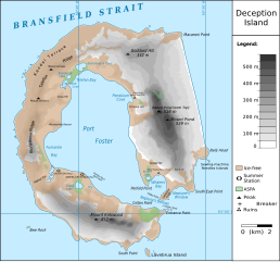
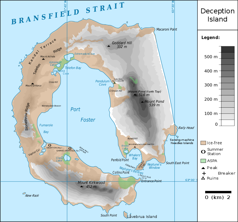
Français : carte de l'île de la Déception avec les toponymes + la position des stations ainsi que des zones protégées
English: map of Deception Island with the topography and the location of the stations and protected zones |
| Petsa | (UTC) |
| Gigikanan | |
| Tagsulat |
|
| This is a retouched picture, which means that it has been digitally altered from its original version. The original can be viewed here: Ile de la Deception.svg:
|
I, the copyright holder of this work, hereby publish it under the following licenses:
This file is licensed under the Creative Commons Attribution 3.0 Unported license.
- Libre ka:
- sa pagsabwag – sa pagkopya, pag-apod-apod ug pagsabwag sa hinimo
- sa pag-remix – sa pag-adap sa binuhat
- Ubos sa mosunod nga mga kondisyon:
- atribusyon – Kinahanglan nimo nga hatagan ang angay nga kredito, maghatag usa ka link sa lisensya, ug ipakita kung adunay mga pagbag-o. Mahimo nimo kini buhaton sa bisan unsang makatarunganon nga paagi, apan dili sa bisan unsang paagi nga nagsugyot nga gi-endorso ka sa licensor o ang imong paggamit.

|
Gitugot ang pagkopya, pag-apud-apod o/ug pag-usab ning maong dokumento ubos sa mga termino sa GNU Free Documentation License, Version 1.2 o mas bag-ong bersiyon nga gimantala sa Free Software Foundation; nga walay Invariant Sections, walay Front-Cover Texts, ug walay Back-Cover Texts. Ang kopya sa lisensiya gilakip sa bahin nga giulohang GNU Free Documentation License. |
You may select the license of your choice.
Original upload log
This image is a derivative work of the following images:
- File:Ile_de_la_Deception.svg licensed with Cc-by-3.0, GFDL
- 2010-06-19T09:08:35Z Treehill 820x763 (464885 Bytes) carrés noirs (tentative)
- 2010-06-18T17:48:51Z Treehill 820x763 (465569 Bytes) deux dernières légendes alignées
- 2010-06-18T17:30:49Z Treehill 820x763 (465601 Bytes) nom de la baie à gauche
- 2010-06-18T17:20:48Z Treehill 820x763 (465594 Bytes) déplacement de certains textes + 1ère tentative de suppression des carrés
- 2010-06-18T14:02:39Z Treehill 820x763 (465599 Bytes) {{Information |Description={{fr|1=carte de l'île de la Déception avec les toponymes + la position des stations ainsi que des zones protégées}} |Source={{own}} |Author=[[User:Treehill|Treehill]] |Date= |Permission= |other_
Uploaded with derivativeFX
Kaagi sa payl
I-klik ang petsa/oras aron makit-an ang hulagway sa payl niadtong panahona.
| Petsa/Takna | Thumbnail | Mga dimensyon | Tiggamit | Komento | |
|---|---|---|---|---|---|
| kasamtangan | 21:59, 13 Mayo 2018 | | 820 × 763 (461 KB) | Hogweard | Rm duplicate |
| 12:45, 25 Marso 2018 |  | 820 × 763 (462 KB) | Hogweard | Corrected height of Pond North Top; Fumarole Bay and additional names. | |
| 16:35, 18 Septiyembre 2016 |  | 820 × 763 (459 KB) | Maproom | 1.) Word "Station" no longer extends off edge of image 2.) "Peak" is spelled without a ffinal "t" 3.) "Breaker" is written in the right place instead of overwritten on "peak" | |
| 11:01, 10 Oktubre 2010 |  | 820 × 763 (459 KB) | Fitzgabbro | Fixed curved writing | |
| 22:11, 9 Oktubre 2010 |  | 820 × 763 (353 KB) | Fitzgabbro | {{Information |Description={{fr|1=carte de l'île de la Déception avec les toponymes + la position des stations ainsi que des zones protégées}} {{en|1=map of Deception Island with the topography and the location of the stations and protected zones}} |S |
Mga paggamit sa payl
Ang mosunod nga 3 panid misumpay niining payl:
Global nga paggamit sa payl
Kining ubang wiki naggamit ning maong payl:
- Paggamit sa cs.wikipedia.org
- Paggamit sa de.wikipedia.org
- Deception Island
- Mount Achala
- Telefon Ridge
- Telefon Bay
- Port Foster
- Ajmonecatsee
- Stancomb Cove
- Laguna Hill
- Fildes Point
- Neptunes Bellows
- Whalers Bay
- Penfold Point
- Collins Point
- Crater Lake (Deception Island)
- Mount Kirkwood
- Entrance Point
- Crimson Hill
- Kendall Terrace
- Kroner Lake
- Låvebrua Island
- South Point (Deception Island)
- New Rock (Südliche Shetlandinseln)
- Mount Pond
- Primero de Mayo Bay
- Ravn Rock
- Ronald Hill
- South East Point
- Stonethrow Ridge
- Vapour Col
- Paggamit sa en.wikipedia.org
- Paggamit sa eu.wikipedia.org
- Paggamit sa it.wikipedia.org
- Paggamit sa ja.wikipedia.org
- Paggamit sa lld.wikipedia.org
- Paggamit sa nds.wikipedia.org
- Paggamit sa nl.wikipedia.org
- Paggamit sa nn.wikipedia.org
- Paggamit sa pl.wikipedia.org
- Paggamit sa ru.wikipedia.org
- Paggamit sa sv.wikipedia.org
- Paggamit sa th.wikipedia.org
- Paggamit sa tr.wikipedia.org
View more global usage of this file.