
Payl:Dunkirk New York aerial view.jpg
Gidak-on ning maong paunang tan-aw: 800 x 562 ka mga piksel. Uban pang mga resoluyon: 320 x 225 ka mga piksel | 640 x 449 ka mga piksel | 1,024 x 719 ka mga piksel | 1,280 x 899 ka mga piksel | 1,500 x 1,053 ka mga piksel.
Tibuok resolusyon (1,500 × 1,053 pixels, size sa payl: 703 KB, MIME type: image/jpeg)
| Deskripsyon |
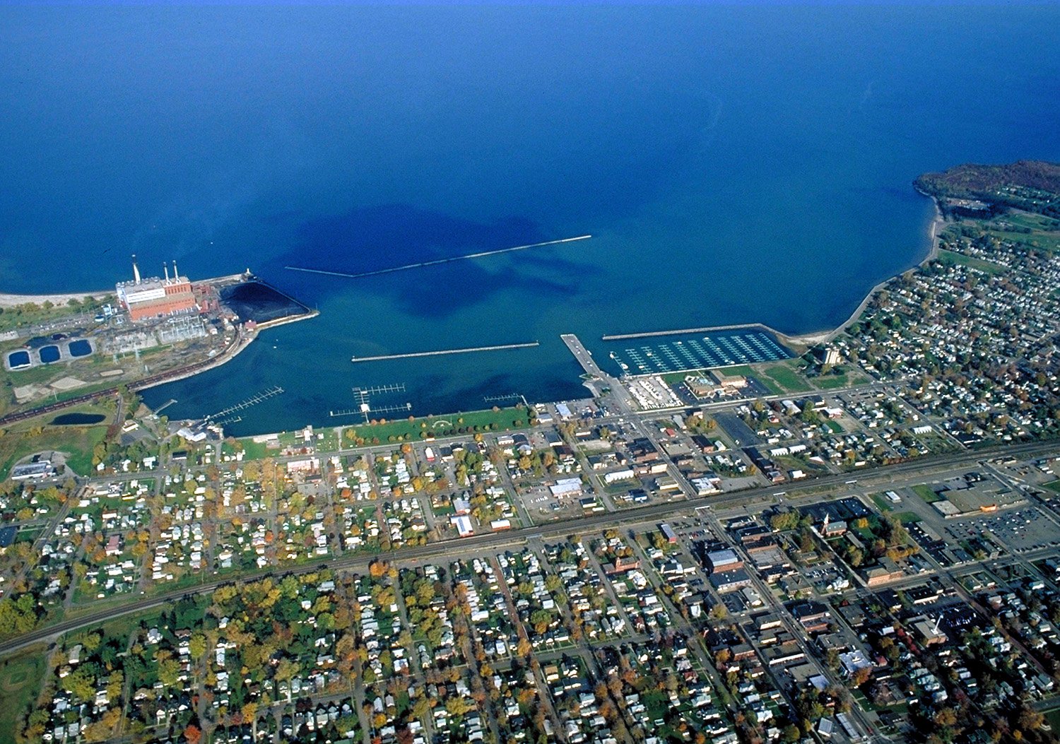
English: Aerial view of Dunkirk, New York, USA. View is to the north over Lake Erie. The large Niagara Mohak power plant can be seen at left. |
|||
| Petsa | ||||
| Gigikanan |
U.S. Army Corps of Engineers Digital Visual Library Image page Image description page Digital Visual Library home page |
|||
| Tagsulat | Ken Winters, U.S. Army Corps of Engineers | |||
| Pagtugot (Paggamit pag-usab niini nga file) |
|
|||
| Location | Dunkirk, New York, USA |
| Camera location | | View this and other nearby images on: OpenStreetMap |
|---|
Kaagi sa payl
I-klik ang petsa/oras aron makit-an ang hulagway sa payl niadtong panahona.
| Petsa/Takna | Thumbnail | Mga dimensyon | Tiggamit | Komento | |
|---|---|---|---|---|---|
| kasamtangan | 06:40, 31 Marso 2007 | | 1,500 × 1,053 (703 KB) | DanMS | {{Information | Description = {{en|Aerial view of Dunkirk, New York, USA. View is to the north over Lake Erie. The large Niagara Mohak power plant can be seen at left.}} | Source = U.S. Army Corps of Engineers Digital Visual Library<br />[http: |
Mga paggamit sa payl
Ang mosunod nga 2 panid misumpay niining payl:
Global nga paggamit sa payl
Kining ubang wiki naggamit ning maong payl:
- Paggamit sa ar.wikipedia.org
- Paggamit sa azb.wikipedia.org
- Paggamit sa ce.wikipedia.org
- Paggamit sa cy.wikipedia.org
- Paggamit sa dag.wikipedia.org
- Paggamit sa de.wikipedia.org
- Paggamit sa en.wikipedia.org
- Paggamit sa en.wikivoyage.org
- Paggamit sa es.wikipedia.org
- Paggamit sa eu.wikipedia.org
- Paggamit sa fa.wikipedia.org
- Paggamit sa fr.wikipedia.org
- Paggamit sa ht.wikipedia.org
- Paggamit sa hu.wikipedia.org
- Paggamit sa it.wikipedia.org
- Paggamit sa lld.wikipedia.org
- Paggamit sa pl.wikipedia.org
- Paggamit sa pt.wikipedia.org
- Paggamit sa simple.wikipedia.org
- Paggamit sa sr.wikipedia.org
- Paggamit sa tg.wikipedia.org
- Paggamit sa tr.wikipedia.org
- Paggamit sa tt.wikipedia.org
- Paggamit sa uk.wikipedia.org
- Paggamit sa www.wikidata.org
- Paggamit sa zh-min-nan.wikipedia.org
- Paggamit sa zh.wikipedia.org