
Payl:Ghurids1200.png
Gidak-on ning maong paunang tan-aw: 800 x 467 ka mga piksel. Uban pang mga resoluyon: 320 x 187 ka mga piksel | 640 x 373 ka mga piksel | 1,024 x 597 ka mga piksel | 1,644 x 959 ka mga piksel.
Tibuok resolusyon (1,644 × 959 pixels, size sa payl: 28 KB, MIME type: image/png)
Mubong sugid:
| Deskripsyon |
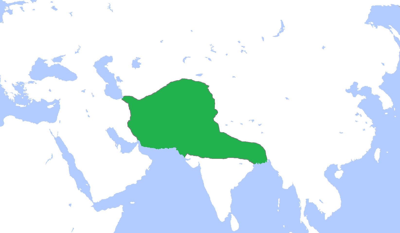
English: Locator map of the Ghurid Empire, c. 1200.
(Partially based on Atlas of World History (2007) - The World 1000-1200, map) |
| Petsa | |
| Gigikanan | Kaugalingong trabaho |
| Tagsulat | Gabagool |
Pagtugot
I, the copyright holder of this work, hereby publish it under the following license:
This file is licensed under the Creative Commons Attribution 3.0 Unported license.
- Libre ka:
- sa pagsabwag – sa pagkopya, pag-apod-apod ug pagsabwag sa hinimo
- sa pag-remix – sa pag-adap sa binuhat
- Ubos sa mosunod nga mga kondisyon:
- atribusyon – Kinahanglan nimo nga hatagan ang angay nga kredito, maghatag usa ka link sa lisensya, ug ipakita kung adunay mga pagbag-o. Mahimo nimo kini buhaton sa bisan unsang makatarunganon nga paagi, apan dili sa bisan unsang paagi nga nagsugyot nga gi-endorso ka sa licensor o ang imong paggamit.
Kaagi sa payl
I-klik ang petsa/oras aron makit-an ang hulagway sa payl niadtong panahona.
| Petsa/Takna | Thumbnail | Mga dimensyon | Tiggamit | Komento | |
|---|---|---|---|---|---|
| kasamtangan | 16:06, 9 Enero 2014 | | 1,644 × 959 (28 KB) | HistoryofIran | Added the domains of the Bamiyan branch. |
| 15:35, 29 Disyembre 2013 |  | 1,644 × 959 (28 KB) | HistoryofIran | Fixed. | |
| 12:00, 29 Disyembre 2013 |  | 1,644 × 959 (28 KB) | HistoryofIran | Made the map more accurate. | |
| 12:57, 18 Hunyo 2013 |  | 1,644 × 959 (28 KB) | HistoryofIran | ||
| 15:32, 24 Abril 2009 |  | 1,644 × 959 (53 KB) | Gabagool | {{Information |Description={{en|1=Locator map of the Ghurid Empire, c. 1200. (Partially based on ''Atlas of World History'' (2007) - The World 1000-1200, map)}} |Source=Own work by uploader |Author=Gabagool / Jarle Grøhn |Date=2009-04- |
Mga paggamit sa payl
Ang mosunod nga mga panid misumpay niining payl:
Global nga paggamit sa payl
Kining ubang wiki naggamit ning maong payl:
- Paggamit sa ar.wikipedia.org
- الدولة الغزنوية
- غوريون
- نيسابور
- غزنة
- باميان
- ولاية غور
- محمد الغوري
- قالب:غوريون
- مستخدم:محمد رشاد ابوالنجا/Spread of Islam
- أبو علي بن محمد
- محمد بن سوري
- أمير سوري
- عباس بن شيت
- محمد بن عباس
- قطب الدين حسن
- عز الدين حسين
- سيف الدين سوري
- بهاء الدين سام الأول
- علاء الدين حسين
- غياث الدين محمد
- بهاء الدين سام الثالث
- غياث الدين محمود
- Paggamit sa arz.wikipedia.org
- Paggamit sa av.wikipedia.org
- Paggamit sa azb.wikipedia.org
- Paggamit sa az.wikipedia.org
- Paggamit sa ba.wikipedia.org
- Paggamit sa bn.wikipedia.org
- Paggamit sa ca.wikipedia.org
- Paggamit sa cv.wikipedia.org
- Paggamit sa da.wikipedia.org
- Paggamit sa de.wikipedia.org
- Paggamit sa en.wikipedia.org
View more global usage of this file.