
Payl:Intersection in Bethesda, Maryland.jpg

Gidak-on ning maong paunang tan-aw: 800 x 250 ka mga piksel. Uban pang mga resoluyon: 320 x 100 ka mga piksel | 640 x 200 ka mga piksel | 1,024 x 319 ka mga piksel | 1,280 x 399 ka mga piksel | 2,560 x 799 ka mga piksel | 12,793 x 3,991 ka mga piksel.
Tibuok resolusyon (12,793 × 3,991 pixels, size sa payl: 16.52 MB, MIME type: image/jpeg)
Mubong sugid:
| Deskripsyon |
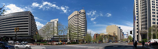
English: Commercial buildings located at the intersection of Maryland Route 187 (Old Georgetown Road), Maryland Route 355 (Wisconsin Avenue), and Maryland Route 410 (East West Highway), near the Bethesda Metro station entrance (pictured, center), in downtown Bethesda, Maryland, United States.
|
||
| Petsa | Taken on 6 Hulyo 2009, 20:01:41 | ||
| Gigikanan | originally posted to Flickr as 2009 04 24 - 4895-4903 - Bethesda - MD187, MD355, MD410 | ||
| Tagsulat | Andrew Bossi | ||
| Pagtugot (Paggamit pag-usab niini nga file) |
|
Pagtugot
This file is licensed under the Creative Commons Attribution-Share Alike 2.0 Generic license.
- Libre ka:
- sa pagsabwag – sa pagkopya, pag-apod-apod ug pagsabwag sa hinimo
- sa pag-remix – sa pag-adap sa binuhat
- Ubos sa mosunod nga mga kondisyon:
- atribusyon – Kinahanglan nimo nga hatagan ang angay nga kredito, maghatag usa ka link sa lisensya, ug ipakita kung adunay mga pagbag-o. Mahimo nimo kini buhaton sa bisan unsang makatarunganon nga paagi, apan dili sa bisan unsang paagi nga nagsugyot nga gi-endorso ka sa licensor o ang imong paggamit.
- share parehas – Kung imong gi-remix, gibag-o, o gibase sa materyal, kinahanglan nimo nga iapod-apod ang imong mga kontribusyon sa ilawom sa parehas o katugma nga lisensya sama sa orihinal.
| Camera location | | View this and other nearby images on: OpenStreetMap |
|---|
Kaagi sa payl
I-klik ang petsa/oras aron makit-an ang hulagway sa payl niadtong panahona.
| Petsa/Takna | Thumbnail | Mga dimensyon | Tiggamit | Komento | |
|---|---|---|---|---|---|
| kasamtangan | 01:00, 11 Disyembre 2009 | 12,793 × 3,991 (16.52 MB) | Flickr upload bot | Uploaded from http://flickr.com/photo/25622716@N02/3695586053 using Flickr upload bot |
Mga paggamit sa payl
Ang mosunod nga mga panid misumpay niining payl:
Global nga paggamit sa payl
Kining ubang wiki naggamit ning maong payl:
- Paggamit sa cs.wikipedia.org
- Paggamit sa en.wikipedia.org
- Paggamit sa fa.wikipedia.org
- Paggamit sa fr.wikipedia.org
- Paggamit sa ja.wikipedia.org
- Paggamit sa lv.wikipedia.org
- Paggamit sa nl.wikipedia.org
- Paggamit sa pt.wikipedia.org
- Paggamit sa simple.wikipedia.org
- Paggamit sa sk.wikipedia.org
- Paggamit sa szl.wikipedia.org
- Paggamit sa tr.wikipedia.org
- Paggamit sa uk.wikipedia.org
- Paggamit sa ur.wikipedia.org
- Paggamit sa zh-min-nan.wikipedia.org
- Paggamit sa zh.wikipedia.org