
Payl:Lancashire UK location map.svg

Size of this PNG preview of this SVG file: 513 x 600 ka mga piksel. Uban pang mga resoluyon: 205 x 240 ka mga piksel | 410 x 480 ka mga piksel | 657 x 768 ka mga piksel | 876 x 1,024 ka mga piksel | 1,751 x 2,048 ka mga piksel | 1,116 x 1,305 ka mga piksel.
Tibuok resolusyon (SVG nga payl, nominally 1,116 × 1,305 pixels, size sa payl: 2.3 MB)
| Deskripsyon |
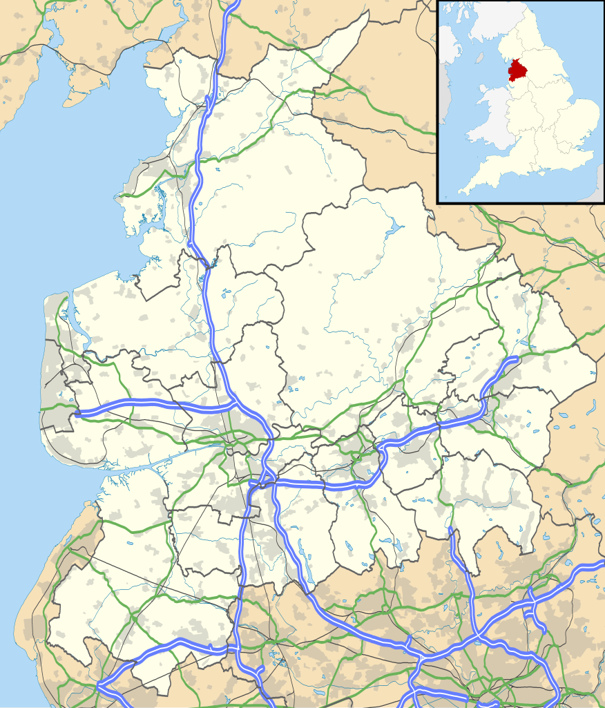
Map of Lancashire, UK with the following information shown:
Equirectangular map projection on WGS 84 datum, with N/S stretched 165% Geographic limits:
|
| Petsa | |
| Gigikanan |
|
| Tagsulat | Nilfanion, created using Ordnance Survey data |
| Pagtugot (Paggamit pag-usab niini nga file) |
This file is licensed under the Creative Commons Attribution-Share Alike 3.0 Unported license. Attribution: Contains Ordnance Survey data © Crown copyright and database right
|
| Other versions | File:Lancashire UK district map (blank).svg - Blank map |
.svg)
Kaagi sa payl
I-klik ang petsa/oras aron makit-an ang hulagway sa payl niadtong panahona.
| Petsa/Takna | Thumbnail | Mga dimensyon | Tiggamit | Komento | |
|---|---|---|---|---|---|
| kasamtangan | 18:59, 26 Septiyembre 2010 | | 1,116 × 1,305 (2.3 MB) | Nilfanion | {{Information |Description=Map of Lancashire, UK with the following information shown: *Administrative borders *Coastline, lakes and rivers *Roads and railways *Urban areas Equirectangular map projection on WGS 84 datum, with N/S stretch |
Mga paggamit sa payl
Ang mosunod nga mga panid misumpay niining payl:
Global nga paggamit sa payl
Kining ubang wiki naggamit ning maong payl:
- Paggamit sa ar.wikipedia.org
- Paggamit sa bg.wikipedia.org
- Paggamit sa en.wikipedia.org
- Accrington
- Bacup
- Lancaster, Lancashire
- Preston, Lancashire
- Chorley
- Astley Hall, Chorley
- Blackpool
- Read, Lancashire
- Ormskirk
- Burnley
- Galgate
- Heysham
- Blackburn
- Barnoldswick
- Darwen
- Clitheroe
- Parbold
- Adlington, Lancashire
- Kirkham, Lancashire
- Lytham St Annes
- Longridge
- Poulton-le-Fylde
- Carnforth
- Reedley Hallows
- Up Holland
- Padiham
- Clayton-le-Moors
- Brierfield, Lancashire
- Oswaldtwistle
- Fleetwood
- Whalley, Lancashire
- Cleveleys
- Centre points of the United Kingdom
- Stonyhurst
- Bolton-le-Sands
- Haslingden
- River Wyre
- Lancashire Infantry Museum
- Higham, Lancashire
- Nelson, Lancashire
- Colne
- Wycoller
- Bleasdale
- Scarisbrick
- Knott End-on-Sea
- Great Altcar
- List of places in Lancashire
- Trawden
View more global usage of this file.