
Payl:Nicaragua location map.svg

Size of this PNG preview of this SVG file: 704 x 599 ka mga piksel. Uban pang mga resoluyon: 282 x 240 ka mga piksel | 564 x 480 ka mga piksel | 902 x 768 ka mga piksel | 1,203 x 1,024 ka mga piksel | 2,405 x 2,048 ka mga piksel | 1,400 x 1,192 ka mga piksel.
Tibuok resolusyon (SVG nga payl, nominally 1,400 × 1,192 pixels, size sa payl: 192 KB)
Mubong sugid:
| Deskripsyon |
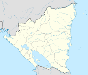
Deutsch: Positionskarte Nicaragua mit Departamentos, Quadratische Plattkarte, N-S-Streckung 100 %. Geographische Begrenzung der Karte:
English: Location map of Nicaragua with Departamentos, Equirectangular projection, N/S stretching 100 %. Geographic limits of the map:
|
| Petsa | |
| Gigikanan | Kaugalingong trabaho,VMAP0,http://maplibrary.org |
| Tagsulat | Alexrk2 |
| Other versions |
Derivative works of this file:
|


|
This map has been made or improved in the German Kartenwerkstatt (Map Lab). You can propose maps to improve as well.
|
Pagtugot
I, the copyright holder of this work, hereby publish it under the following license:
This file is licensed under the Creative Commons Attribution-Share Alike 3.0 Unported license.
- Libre ka:
- sa pagsabwag – sa pagkopya, pag-apod-apod ug pagsabwag sa hinimo
- sa pag-remix – sa pag-adap sa binuhat
- Ubos sa mosunod nga mga kondisyon:
- atribusyon – Kinahanglan nimo nga hatagan ang angay nga kredito, maghatag usa ka link sa lisensya, ug ipakita kung adunay mga pagbag-o. Mahimo nimo kini buhaton sa bisan unsang makatarunganon nga paagi, apan dili sa bisan unsang paagi nga nagsugyot nga gi-endorso ka sa licensor o ang imong paggamit.
- share parehas – Kung imong gi-remix, gibag-o, o gibase sa materyal, kinahanglan nimo nga iapod-apod ang imong mga kontribusyon sa ilawom sa parehas o katugma nga lisensya sama sa orihinal.
Kaagi sa payl
I-klik ang petsa/oras aron makit-an ang hulagway sa payl niadtong panahona.
| Petsa/Takna | Thumbnail | Mga dimensyon | Tiggamit | Komento | |
|---|---|---|---|---|---|
| kasamtangan | 06:36, 25 Mayo 2021 | | 1,400 × 1,192 (192 KB) | Milenioscuro | corrected some errors |
| 06:30, 25 Mayo 2021 |  | 1,400 × 1,192 (192 KB) | Milenioscuro | corrected department boundaries | |
| 22:09, 17 Pebrero 2010 |  | 1,400 × 1,192 (416 KB) | Alexrk2 | - | |
| 20:12, 16 Pebrero 2010 |  | 1,400 × 1,192 (415 KB) | Alexrk2 | == Summary == {{Information |Description= {{de|Positionskarte Nicaragua mit Departamentos, Quadratische Plattkarte, N-S-Streckung 100 %. Geographische Begrenzung der Karte:}} {{en|Location map Nicaragua with Departament |
Mga paggamit sa payl
More than 100 pages use this file. The following list shows the first 100 pages that use this file only. A full list is available.
- Belen
- Belén
- Blowing Rock
- Bluff Point
- Buenos Aires (pagklaro)
- Cerro Bonito
- Cerro La Tortuga
- Cerro Pelon
- Cerro Pelón
- Cerro Santa Ana
- Cerro Santa María
- Cerro Ventura
- Cerro Verde
- Cerro Volcán Grande
- Coconut Point
- Concepción
- Concordia
- Dolores
- Estero Grande
- French Cay
- Green Cay
- Green Point
- Gun Point
- Guzmán
- Hog Cay
- Isla Grande
- La Cruz
- La Paz
- Laguna Blanca
- Laguna Grande
- Laguna Las Piedras
- Laguna Seca
- Laguna Verde
- Laguna del Tigre
- León
- Libertad
- Loma
- Long Bay
- Man of War Cays
- Mangrove Cay
- Medio
- Mount Pleasant
- Pataste
- Pelican Bay
- Punta Cañón
- Quebrada Grande
- Quebrada Santa Rosa
- Quebrada Seca
- Red Hill
- Rio Negro
- Rio San Antonio
- Rio Santa Cruz
- Rio Seco
- Rio Soledad
- Rio Supa
- Rio Tala
- Rio Viejo
- Río Grande
- Río Hondo
- Río Negro
- Río San Antonio
- Río Santa Clara
- Río Santa Cruz
- Río Seco
- Río Soledad
- Río Sucio
- Río Tala
- Río Tesorero
- Río Tigre
- Río Varela
- Río Viejo
- San Antonio
- San Carlos
- San Fernando
- San Isidro
- San Lorenzo (pagklaro)
- San Nicolás
- San Pedro (pagklaro)
- San Rafael
- Sandy Bay
- Santa Isabel
- Santa Lucia
- Santa Lucía
- Santa Maria (pagklaro)
- Santa María (pagklaro)
- Santa Rosa
- Santa Teresa
- Santo Tomas
- Santo Tomás
- Sauce
- Schooner Cays
- Seal Cay
- Seal Rock
- Sister Cays
- South End
- Tola
- Toro
- Villanueva
- Virginia
- West Point
View more links to this file.
Global nga paggamit sa payl
Kining ubang wiki naggamit ning maong payl:
- Paggamit sa af.wikipedia.org
- Paggamit sa an.wikipedia.org
- Paggamit sa ar.wikipedia.org
- Paggamit sa ast.wikipedia.org
- Greytown (Nicaragua)
- Zapatera (volcán)
- Managua
- Matiguás
- Muy Muy
- Llagu Apanás
- Módulu:Mapa de llocalización/datos/Nicaragua
- Módulu:Mapa de llocalización/datos/Nicaragua/usu
- Aeropuertu Bonanza
- Aeropuertu Punta Huete
- Aeropuertu de Chinandega
- Aeropuertu de Juigalpa
- Aeropuertu de Los Brasiles
- Aeropuertu de Montelimar
- Aeropuertu de Nueva Guinea
- Aeropuertu d'Ometepe
- Aeropuertu de Rosita
- Aeropuertu de San Juan de Nicaragua
- Aeropuertu de Siuna
- Aeropuertu de Waspán
- Aeropuertu internacional Costa Esmeralda
- San Isidro (Nicaragua)
- Paggamit sa ba.wikipedia.org
- Paggamit sa be-tarask.wikipedia.org
- Paggamit sa be.wikipedia.org
- Paggamit sa bg.wikipedia.org
- Paggamit sa bh.wikipedia.org
- Paggamit sa bn.wikipedia.org
View more global usage of this file.