
Payl:Peillon Landscape.jpg

Gidak-on ning maong paunang tan-aw: 800 x 531 ka mga piksel. Uban pang mga resoluyon: 320 x 213 ka mga piksel | 640 x 425 ka mga piksel | 1,024 x 680 ka mga piksel | 1,280 x 850 ka mga piksel | 2,560 x 1,700 ka mga piksel | 3,565 x 2,368 ka mga piksel.
Tibuok resolusyon (3,565 × 2,368 pixels, size sa payl: 3.22 MB, MIME type: image/jpeg)
Mubong sugid:
| Deskripsyon |
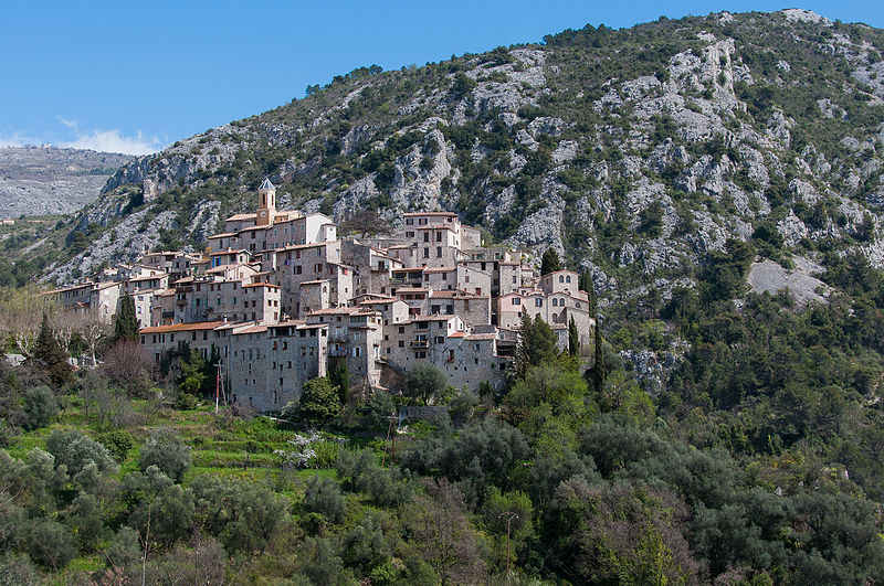
English: A view across the Paillon Valley of the town of Peillon, France.
Peillon is a picturesque fortified village about 15 miles north of Nice, France. The village is perched on top of a high narrow rocky peak, with the compact collection of stone houses, narrow streets, vaulted passages, and sometimes steep stairs. The area has been inhabited since the Iron Age age and the first fortifed town was built on the site near the end of the 10th Century. Most of the current buildings date from the 19th Century, but a few date from the 17th Century. Peillon sits on top of a narrow peak about three miles from the Peillon-Saint Thecle SNCF train station (which houses a small railroad museum open during the summer months). The uphill walk to the town take a little over an hour following the road to town or a hiking path through the countryside. Unlike many other medieval towns in the area, Peillon is an authentic town which is not oriented towards tourists. There are not souvenir shops or other tourist-oriented facilities. The only amenities are one restaurant inside the town and two more in the auberges just outside the town. |
| Petsa | |
| Gigikanan | https://www.flickr.com/photos/fischerfotos/8722255804/ |
| Tagsulat | Mark Fischer |
| Camera location | | View this and other nearby images on: OpenStreetMap |
|---|
Pagtugot
| This image was originally posted to Flickr. Its license was verified as "cc-by-sa-2.0" by the UploadWizard Extension at the time it was transferred to Commons. See the license information for further details. |
This file is licensed under the Creative Commons Attribution-Share Alike 2.0 Generic license.
- Libre ka:
- sa pagsabwag – sa pagkopya, pag-apod-apod ug pagsabwag sa hinimo
- sa pag-remix – sa pag-adap sa binuhat
- Ubos sa mosunod nga mga kondisyon:
- atribusyon – Kinahanglan nimo nga hatagan ang angay nga kredito, maghatag usa ka link sa lisensya, ug ipakita kung adunay mga pagbag-o. Mahimo nimo kini buhaton sa bisan unsang makatarunganon nga paagi, apan dili sa bisan unsang paagi nga nagsugyot nga gi-endorso ka sa licensor o ang imong paggamit.
- share parehas – Kung imong gi-remix, gibag-o, o gibase sa materyal, kinahanglan nimo nga iapod-apod ang imong mga kontribusyon sa ilawom sa parehas o katugma nga lisensya sama sa orihinal.
Kaagi sa payl
I-klik ang petsa/oras aron makit-an ang hulagway sa payl niadtong panahona.
| Petsa/Takna | Thumbnail | Mga dimensyon | Tiggamit | Komento | |
|---|---|---|---|---|---|
| kasamtangan | 23:53, 9 Agosto 2015 | | 3,565 × 2,368 (3.22 MB) | Alifazal | User created page with UploadWizard |
Mga paggamit sa payl
Ang mosunod nga mga panid misumpay niining payl:
Global nga paggamit sa payl
Kining ubang wiki naggamit ning maong payl:
- Paggamit sa en.wikipedia.org
- Paggamit sa fr.wikipedia.org