
Payl:Pioneer Valley South From Mt. Sugarloaf.jpg
Gidak-on ning maong paunang tan-aw: 800 x 600 ka mga piksel. Uban pang mga resoluyon: 320 x 240 ka mga piksel | 640 x 480 ka mga piksel | 1,024 x 768 ka mga piksel | 1,280 x 960 ka mga piksel | 2,272 x 1,704 ka mga piksel.
Tibuok resolusyon (2,272 × 1,704 pixels, size sa payl: 808 KB, MIME type: image/jpeg)
Mubong sugid:
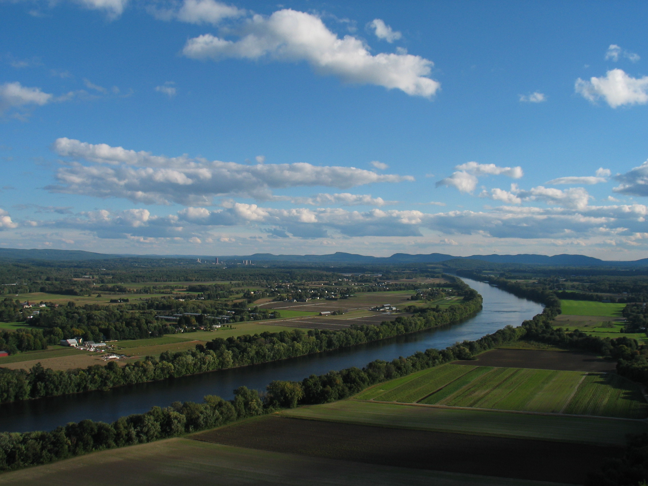
| Deskripsyon | The Connecticut River and Pioneer Valley of Massachusetts. Looking south from Mt. Sugarloaf in Deerfield, toward the towns of Sunderland, Amherst and Whately. The buildings of the University of Massachusetts Amherst can be seen in the distance to the left, and farther off, the Holyoke range of mountains. |
| Petsa | |
| Gigikanan | Transferred from en.wikipedia to Commons. |
| Tagsulat | The original uploader was BenFrantzDale at English Wikipedya. |
| Other versions | cropped & labeled Mount Holyoke Range in German: Image:Pioneer_Valley_South_From_Mt._Sugarloaf_cropped,Namen.jpg |
Pagtugot
| This file is licensed under the Creative Commons Attribution-Share Alike 3.0 Unported license. Subject to disclaimers. | ||
| ||
| This licensing tag was added to this file as part of the GFDL licensing update. |

|
Gitugot ang pagkopya, pag-apud-apod o/ug pag-usab ning maong dokumento ubos sa mga termino sa GNU Free Documentation License, Version 1.2 o mas bag-ong bersiyon nga gimantala sa Free Software Foundation; nga walay Invariant Sections, walay Front-Cover Texts, ug walay Back-Cover Texts. Ang kopya sa lisensiya gilakip sa bahin nga giulohang GNU Free Documentation License. Subject to disclaimers. |
Original upload log
The original description page was here. All following user names refer to en.wikipedia.
- 2004-10-16 20:40 BenFrantzDale 2272×1704×8 (827549 bytes) Pioneer Valley South From Mt. Sugarloaf
Kaagi sa payl
I-klik ang petsa/oras aron makit-an ang hulagway sa payl niadtong panahona.
| Petsa/Takna | Thumbnail | Mga dimensyon | Tiggamit | Komento | |
|---|---|---|---|---|---|
| kasamtangan | 05:18, 19 Oktubre 2007 | | 2,272 × 1,704 (808 KB) | Ibn Battuta | {{Information |Description=The Connecticut River and Pioneer Valley of Massachusetts. Looking south from Mt. Sugarloaf in Deerfield, toward the towns of [[:en:Sunderland, M |
Mga paggamit sa payl
Ang mosunod nga mga panid misumpay niining payl:
Global nga paggamit sa payl
Kining ubang wiki naggamit ning maong payl:
- Paggamit sa af.wikipedia.org
- Paggamit sa ar.wikipedia.org
- Paggamit sa arz.wikipedia.org
- Paggamit sa ba.wikipedia.org
- Paggamit sa be.wikipedia.org
- Paggamit sa bg.wikipedia.org
- Paggamit sa cy.wikipedia.org
- Paggamit sa da.wikipedia.org
- Paggamit sa de.wikipedia.org
- Paggamit sa el.wikipedia.org
- Paggamit sa en.wikipedia.org
- Paggamit sa en.wikiquote.org
- Paggamit sa es.wikipedia.org
- Paggamit sa fa.wikipedia.org
- Paggamit sa fo.wikipedia.org
- Paggamit sa gl.wikipedia.org
- Paggamit sa hy.wikipedia.org
- Paggamit sa incubator.wikimedia.org
- Paggamit sa it.wikipedia.org
- Paggamit sa pl.wikipedia.org
- Paggamit sa pl.wiktionary.org
- Paggamit sa tl.wikipedia.org
- Paggamit sa tr.wikipedia.org
- Paggamit sa ug.wikipedia.org
- Paggamit sa www.wikidata.org