
Payl:Procés de Marratxinització.JPG
Gidak-on ning maong paunang tan-aw: 800 x 238 ka mga piksel. Uban pang mga resoluyon: 320 x 95 ka mga piksel | 640 x 190 ka mga piksel | 1,024 x 304 ka mga piksel | 3,311 x 984 ka mga piksel.
Tibuok resolusyon (3,311 × 984 pixels, size sa payl: 1.58 MB, MIME type: image/jpeg)
Mubong sugid:
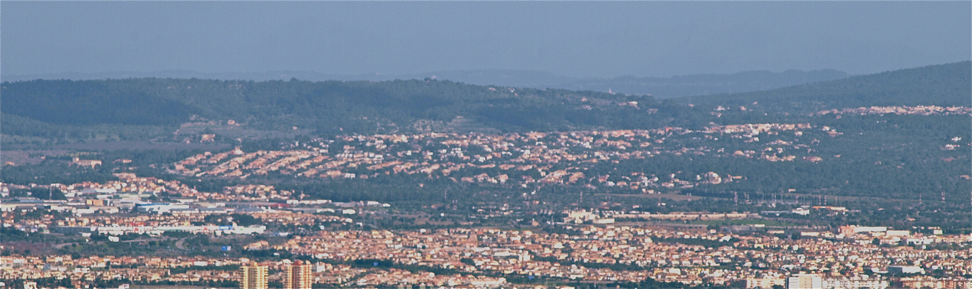
| Deskripsyon |
Place
|
| Petsa | 07.02.2010 |
| Gigikanan | Self-photographed |
| Tagsulat | Chixoy |
| Camera location | | View this and other nearby images on: OpenStreetMap |
|---|
Pagtugot
| I, the copyright holder of this work, release this work into the public domain. This applies worldwide. In some countries this may not be legally possible; if so: I grant anyone the right to use this work for any purpose, without any conditions, unless such conditions are required by law. |
Kaagi sa payl
I-klik ang petsa/oras aron makit-an ang hulagway sa payl niadtong panahona.
| Petsa/Takna | Thumbnail | Mga dimensyon | Tiggamit | Komento | |
|---|---|---|---|---|---|
| kasamtangan | 19:07, 7 Pebrero 2010 | 3,311 × 984 (1.58 MB) | Chixoy | ==== {{int:filedesc}} ==== *{{ca|Procés de Marratxinització, pèrdua de l'entorn rural del municipi de Marratxí}} *{{en|"Marratxining" proces or loss of rural landscape at Marratxí municipality}} ===Place=== * '''Lloc'''/'''Place''': Coll de Sa Creu, |
Mga paggamit sa payl
Ang mosunod nga mga panid misumpay niining payl:
Global nga paggamit sa payl
Kining ubang wiki naggamit ning maong payl:
- Paggamit sa an.wikipedia.org
- Paggamit sa arz.wikipedia.org
- Paggamit sa azb.wikipedia.org
- Paggamit sa ca.wikipedia.org
- Paggamit sa ce.wikipedia.org
- Paggamit sa en.wikipedia.org
- Paggamit sa eo.wikipedia.org
- Paggamit sa es.wikipedia.org
- Paggamit sa eu.wikipedia.org
- Paggamit sa fa.wikipedia.org
- Paggamit sa fr.wikipedia.org
- Paggamit sa gl.wikipedia.org
- Paggamit sa hu.wikipedia.org
- Paggamit sa hy.wikipedia.org
- Paggamit sa ia.wikipedia.org
- Paggamit sa ja.wikipedia.org
- Paggamit sa ka.wikipedia.org
- Paggamit sa lld.wikipedia.org
- Paggamit sa lmo.wikipedia.org
- Paggamit sa no.wikipedia.org
- Paggamit sa pl.wikipedia.org
- Paggamit sa ru.wikipedia.org
- Paggamit sa sq.wikipedia.org
- Paggamit sa sr.wikipedia.org
- Paggamit sa sv.wikipedia.org
- Paggamit sa tt.wikipedia.org
- Paggamit sa uz.wikipedia.org
- Paggamit sa vec.wikipedia.org
- Paggamit sa www.wikidata.org