
Payl:Relief Map of Bulgaria.jpg

Gidak-on ning maong paunang tan-aw: 800 x 505 ka mga piksel. Uban pang mga resoluyon: 320 x 202 ka mga piksel | 640 x 404 ka mga piksel | 1,024 x 646 ka mga piksel | 1,280 x 808 ka mga piksel | 1,642 x 1,036 ka mga piksel.
Tibuok resolusyon (1,642 × 1,036 pixels, size sa payl: 459 KB, MIME type: image/jpeg)
Mubong sugid:
| Deskripsyon |
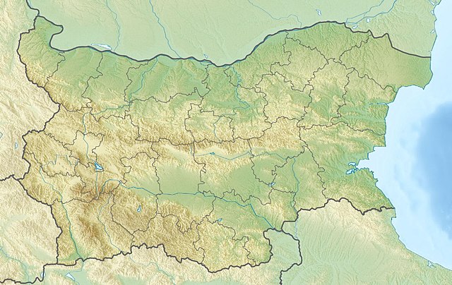
English: Location map of Bulgaria Equirectangular projection, N/S stretching 130 %. Geographic limits of the map:
|
| Petsa | (UTC) |
| Gigikanan |
|
| Tagsulat |
|
| Other versions | Derivative works of this file: Relief Map of Bulgaria Burgasebene.jpg |
| This is a retouched picture, which means that it has been digitally altered from its original version. The original can be viewed here: Bulgaria location map.svg:
|
Pagtugot
I, the copyright holder of this work, hereby publish it under the following licenses:
This file is licensed under the Creative Commons Attribution-Share Alike 3.0 Unported license.
- Libre ka:
- sa pagsabwag – sa pagkopya, pag-apod-apod ug pagsabwag sa hinimo
- sa pag-remix – sa pag-adap sa binuhat
- Ubos sa mosunod nga mga kondisyon:
- atribusyon – Kinahanglan nimo nga hatagan ang angay nga kredito, maghatag usa ka link sa lisensya, ug ipakita kung adunay mga pagbag-o. Mahimo nimo kini buhaton sa bisan unsang makatarunganon nga paagi, apan dili sa bisan unsang paagi nga nagsugyot nga gi-endorso ka sa licensor o ang imong paggamit.
- share parehas – Kung imong gi-remix, gibag-o, o gibase sa materyal, kinahanglan nimo nga iapod-apod ang imong mga kontribusyon sa ilawom sa parehas o katugma nga lisensya sama sa orihinal.

|
Gitugot ang pagkopya, pag-apud-apod o/ug pag-usab ning maong dokumento ubos sa mga termino sa GNU Free Documentation License, Version 1.2 o mas bag-ong bersiyon nga gimantala sa Free Software Foundation; nga walay Invariant Sections, walay Front-Cover Texts, ug walay Back-Cover Texts. Ang kopya sa lisensiya gilakip sa bahin nga giulohang GNU Free Documentation License. |
You may select the license of your choice.
Original upload log
This image is a derivative work of the following images:
- File:Bulgaria_location_map.svg licensed with Cc-by-sa-3.0, GFDL
- 2010-10-06T18:28:14Z NordNordWest 1642x1036 (282074 Bytes) upd
- 2009-08-12T18:23:52Z Пакко 1536x970 (209136 Bytes) fixed Iskar Lake
- 2009-08-03T18:12:56Z Пакко 1534x967 (211583 Bytes) fixed some borders according to current administrative division
- 2008-08-25T18:52:33Z NordNordWest 1645x1038 (304442 Bytes) size correction
- 2008-08-12T12:25:58Z NordNordWest 548x346 (298143 Bytes) corrected
- 2008-08-05T20:30:09Z NordNordWest 548x346 (296113 Bytes) {{Information |Description= {{de|Positionskarte von [[:de:Bulgarien|Bulgarien]]}} Quadratische Plattkarte, N-S-Streckung 130 %. Geographische Begrenzung der Karte: * N: 44.4° N * S: 41.1° N * W: 22.1° O * O: 28.9° O {{en|
Uploaded with derivativeFX
Kaagi sa payl
I-klik ang petsa/oras aron makit-an ang hulagway sa payl niadtong panahona.
| Petsa/Takna | Thumbnail | Mga dimensyon | Tiggamit | Komento | |
|---|---|---|---|---|---|
| kasamtangan | 09:20, 3 Abril 2016 | | 1,642 × 1,036 (459 KB) | Pticy uleteli | унификация разрешения с административной картой для корректной работы imagemap |
| 10:26, 28 Nobiyembre 2010 |  | 1,200 × 757 (306 KB) | Виктор В | {{Information |Description={{en|Location map of Bulgaria}} Equirectangular projection, N/S stretching 130 %. Geographic limits of the map: * N: 44.4° N * S: 41.1° N * W: 22.1° E * E: 28.9° E |Source=*[[:File:Bulgaria_location_map. |
Mga paggamit sa payl
Ang mosunod nga mga panid misumpay niining payl:
Global nga paggamit sa payl
Kining ubang wiki naggamit ning maong payl:
- Paggamit sa am.wikipedia.org
- Paggamit sa ar.wikipedia.org
- Paggamit sa ast.wikipedia.org
- Paggamit sa azb.wikipedia.org
- Paggamit sa az.wikipedia.org
- Şablon:Yer xəritəsi Bolqarıstan
- Pirin Milli Parkı
- Rodop dağları
- Srebırna Təbiət Qoruğu
- Maqura mağarası
- Pirin
- Belintaş
- Balkan dağları
- Mərkəzi Balkan Milli Parkı
- Əminə burnu
- Kom dağı
- Stara-Reka qoruğu
- Bayuvi-Dupki — Cincirsa
- Uzunbucaq
- Yulen qoruğu
- Orelyak qoruğu
- Sıyeva dupka
- Buynovsk dərəsi
- Uxlovitsa mağarası
- Triqrad dərəsi
- Kamçiya qoruğu
- Ali Botuş qoruğu
- Pobiti daşları
- Torfeno Branişte
- Bistrişko Branişte
- Poda Qorunan Təbiət Ərazisi
- Beloslav gölü
- Proxodna mağarası
- Rozhen Rəsədxanası
- Paggamit sa ban.wikipedia.org
- Paggamit sa ba.wikipedia.org
- Paggamit sa be.wikipedia.org
View more global usage of this file.