
Payl:Springboro and Clearcreek Township.jpg
Gidak-on ning maong paunang tan-aw: 800 x 600 ka mga piksel. Uban pang mga resoluyon: 320 x 240 ka mga piksel | 640 x 480 ka mga piksel | 1,024 x 768 ka mga piksel | 1,280 x 960 ka mga piksel | 2,272 x 1,704 ka mga piksel.
Tibuok resolusyon (2,272 × 1,704 pixels, size sa payl: 1.58 MB, MIME type: image/jpeg)
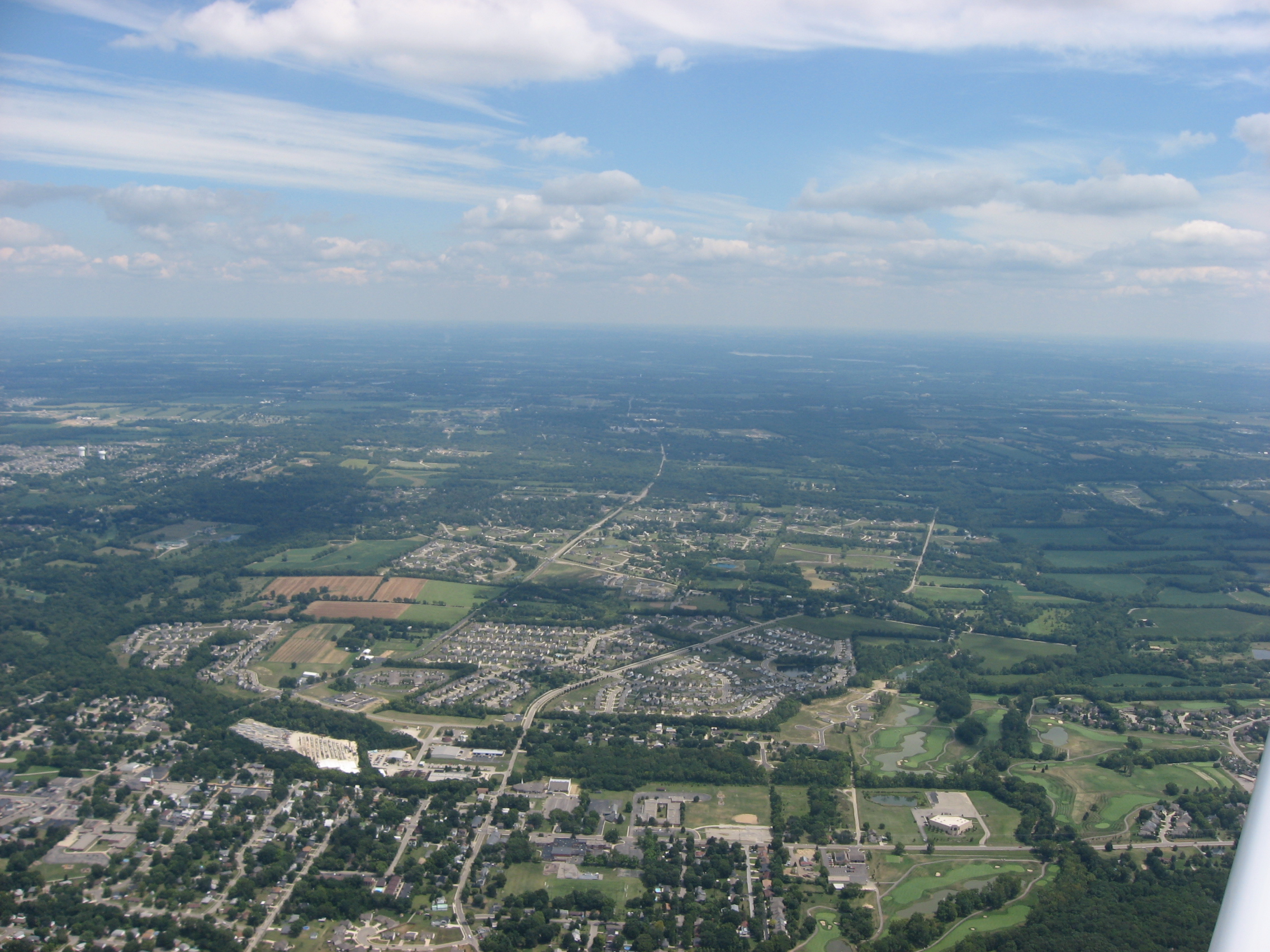
| Deskripsyon | Aerial view of Springboro, a city primarily in Warren County, Ohio, United States; although part of the city extends into Montgomery County, this picture is taken exclusively over Warren County. Heatherwoode Golf Club is visible on the right side of the picture. Picture taken from a Diamond Eclipse light airplane at an altitude of 3,440 feet MSL and a bearing of approximately 95º. | ||
| Petsa | Taken on 12 Agosto 2008 | ||
| Gigikanan | Kaugalingong trabaho | ||
| Tagsulat | Nyttend | ||
| Pagtugot (Paggamit pag-usab niini nga file) |
|
Kaagi sa payl
I-klik ang petsa/oras aron makit-an ang hulagway sa payl niadtong panahona.
| Petsa/Takna | Thumbnail | Mga dimensyon | Tiggamit | Komento | |
|---|---|---|---|---|---|
| kasamtangan | 02:16, 23 Septiyembre 2008 | | 2,272 × 1,704 (1.58 MB) | Nyttend | {{Information |Description=Aerial view of {{w|Springboro, Ohio|Springboro}}, a city primarily in {{w|Warren County, Ohio|Warren County}}, {{w|Ohio}}, {{w|United States}}; although part of the city extends into {{w|Montgomery County, Ohio|Montgomery County |
Mga paggamit sa payl
Ang mosunod nga mga panid misumpay niining payl:
Global nga paggamit sa payl
Kining ubang wiki naggamit ning maong payl:
- Paggamit sa ar.wikipedia.org
- Paggamit sa arz.wikipedia.org
- Paggamit sa azb.wikipedia.org
- Paggamit sa ca.wikipedia.org
- Paggamit sa ce.wikipedia.org
- Paggamit sa cy.wikipedia.org
- Paggamit sa en.wikipedia.org
- Paggamit sa en.wikivoyage.org
- Paggamit sa es.wikipedia.org
- Paggamit sa eu.wikipedia.org
- Paggamit sa fa.wikipedia.org
- Paggamit sa fr.wikipedia.org
- Paggamit sa ht.wikipedia.org
- Paggamit sa it.wikipedia.org
- Paggamit sa it.wikivoyage.org
- Paggamit sa ky.wikipedia.org
- Paggamit sa lld.wikipedia.org
- Paggamit sa pl.wikipedia.org
- Paggamit sa pt.wikipedia.org
- Paggamit sa sh.wikipedia.org
- Paggamit sa sr.wikipedia.org
- Paggamit sa tr.wikipedia.org
- Paggamit sa tt.wikipedia.org
- Paggamit sa uk.wikipedia.org
- Paggamit sa uz.wikipedia.org
- Paggamit sa vi.wikipedia.org
- Paggamit sa vo.wikipedia.org
- Paggamit sa www.wikidata.org
- Paggamit sa zh-min-nan.wikipedia.org
- Paggamit sa zh.wikipedia.org