
Payl:United Kingdom relief location map.jpg

Gidak-on ning maong paunang tan-aw: 388 x 600 ka mga piksel. Uban pang mga resoluyon: 155 x 240 ka mga piksel | 310 x 480 ka mga piksel | 497 x 768 ka mga piksel | 662 x 1,024 ka mga piksel | 1,348 x 2,083 ka mga piksel.
Tibuok resolusyon (1,348 × 2,083 pixels, size sa payl: 831 KB, MIME type: image/jpeg)
Du
Mubong sugid:
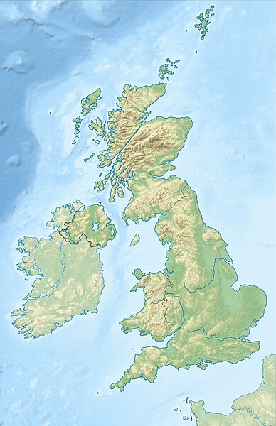
| Deskripsyon |
Deutsch: Positionskarte des Vereinigten Königreichs
Quadratische Plattkarte, N-S-Streckung 170 %. Geographische Begrenzung der Karte:
English: Location map of the United Kingdom
Equirectangular projection, N/S stretching 170 %. Geographic limits of the map:
|
| Petsa | |
| Gigikanan |
own work, using SRTM Data, |
| Tagsulat | Alexrk2 |
| Other versions |
|


|
This map has been made or improved in the German Kartenwerkstatt (Map Lab). You can propose maps to improve as well.
|
ПРИВЕТ ВСЕМ
Pagtugot
I, the copyright holder of this work, hereby publish it under the following licenses:

|
Gitugot ang pagkopya, pag-apud-apod o/ug pag-usab ning maong dokumento ubos sa mga termino sa GNU Free Documentation License, Version 1.2 o mas bag-ong bersiyon nga gimantala sa Free Software Foundation; nga walay Invariant Sections, walay Front-Cover Texts, ug walay Back-Cover Texts. Ang kopya sa lisensiya gilakip sa bahin nga giulohang GNU Free Documentation License. |
This file is licensed under the Creative Commons Attribution-Share Alike 3.0 Unported license.
- Libre ka:
- sa pagsabwag – sa pagkopya, pag-apod-apod ug pagsabwag sa hinimo
- sa pag-remix – sa pag-adap sa binuhat
- Ubos sa mosunod nga mga kondisyon:
- atribusyon – Kinahanglan nimo nga hatagan ang angay nga kredito, maghatag usa ka link sa lisensya, ug ipakita kung adunay mga pagbag-o. Mahimo nimo kini buhaton sa bisan unsang makatarunganon nga paagi, apan dili sa bisan unsang paagi nga nagsugyot nga gi-endorso ka sa licensor o ang imong paggamit.
- share parehas – Kung imong gi-remix, gibag-o, o gibase sa materyal, kinahanglan nimo nga iapod-apod ang imong mga kontribusyon sa ilawom sa parehas o katugma nga lisensya sama sa orihinal.
You may select the license of your choice.
Kaagi sa payl
I-klik ang petsa/oras aron makit-an ang hulagway sa payl niadtong panahona.
| Petsa/Takna | Thumbnail | Mga dimensyon | Tiggamit | Komento | |
|---|---|---|---|---|---|
| kasamtangan | 18:13, 17 Hunyo 2012 | | 1,348 × 2,083 (831 KB) | Alexrk2 | inland water |
| 18:12, 17 Hunyo 2012 |  | 1,354 × 2,090 (829 KB) | Alexrk2 | == {{int:filedesc}} == {{Information |Description= {{de|Positionskarte des Vereinigten Königreichs}} Quadratische Plattkarte, N-S-Streckung 170 %. Geographische Begrenzung der Karte: * N: 61.0° N * S: 49.0° N * W: 11.... |
Mga paggamit sa payl
Ang mosunod nga 5 panid misumpay niining payl:
Global nga paggamit sa payl
Kining ubang wiki naggamit ning maong payl:
- Paggamit sa ab.wikipedia.org
- Paggamit sa ar.wikipedia.org
- Paggamit sa arz.wikipedia.org
- Paggamit sa ast.wikipedia.org
- Paggamit sa azb.wikipedia.org
- Paggamit sa az.wikipedia.org
- Şablon:Yer xəritəsi Böyük Britaniya
- İrland dənizi
- Ben Nevis
- Pa-de-Kale boğazı
- Şimal boğazı
- Orkney adaları
- Lox Ness
- Arran (ada)
- Fer adası
- Qrampian dağları
- Flanan adaları
- Finqal mağarası
- Hebrid dənizi
- Kelt dənizi
- Menay boğazı
- Nort-Minç boğazı
- Pentlənd-Ferd boğazı
- Yell boğazı
- Lya-Kupe bərzəxi
- Böyük Britaniya (ada)
- Solent
- Leskov adası
- Kernqorms Milli Parkı
- Kembri dağları
- Llin yarımadası
- Ardnamerxan
- Kintayr yarımadası
- Qrinviç yarımadası
- Qauer yarımadası
- Lends End
- Trevos burnu
- Müqəddəs Yekaterina burnu
- Lizard burnu
- Ayona
View more global usage of this file.