
Payl:Uttarakhand locator map.svg

Size of this PNG preview of this SVG file: 666 x 599 ka mga piksel. Uban pang mga resoluyon: 267 x 240 ka mga piksel | 533 x 480 ka mga piksel | 853 x 768 ka mga piksel | 1,138 x 1,024 ka mga piksel | 2,276 x 2,048 ka mga piksel | 1,250 x 1,125 ka mga piksel.
Tibuok resolusyon (SVG nga payl, nominally 1,250 × 1,125 pixels, size sa payl: 137 KB)
Mubong sugid:
| Deskripsyon |
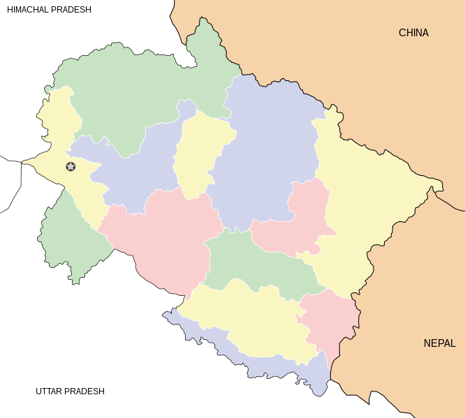
English: Locator map for the state of w:Uttarakhand. Equirectangular projection. Geographic limits of the map: top=31.61, bottom=28.50, left=77.46, right=81.19. |
| Petsa | |
| Gigikanan | Kaugalingong trabaho |
| Tagsulat | Mkeranat |
Pagtugot
I, the copyright holder of this work, hereby publish it under the following licenses:

|
Gitugot ang pagkopya, pag-apud-apod o/ug pag-usab ning maong dokumento ubos sa mga termino sa GNU Free Documentation License, Version 1.2 o mas bag-ong bersiyon nga gimantala sa Free Software Foundation; nga walay Invariant Sections, walay Front-Cover Texts, ug walay Back-Cover Texts. Ang kopya sa lisensiya gilakip sa bahin nga giulohang GNU Free Documentation License. |
This file is licensed under the Creative Commons Attribution 3.0 Unported license.
- Libre ka:
- sa pagsabwag – sa pagkopya, pag-apod-apod ug pagsabwag sa hinimo
- sa pag-remix – sa pag-adap sa binuhat
- Ubos sa mosunod nga mga kondisyon:
- atribusyon – Kinahanglan nimo nga hatagan ang angay nga kredito, maghatag usa ka link sa lisensya, ug ipakita kung adunay mga pagbag-o. Mahimo nimo kini buhaton sa bisan unsang makatarunganon nga paagi, apan dili sa bisan unsang paagi nga nagsugyot nga gi-endorso ka sa licensor o ang imong paggamit.
You may select the license of your choice.
Kaagi sa payl
I-klik ang petsa/oras aron makit-an ang hulagway sa payl niadtong panahona.
| Petsa/Takna | Thumbnail | Mga dimensyon | Tiggamit | Komento | |
|---|---|---|---|---|---|
| kasamtangan | 19:48, 1 Marso 2008 | | 1,250 × 1,125 (137 KB) | Mkeranat~commonswiki | {{Information |Description=Locator map for the state of Uttarakhand updated with white borders for districts |Source=self-made |Date=Feb 2008 |Author= Mkeranat |Permission= |other_versions= }} |
| 13:04, 10 Pebrero 2008 |  | 1,250 × 1,125 (136 KB) | Mkeranat~commonswiki | {{Information |Title=Uttarakhand locator map |Description=Locator map for the state of [w:Uttarakhand]] |Source=self-made |Date=February 2007 |Author= Mkeranat |Permission= |other_versions= }} |
Mga paggamit sa payl
Ang mosunod nga mga panid misumpay niining payl:
Global nga paggamit sa payl
Kining ubang wiki naggamit ning maong payl:
- Paggamit sa ar.wikipedia.org
- Paggamit sa ast.wikipedia.org
- Paggamit sa as.wikipedia.org
- Paggamit sa awa.wikipedia.org
- Paggamit sa ba.wikipedia.org
- Paggamit sa bh.wikipedia.org
- Paggamit sa bn.wikipedia.org
- Paggamit sa de.wikipedia.org
- Paggamit sa en.wikipedia.org
- Paggamit sa es.wikipedia.org
- Paggamit sa fa.wikipedia.org
- Paggamit sa gu.wikipedia.org
- Paggamit sa hi.wikipedia.org
View more global usage of this file.