
Payl:Wallis-et-Futuna collectivity location map.svg

Size of this PNG preview of this SVG file: 800 x 508 ka mga piksel. Uban pang mga resoluyon: 320 x 203 ka mga piksel | 640 x 406 ka mga piksel | 1,024 x 650 ka mga piksel | 1,280 x 813 ka mga piksel | 2,560 x 1,626 ka mga piksel | 1,691 x 1,074 ka mga piksel.
Tibuok resolusyon (SVG nga payl, nominally 1,691 × 1,074 pixels, size sa payl: 89 KB)
Mubong sugid:
| Camera location | | View this and other nearby images on: OpenStreetMap |
|---|
| Deskripsyon |
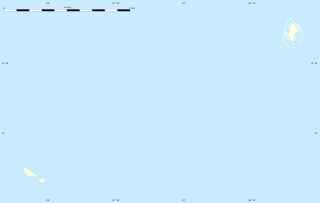
English: Blank administrative map of the French overseas collectivity of Wallis and Futuna, for geo-location purpose.
Français : Carte administrative vierge de la Collectivité d'outre-mer de Wallis-et-Futuna, destinée à la géolocalisation. Estimated scale: 1:400,000 (precision: 100 m)
Geographic limits of the map:
|
||
| Petsa | |||
| Gigikanan |
Kaugalingong trabaho
|
||
| Tagsulat | Eric Gaba (Sting - fr:Sting) | ||
| Pagtugot (Paggamit pag-usab niini nga file) |
|
||
| Other versions |
See also:
|


Pagtugot
Eric Gaba, Wikimedia Commons user Sting, the copyright holder of this work, hereby publishes it under the following license:
This file is licensed under the Creative Commons Attribution-Share Alike 3.0 Unported license.
Attribution: Eric Gaba, Wikimedia Commons user Sting
- Libre ka:
- sa pagsabwag – sa pagkopya, pag-apod-apod ug pagsabwag sa hinimo
- sa pag-remix – sa pag-adap sa binuhat
- Ubos sa mosunod nga mga kondisyon:
- atribusyon – Kinahanglan nimo nga hatagan ang angay nga kredito, maghatag usa ka link sa lisensya, ug ipakita kung adunay mga pagbag-o. Mahimo nimo kini buhaton sa bisan unsang makatarunganon nga paagi, apan dili sa bisan unsang paagi nga nagsugyot nga gi-endorso ka sa licensor o ang imong paggamit.
- share parehas – Kung imong gi-remix, gibag-o, o gibase sa materyal, kinahanglan nimo nga iapod-apod ang imong mga kontribusyon sa ilawom sa parehas o katugma nga lisensya sama sa orihinal.
Kaagi sa payl
I-klik ang petsa/oras aron makit-an ang hulagway sa payl niadtong panahona.
| Petsa/Takna | Thumbnail | Mga dimensyon | Tiggamit | Komento | |
|---|---|---|---|---|---|
| kasamtangan | 21:03, 12 Hulyo 2010 | | 1,691 × 1,074 (89 KB) | Sting | == {{int:filedesc}} == {{Location|13|46|30|S|177|10|30|W|scale:1000000}} <br/> {{Information |Description={{en|Blank administrative map of the French overseas collectivity of Wallis and Futuna |
Mga paggamit sa payl
More than 100 pages use this file. The following list shows the first 100 pages that use this file only. A full list is available.
- Akaka
- Alele
- Alo
- Chenal Sain
- Circonscription d'Uvéa
- Circonscription de Sigavé
- Combe Bank
- Combe Seamount
- Entrance Island
- Field Seamount
- Foss Reef
- Gahi
- Green Point
- Halalo
- Home Seamount
- Isabella Reef
- Kolia
- Lac Lano
- Lalla Rookh Seamount
- Les Lions
- Liku
- Little Peak
- Lulu Hill
- Mamelon Vert
- Mata Utu
- Mont Lulu Luo
- Mont Singavi
- North Point
- Nukufetau
- Ouvéa
- Pasco Reef
- Pasco Seamount
- Petit Piton
- Petit Piton (tumoy sa bukid)
- Pointe Falaise
- Pointe Mataaho
- Pointe Matakaviki
- Pointe Matalaa
- Pointe Mua
- Pointe Nord
- Pointe Nord (punta sa Wallis and Futuna)
- Pointe Pagaga
- Pointe Pukega
- Pointe Puko
- Pointe Pyramides
- Pointe Rocheuse (punta sa Wallis and Futuna)
- Pointe Rouge
- Pointe Rouge (punta sa Wallis and Futuna)
- Pointe Sauma
- Pointe Tepako
- Pointe Utuhamia
- Pointe Utuloko
- Pointe Vailala
- Pointe Velé
- Pointe Verte
- Pointe Verte (punta sa Wallis and Futuna)
- Pointe de Sable (punta sa Wallis and Futuna)
- Red Point
- Robbie Bank
- Rocky Point
- Rotumah Reef
- Sail Rock
- Sigavé
- Sommet Matsi
- Southwest Rock
- Tauai
- Taviuni Reef
- Teesi
- Tekaviki
- Tepa (lungsod)
- Tepa (pagklaro)
- The Lions
- Tufuone
- Utufua
- Vailala
- Vaitupu
- Vaitupu (lungsod)
- Vele
- Velé
- Wallis Island
- Wallis Island (pulo sa Wallis and Futuna)
- Wallis Islands
- Waterwitch Seamount
- Île Futuna
- Île Nukuaéta
- Île Nukufufulanoa
- Île Nukuhifala
- Île Nukuhione
- Île Nukulaelae
- Île Nukuloa
- Île Nukuloa (pulo sa Wallis and Futuna)
- Île Nukuofo
- Île Nukutapu
- Île Nukutapu (pulo, lat -13,22, long -176,17)
- Île Nukutapu (pulo, lat -13,36, long -176,22)
- Île Nukuteatea
- Île Uluiutu
- Îlot Nuku Fetau
- Îlot Nukufotu
- Îlot Nukutaakimua
View more links to this file.
Global nga paggamit sa payl
Kining ubang wiki naggamit ning maong payl:
- Paggamit sa af.wikipedia.org
- Paggamit sa als.wikipedia.org
- Paggamit sa an.wikipedia.org
- Paggamit sa ar.wikipedia.org
- Paggamit sa ast.wikipedia.org
- Paggamit sa az.wikipedia.org
- Paggamit sa bg.wikipedia.org
- Paggamit sa bs.wikipedia.org
- Paggamit sa cs.wikipedia.org
- Paggamit sa de.wikipedia.org
- Paggamit sa de.wikivoyage.org
- Paggamit sa el.wikipedia.org
- Paggamit sa en.wikipedia.org
- Paggamit sa eo.wikipedia.org
- Paggamit sa es.wikipedia.org
- Paggamit sa fa.wikipedia.org
- Paggamit sa fr.wikipedia.org
- Mata Utu
- Hahake
- Futuna
- Alofi (île)
- Wallis (île)
- Projet:Cartographie/Cartes standards/France
- Modèle:Géolocdual/Wallis-et-Futuna
- Modèle:Géolocalisation/Wallis-et-Futuna
- Modèle:Géolocalisation/Wallis-et-Futuna/Documentation
- Wikipédia:Atelier graphique/Cartes/Archives/juillet 2010
- Îles Horn
- Mont Puke
- Faioa
- Aéroport de Wallis-Hihifo
- Aérodrome de Futuna Pointe Vele
- Vailala
View more global usage of this file.