
Payl:Wfm yerba buena treasure islands usgs.jpg
Gidak-on ning maong paunang tan-aw: 448 x 599 ka mga piksel. Uban pang mga resoluyon: 179 x 240 ka mga piksel | 359 x 480 ka mga piksel | 861 x 1,152 ka mga piksel.
Tibuok resolusyon (861 × 1,152 pixels, size sa payl: 532 KB, MIME type: image/jpeg)
Mubong sugid:
| Deskripsyon |
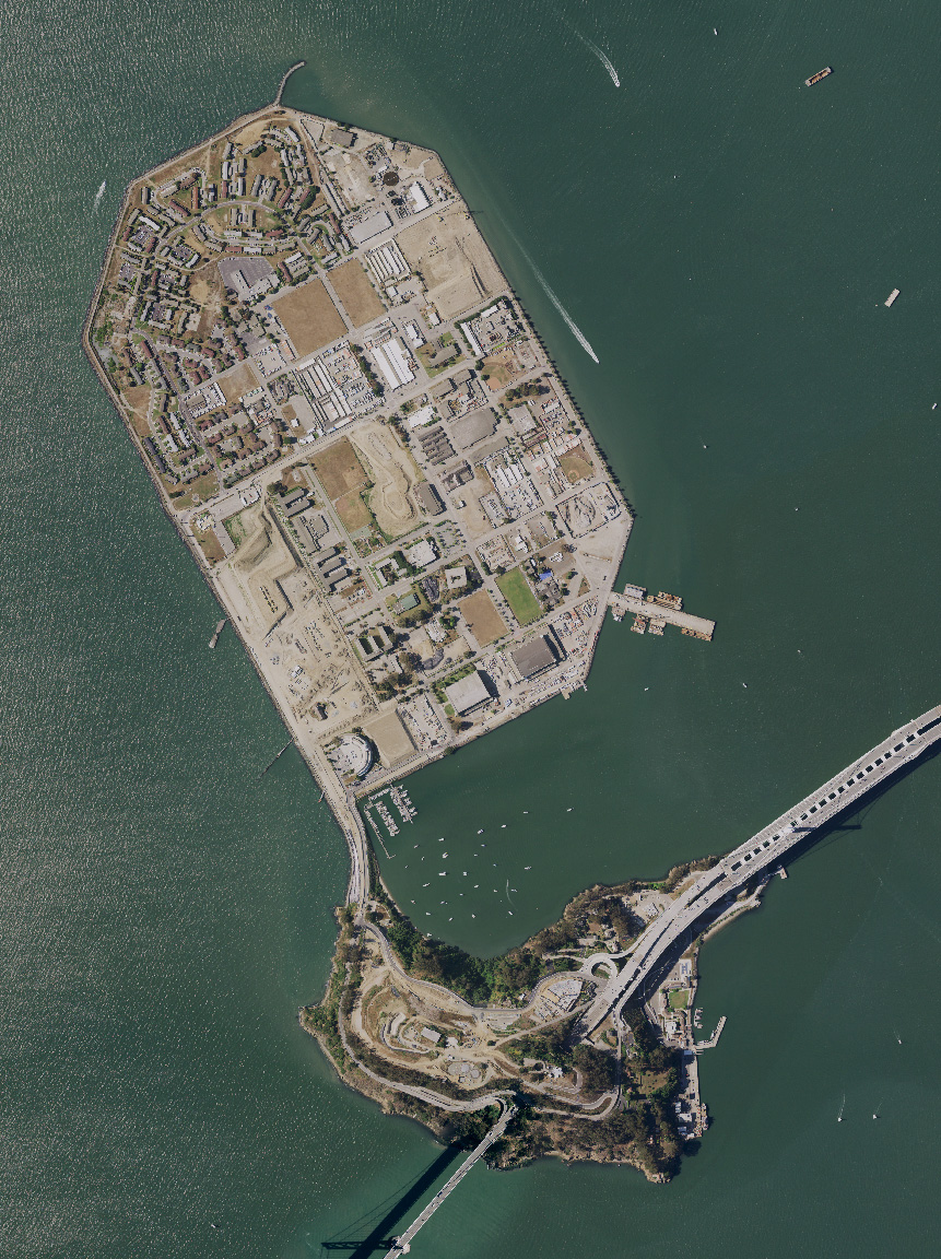
English: Treasure Island and Yerba Buena island, and the San Francisco Bay Bridge, in San Francisco Bay, California. USDA aerial photograph montage. |
| Petsa | 27 Oktubre 2021 (upload date) |
| Gigikanan | Satellite imagery taken from USDA's NAIP |
| Tagsulat | USDA |
Pagtugot
This work is in the public domain in the United States because it is a work prepared by an officer or employee of the United States Government as part of that person’s official duties under the terms of Title 17, Chapter 1, Section 105 of the US Code.
Note: This only applies to original works of the Federal Government and not to the work of any individual U.S. state, territory, commonwealth, county, municipality, or any other subdivision. This template also does not apply to postage stamp designs published by the United States Postal Service since 1978. (See § 313.6(C)(1) of Compendium of U.S. Copyright Office Practices). It also does not apply to certain US coins; see The US Mint Terms of Use.
|
 | |
| This file has been identified as being free of known restrictions under copyright law, including all related and neighboring rights. | ||
Kaagi sa payl
I-klik ang petsa/oras aron makit-an ang hulagway sa payl niadtong panahona.
| Petsa/Takna | Thumbnail | Mga dimensyon | Tiggamit | Komento | |
|---|---|---|---|---|---|
| kasamtangan | 16:12, 27 Oktubre 2021 | | 861 × 1,152 (532 KB) | 9yz | New NAIP imagery from 2020 |
| 11:54, 1 Agosto 2005 |  | 948 × 1,280 (217 KB) | Finlay McWalter | Treasure Island and Yerba Buena island, and the San Francisco Bay Bridge, in San Francisco Bay, California. USGS aerial photograph montage. Made using NASA World Wind. {{PD-USGov-USGS}} category:maps |
Mga paggamit sa payl
Ang mosunod nga mga panid misumpay niining payl:
Global nga paggamit sa payl
Kining ubang wiki naggamit ning maong payl:
- Paggamit sa bg.wikipedia.org
- Paggamit sa de.wikipedia.org
- Paggamit sa en.wikipedia.org
- Paggamit sa en.wikivoyage.org
- Paggamit sa es.wikipedia.org
- Paggamit sa et.wikipedia.org
- Paggamit sa fr.wikipedia.org
- Paggamit sa is.wikipedia.org
- Paggamit sa nl.wikipedia.org
- Paggamit sa ru.wikipedia.org
- Paggamit sa th.wikipedia.org
- Paggamit sa www.wikidata.org
- Paggamit sa zh.wikipedia.org