
Payl:Wordie House, Winter Island (Base F).jpg
Gidak-on ning maong paunang tan-aw: 800 x 518 ka mga piksel. Uban pang mga resoluyon: 320 x 207 ka mga piksel | 640 x 415 ka mga piksel | 1,024 x 663 ka mga piksel | 1,280 x 829 ka mga piksel.
Tibuok resolusyon (1,280 × 829 pixels, size sa payl: 178 KB, MIME type: image/jpeg)
.jpg)
| Deskripsyon |
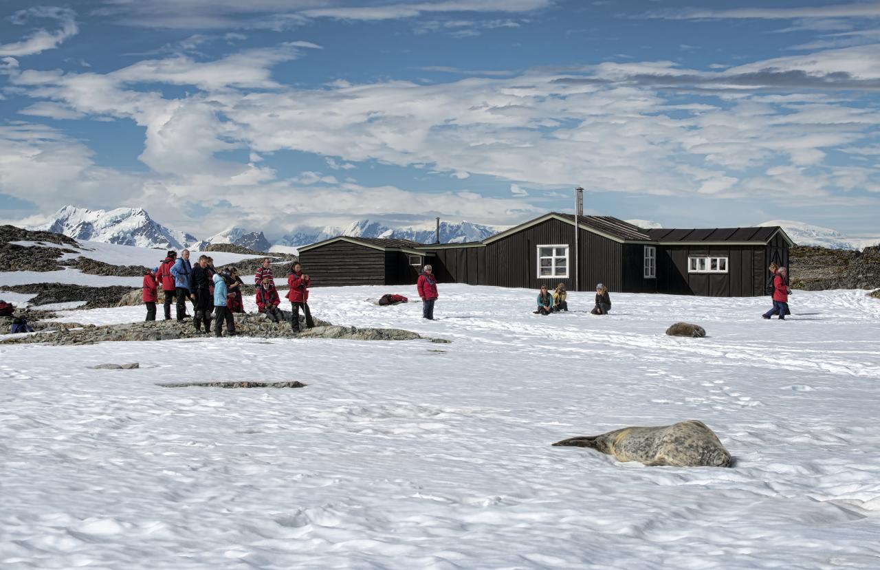
English: Winter Island is an island 0.5 nautical miles (0.9 km) long, lying 0.1 nautical miles (0.2 km) north of Skua Island in the Argentine Islands, Wilhelm Archipelago. Winter Island was named by the British Graham Land Expedition (BGLE), 1934–37, which made this island the site of its winter base during 1935.
In 1947, Falkland Islands Dependencies Survey established a base on Winter Island, Base F (Argentine Islands). The main building ("Wordie House") was erected at the old camp site. The station were relocated to the neighbouring Galindez Island in May 1954 and renamed Faraday Station in 1977. |
||
| Petsa | |||
| Gigikanan | Flickr: Antarctica 2013: Journey to the Crystal Desert | ||
| Tagsulat | *christopher* | ||
| Pagtugot (Paggamit pag-usab niini nga file) |
This file is licensed under the Creative Commons Attribution 2.0 Generic license.
|
| Camera location | | View this and other nearby images on: OpenStreetMap |
|---|
.jpg¶ms=-65.250533_N_-064.254870_E_globe:Earth_type:camera_alt:11_source:exif_&language=ceb)
Kaagi sa payl
I-klik ang petsa/oras aron makit-an ang hulagway sa payl niadtong panahona.
| Petsa/Takna | Thumbnail | Mga dimensyon | Tiggamit | Komento | |
|---|---|---|---|---|---|
| kasamtangan | 21:29, 15 Enero 2013 | | 1,280 × 829 (178 KB) | Flickr upload bot | Uploaded from http://flickr.com/photo/50979393@N00/8369580321 using Flickr upload bot |
Mga paggamit sa payl
Ang mosunod nga mga panid misumpay niining payl:
Global nga paggamit sa payl
Kining ubang wiki naggamit ning maong payl:
- Paggamit sa de.wikipedia.org
- Paggamit sa en.wikipedia.org
- Paggamit sa fi.wikipedia.org
- Paggamit sa no.wikipedia.org
- Paggamit sa pt.wikipedia.org
- Paggamit sa www.wikidata.org
.jpg)