School of Mathematics, Physics e Natural Sciences
Paghimo ni bot Lsjbot. |
| School of Mathematics, Physics e Natural Sciences | |
| Unibersidad | |
| Nasod | |
|---|---|
| Rehiyon | Toscana |
| Lalawigan | Province of Florence |
| Gitas-on | 65 m (213 ft) |
| Tiganos | 43°48′08″N 11°14′43″E / 43.80231°N 11.24519°E |
| Timezone | CET (UTC+1) |
| - summer (DST) | CEST (UTC+2) |
| GeoNames | 11055134 |
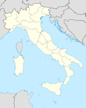
Unibersidad ang School of Mathematics, Physics e Natural Sciences sa Italya.[1] Nahimutang ni sa lalawigan sa Province of Florence ug rehiyon sa Toscana, sa sentro nga bahin sa nasod, 240 km sa amihanan sa Rome ang ulohan sa nasod. 65 metros ibabaw sa dagat kahaboga ang nahimutangan sa School of Mathematics, Physics e Natural Sciences.[1]
Ang yuta palibot sa School of Mathematics, Physics e Natural Sciences patag sa habagatang-kasadpan, apan sa amihang-sidlakan nga kini mao ang kabungtoran.[saysay 1] Kinahabogang dapit sa palibot ang Poggio del Giro, 722 ka metros ni kahaboga ibabaw sa dagat, 5.3 km sa amihanan sa School of Mathematics, Physics e Natural Sciences.[saysay 2] Dunay mga 1,095 ka tawo kada kilometro kwadrado sa palibot sa School of Mathematics, Physics e Natural Sciences may kaayo hilabihan populasyon.[3] Ang kinadul-ang mas dakong lungsod mao ang Florence, 2.6 km sa habagatan sa School of Mathematics, Physics e Natural Sciences. Hapit nalukop sa kabalayan ang palibot sa School of Mathematics, Physics e Natural Sciences.[4]
Ang klima mediteranyo.[5] Ang kasarangang giiniton 15 °C. Ang kinainitan nga bulan Hulyo, sa 28 °C, ug ang kinabugnawan Disyembre, sa 4 °C.[6] Ang kasarangang pag-ulan 1,261 milimetro matag tuig. Ang kinabasaan nga bulan Nobiyembre, sa 205 milimetro nga ulan, ug ang kinaugahan Hunyo, sa 50 milimetro.[7]
Saysay[usba | usba ang wikitext]
- ↑ Kalkulado gikan sa pakigbingkil sa tanan nga gitas-on data (DEM 3") gikan sa Viewfinder Panoramas, sa sulod sa 10 ka kilometro radius.[2] Ang bug-os nga algoritmo anaa dinhi.
- ↑ Ang punto nga labing taas sa ibabaw sa mga lokal nga kapunawpunawan, sumala sa gihabogon data sa GeoNames.[1]
Ang mga gi basihan niini[usba | usba ang wikitext]
- ↑ 1.0 1.1 1.2 School of Mathematics, Physics e Natural Sciences sa Geonames.org (cc-by); post updated 2016-02-08; database download sa 2016-08-15
- ↑ "Viewfinder Panoramas Digital elevation Model". 2015-06-21.
- ↑ "NASA Earth Observations: Population Density". NASA/SEDAC. Retrieved 30 Enero 2016.
- ↑ "NASA Earth Observations: Land Cover Classification". NASA/MODIS. Retrieved 30 Enero 2016.
- ↑ Peel, M C; Finlayson, B L. "Updated world map of the Köppen-Geiger climate classification". Hydrology and Earth System Sciences. 11: 1633–1644. doi:10.5194/hess-11-1633-2007. Retrieved 30 Enero 2016.
{{cite journal}}: CS1 maint: unflagged free DOI (link) - ↑ "NASA Earth Observations Data Set Index". NASA. Retrieved 30 Enero 2016.
- ↑ "NASA Earth Observations: Rainfall (1 month - TRMM)". NASA/Tropical Rainfall Monitoring Mission. Retrieved 30 Enero 2016.

