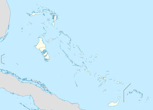
The Brothers (bato sa Bahamas, Ragged Island District, lat 22,02, long -75,77)
Paghimo ni bot Lsjbot. |
- Alang sa ubang mga dapit sa mao gihapon nga ngalan, tan-awa ang The Brothers.
| The Brothers | |
| Bato | |
| Nasod | |
|---|---|
| Distrito | Ragged Island District |
| Tiganos | 22°01′00″N 75°46′00″W / 22.01667°N 75.76667°W |
| Timezone | EST (UTC-5) |
| - summer (DST) | EDT (UTC-4) |
| GeoNames | 3572731 |
Bato ang The Brothers sa Bahamas.[1] Nahimutang ni sa distrito sa Ragged Island District, sa habagatang bahin sa nasod, 400 km sa habagatan sa Nassau ang ulohan sa nasod.
Ang yuta palibot sa The Brothers lain-lain.[saysay 1] Ang kinahabogang dapit sa palibot dunay gihabogon nga 32 ka metro ug 19.6 km sa amihanan sa The Brothers.[saysay 2] Diyutay ray lumulupyo ining dapita. Walay lungsod sa palibot. Sa rehiyon palibot sa The Brothers, nga bato nga pormasyon talagsaon komon.[saysay 3]
Saysay[usba | usba ang wikitext]
- ↑ Kalkulado gikan sa pakigbingkil sa tanan nga gitas-on data (DEM 3") gikan sa Viewfinder Panoramas, sa sulod sa 10 ka kilometro radius.[2] Ang bug-os nga algoritmo anaa dinhi.
- ↑ Kalkulado gikan sa gitas-on data (DEM 3") gikan sa Viewfinder Panoramas.[2] Ang bug-os nga algoritmo anaa dinhi.
- ↑ Mas sulod sa 20 ka kilometro gilay-on itandi sa average nga densidad sa Yuta, sumala sa GeoNames.[1]
Ang mga gi basihan niini[usba | usba ang wikitext]
- ↑ 1.0 1.1 The Brothers sa GeoNames.Org (cc-by); post updated 1993-12-30; database download sa 2015-05-11
- ↑ 2.0 2.1 "Viewfinder Panoramas Digital elevation Model". 2015-06-21.

