Panemote Island
Appearance
Paghimo ni bot Lsjbot. |
| Panemote Island | |
| Nasakori Island, Panemate | |
| Pulo | |
| Nasod | |
|---|---|
| Lalawigan | Milne Bay Province |
| Tiganos | 9°25′16″S 151°57′26″E / 9.42118°S 151.95736°E |
| Timezone | AEST (UTC+10) |
| GeoNames | 2088677 |
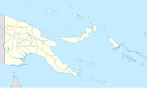
Pulo ang Panemote Island sa Nugini sa Papua.[1] Nahimutang ni sa lalawigan sa Milne Bay Province, sa sidlakang bahin sa nasod, 500 km sa sidlakan sa Port Moresby ang ulohan sa nasod.
Ang mga gi basihan niini[usba | usba ang wikitext]
- ↑ Panemote Island sa Geonames.org (cc-by); post updated 2012-01-17; database download sa 2015-06-22

