
Payl:Ambleston1.jpg
Ambleston1.jpg (640 × 480 pixels, size sa payl: 54 KB, MIME type: image/jpeg)
Mubong sugid:
| Deskripsyon |
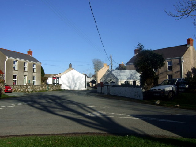
English: Treamlod/Ambleston village centre Tiny agricultural village (popn. 150) south of the Preselis.
From the community action plan 2005: "Despite Flemish settlements typical of Pembrokeshire roundabout Ambleston Parish, and despite more recent population changes, the character of Ambleston is decidedly Welsh. It would be wrong to include it in the dubious Little England beyond Wales description applied to South Pembrokeshire; mostly by travel brochures. The illdefined Landsker probably lies to the south of Ambleston although some historians have associated it with Woodstock. Most families rooted in the area are Welsh speaking and many use Welsh by choice." Ambleston has no pub, school or shops, although it used to have several. There is concern about the lack of amenities in the village and efforts are being made to restore community activities. |
| Petsa | |
| Gigikanan | From geograph.org.uk |
| Tagsulat | ceridwen |
| Attribution (required by the license) | ceridwen / Treamlod/Ambleston village centre / |
| Camera location | | View this and other nearby images on: OpenStreetMap |
|---|
Pagtugot

|
This image was taken from the Geograph project collection. See this photograph's page on the Geograph website for the photographer's contact details. The copyright on this image is owned by ceridwen and is licensed for reuse under the Creative Commons Attribution-ShareAlike 2.0 license.
|
- Libre ka:
- sa pagsabwag – sa pagkopya, pag-apod-apod ug pagsabwag sa hinimo
- sa pag-remix – sa pag-adap sa binuhat
- Ubos sa mosunod nga mga kondisyon:
- atribusyon – Kinahanglan nimo nga hatagan ang angay nga kredito, maghatag usa ka link sa lisensya, ug ipakita kung adunay mga pagbag-o. Mahimo nimo kini buhaton sa bisan unsang makatarunganon nga paagi, apan dili sa bisan unsang paagi nga nagsugyot nga gi-endorso ka sa licensor o ang imong paggamit.
- share parehas – Kung imong gi-remix, gibag-o, o gibase sa materyal, kinahanglan nimo nga iapod-apod ang imong mga kontribusyon sa ilawom sa parehas o katugma nga lisensya sama sa orihinal.
Kaagi sa payl
I-klik ang petsa/oras aron makit-an ang hulagway sa payl niadtong panahona.
| Petsa/Takna | Thumbnail | Mga dimensyon | Tiggamit | Komento | |
|---|---|---|---|---|---|
| kasamtangan | 19:21, 9 Nobiyembre 2009 | | 640 × 480 (54 KB) | Perry Rimmer | {{Information |Description={{en|1=h}} |Source=h |Author=h |Date=h |Permission= |other_versions= }} |
Mga paggamit sa payl
Ang mosunod nga mga panid misumpay niining payl:
Global nga paggamit sa payl
Kining ubang wiki naggamit ning maong payl: