
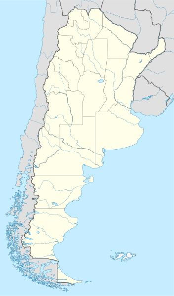
Payl:Argentina location map.svg

Size of this PNG preview of this SVG file: 352 x 599 ka mga piksel. Uban pang mga resoluyon: 141 x 240 ka mga piksel | 282 x 480 ka mga piksel | 451 x 768 ka mga piksel | 602 x 1,024 ka mga piksel | 1,204 x 2,048 ka mga piksel | 1,418 x 2,412 ka mga piksel.
Tibuok resolusyon (SVG nga payl, nominally 1,418 × 2,412 pixels, size sa payl: 1.03 MB)
Mubong sugid:
.svg)
.svg)

|
This map has been made or improved in the German Kartenwerkstatt (Map Lab). You can propose maps to improve as well.
|
Pagtugot
I, the copyright holder of this work, hereby publish it under the following licenses:

|
Gitugot ang pagkopya, pag-apud-apod o/ug pag-usab ning maong dokumento ubos sa mga termino sa GNU Free Documentation License, Version 1.2 o mas bag-ong bersiyon nga gimantala sa Free Software Foundation; nga walay Invariant Sections, walay Front-Cover Texts, ug walay Back-Cover Texts. Ang kopya sa lisensiya gilakip sa bahin nga giulohang GNU Free Documentation License. |
This file is licensed under the Creative Commons Attribution-Share Alike 3.0 Unported license.
- Libre ka:
- sa pagsabwag – sa pagkopya, pag-apod-apod ug pagsabwag sa hinimo
- sa pag-remix – sa pag-adap sa binuhat
- Ubos sa mosunod nga mga kondisyon:
- atribusyon – Kinahanglan nimo nga hatagan ang angay nga kredito, maghatag usa ka link sa lisensya, ug ipakita kung adunay mga pagbag-o. Mahimo nimo kini buhaton sa bisan unsang makatarunganon nga paagi, apan dili sa bisan unsang paagi nga nagsugyot nga gi-endorso ka sa licensor o ang imong paggamit.
- share parehas – Kung imong gi-remix, gibag-o, o gibase sa materyal, kinahanglan nimo nga iapod-apod ang imong mga kontribusyon sa ilawom sa parehas o katugma nga lisensya sama sa orihinal.
You may select the license of your choice.
Kaagi sa payl
I-klik ang petsa/oras aron makit-an ang hulagway sa payl niadtong panahona.
| Petsa/Takna | Thumbnail | Mga dimensyon | Tiggamit | Komento | |
|---|---|---|---|---|---|
| kasamtangan | 15:26, 11 Agosto 2022 | | 1,418 × 2,412 (1.03 MB) | Janitoalevic | Reverted to version as of 02:18, 25 May 2021 (UTC) |
| 00:27, 9 Mayo 2022 |  | 1,418 × 2,412 (1.51 MB) | Buttons0603 | Reverted to version as of 20:33, 29 January 2021 (UTC) see below | |
| 02:18, 25 Mayo 2021 |  | 1,418 × 2,412 (1.03 MB) | MinervaAustral | Reverted to version as of 03:37, 24 November 2018 (UTC) | |
| 20:33, 29 Enero 2021 |  | 1,418 × 2,412 (1.51 MB) | Buttons0603 | Reverted to version as of 13:13, 23 November 2018 (UTC) There is already a version with the Falklands in white at File:Argentina location map (+Falkland).svg for when such a map is needed. | |
| 03:37, 24 Nobiyembre 2018 |  | 1,418 × 2,412 (1.03 MB) | Cacen Gymraeg | Reverted to version as of 01:43, 6 November 2017 (UTC). Added claim territories (neutral point of view) | |
| 13:13, 23 Nobiyembre 2018 |  | 1,418 × 2,412 (1.51 MB) | Mr. James Dimsey | Reverted to version as of 23:25, 9 October 2015 (UTC) | |
| 01:43, 6 Nobiyembre 2017 |  | 1,418 × 2,412 (1.03 MB) | Janitoalevic | Added Fontana and Plata Lake. | |
| 01:37, 6 Nobiyembre 2017 |  | 1,418 × 2,412 (1.02 MB) | Janitoalevic | Fixed provincial and international borders. | |
| 21:36, 25 Marso 2016 |  | 1,418 × 2,412 (997 KB) | Janitoalevic | Added all the Disputed Territories | |
| 19:00, 21 Marso 2016 |  | 1,418 × 2,412 (994 KB) | Gustavo Girardelli | Detalles. |
.svg)
Mga paggamit sa payl
More than 100 pages use this file. The following list shows the first 100 pages that use this file only. A full list is available.
- Banda
- Bandera (pagklaro)
- Belén
- Buenos Aires (pagklaro)
- Capital
- Cerro Bonito
- Cerro Colorado
- Cerro La Tortuga
- Cerro Negro
- Cerro Pelon
- Cerro Pelón
- Cerro San Jeronimo
- Cerro San Jerónimo
- Cerro San Lorenzo
- Cerro Santa Ana
- Cerro Santa María
- Cerro Ventura
- Cerro Verde
- Cerro Volcán Grande
- Concepción
- Concordia
- Dolores
- East Point
- Estero Grande
- Fontana
- Isla Grande
- La Cruz
- La Paz
- Laguna Blanca
- Laguna Grande
- Laguna Las Piedras
- Laguna Seca
- Laguna Verde
- Laguna del Tigre
- León
- Libertad
- Magdalena (pagklaro)
- North Channel
- Punta Cañón
- Quebrada Grande
- Quebrada San José
- Quebrada Santa Rosa
- Quebrada Seca
- Rio Negro
- Rio San Antonio
- Rio San Jose
- Rio San Juan
- Rio San Lorenzo
- Rio Santa Cruz
- Rio Seco
- Rio Soledad
- Rio Tala
- Rio Viejo
- Río Grande
- Río Hondo
- Río Negro
- Río San Antonio
- Río San José
- Río San Juan
- Río San Lorenzo
- Río Santa Ana
- Río Santa Clara
- Río Santa Cruz
- Río Seco
- Río Soledad
- Río Sucio
- Río Tala
- Río Tesorero
- Río Tigre
- Río Varela
- Río Viejo
- San Antonio
- San Carlos
- San Fernando
- San Francisco
- San Isidro
- San Jorge
- San Lorenzo (pagklaro)
- San Nicolas
- San Nicolás
- San Pedro (pagklaro)
- San Rafael
- San Salvador
- Santa Isabel
- Santa Lucia
- Santa Lucía
- Santa Maria (pagklaro)
- Santa María (pagklaro)
- Santa Rosa
- Santa Teresa
- Santo Tomas
- Santo Tomás
- Sauce
- South Channel
- Tala
- Victoria
- Gumagamit:Lsjbot/geotest/Departamento de Oberá
- Gumagamit:Lsjbot/geotest/Departamento de San Ignacio
- Gumagamit:Lsjbot/geotest/Departamento de San Javier (lalawigan sa Arhentina, Provincia de Misiones)
- Gumagamit:Lsjbot/geotest/Departamento de San Pedro (lalawigan sa Arhentina, Provincia de Misiones)
View more links to this file.
Global nga paggamit sa payl
Kining ubang wiki naggamit ning maong payl:
- Paggamit sa af.wikipedia.org
- Comodoro Rivadavia
- Mar del Plata
- Bariloche
- La Plata
- Villa General Belgrano
- FIFA Sokker-Wêreldbekertoernooi in 1978
- Balcarce
- Sarmiento
- Sjabloon:Liggingkaart Argentinië
- Monserrat, Buenos Aires
- Aconcagua
- Ojos del Salado
- Los Toldos
- Coloradorivier (Argentinië)
- Rawson
- Ministro Pistarini Internasionale Lughawe
- Paggamit sa an.wikipedia.org
- Paggamit sa ar.wikipedia.org
- Paggamit sa ast.wikipedia.org
- Buenos Aires
- Abbott
- Agote (Buenos Aires)
- La Plata
- Partido de La Plata
- Abasto (La Plata)
- Ángel Etcheverry
- Arturo Seguí
- City Bell
- Joaquín Gorina
- José Hernández (Buenos Aires)
- Manuel B. Gonnet
- Ringuelet
- Tolosa (Buenos Aires)
- Villa Elvira
- Ignacio Correas
- El Peligro (La Plata)
- San Carlos (Buenos Aires)
- San Lorenzo (Buenos Aires)
- Ríu de la Plata
- Mendoza (Arxentina)
- Juan Tronconi
View more global usage of this file.