
Payl:Bělá - meandr na horním toku.jpg

Gidak-on ning maong paunang tan-aw: 800 x 530 ka mga piksel. Uban pang mga resoluyon: 320 x 212 ka mga piksel | 640 x 424 ka mga piksel | 1,024 x 679 ka mga piksel | 1,280 x 849 ka mga piksel | 3,038 x 2,014 ka mga piksel.
Tibuok resolusyon (3,038 × 2,014 pixels, size sa payl: 4.93 MB, MIME type: image/jpeg)
Mubong sugid:
| Deskripsyon |
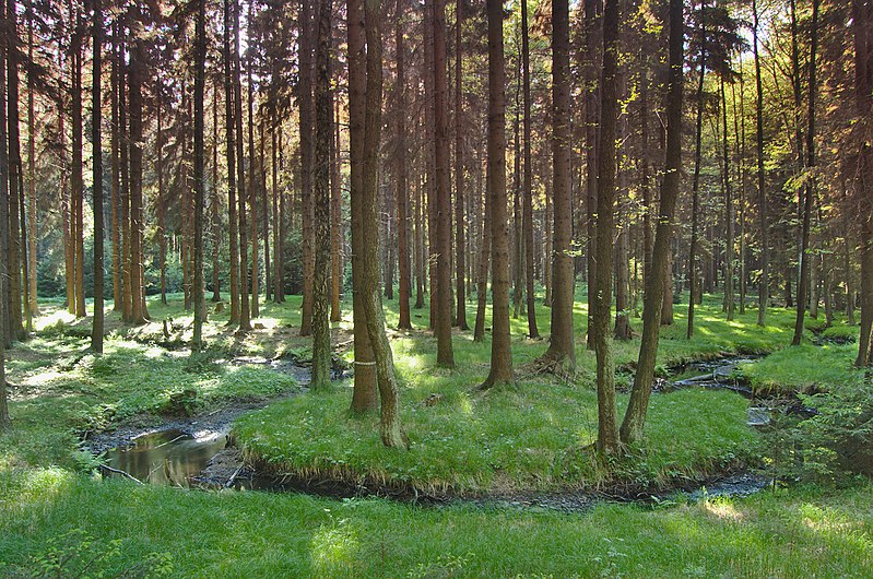
Čeština: Bělá - meandr na horním toku |
| Petsa | |
| Gigikanan | Kaugalingong trabaho |
| Tagsulat | xkomczax |
| Camera location | | View this and other nearby images on: OpenStreetMap |
|---|
Pagtugot
I, the copyright holder of this work, hereby publish it under the following license:
This file is licensed under the Creative Commons Attribution-Share Alike 4.0 International license.
- Libre ka:
- sa pagsabwag – sa pagkopya, pag-apod-apod ug pagsabwag sa hinimo
- sa pag-remix – sa pag-adap sa binuhat
- Ubos sa mosunod nga mga kondisyon:
- atribusyon – Kinahanglan nimo nga hatagan ang angay nga kredito, maghatag usa ka link sa lisensya, ug ipakita kung adunay mga pagbag-o. Mahimo nimo kini buhaton sa bisan unsang makatarunganon nga paagi, apan dili sa bisan unsang paagi nga nagsugyot nga gi-endorso ka sa licensor o ang imong paggamit.
- share parehas – Kung imong gi-remix, gibag-o, o gibase sa materyal, kinahanglan nimo nga iapod-apod ang imong mga kontribusyon sa ilawom sa parehas o katugma nga lisensya sama sa orihinal.

I. Licence

In printed material: Photo: © Jiří Komárek, JiriKomarek.net, Licence: Creative Commons BY-SA 4.0 (URL: https://creativecommons.org/licenses/by/4.0/legalcode), Source: Wikimedia Commons
The author of this picture, Jiří Komárek, published this file under the Creative Commons Licence Attribution-ShareAlike 4.0. The image can be used freely under the license, as long as the author is mentioned in the following form in the caption or for printed products in the image credits: © Jiří Komárek, JiriKomarek.net, CC BY-SA 4.0.
It is also necessary to provide a copy of the license or at least its full Internet address (https://creativecommons.org/licenses/by/4.0/legalcode). In online media is in use in addition to the aforementioned copyright and license specifying a reference (link) to put on the original image - so this page with descriptions and license conditions. For more information or examples of use can be found at re-use (with example file). Modifications have to be declared as such.
If you need another license to use or a different resolution, so please contact the author before using.
From printed materials and other tangible products that use that work, the user is asked to send a copy to the author. The mailing address can be requested via the contact options.
In the case of a breach of the license conditions, the rights granted hereunder will expire automatically. The author reserves the right in this case to assert injunctive relief and damages.
II. Disclaimer
It is possible that third parties are to be considered for example in case of trademark, design or personality rights. You are responsible to check and respect these rights in the publication in the respective medium or country.
Please note the General disclaimer.
III. Contact
E-mail me to JiriKomarek.net@gmail.com or visit the author's website

Please do not upload an updated image here without consultation with the author. The author would like to make corrections only at his own source.
Kaagi sa payl
I-klik ang petsa/oras aron makit-an ang hulagway sa payl niadtong panahona.
| Petsa/Takna | Thumbnail | Mga dimensyon | Tiggamit | Komento | |
|---|---|---|---|---|---|
| kasamtangan | 18:25, 29 Septiyembre 2014 | | 3,038 × 2,014 (4.93 MB) | Jiří Komárek | VicuñaUploader 1.20 |
Mga paggamit sa payl
Ang mosunod nga mga panid misumpay niining payl:
Global nga paggamit sa payl
Kining ubang wiki naggamit ning maong payl:
- Paggamit sa cs.wikipedia.org
- Paggamit sa www.wikidata.org