
Payl:Big Cypress Creek near Jefferson, TX upstream from Hwy 59 - panoramio.jpg

Gidak-on ning maong paunang tan-aw: 800 x 600 ka mga piksel. Uban pang mga resoluyon: 320 x 240 ka mga piksel | 640 x 480 ka mga piksel | 1,024 x 768 ka mga piksel | 1,280 x 960 ka mga piksel | 2,560 x 1,920 ka mga piksel | 3,264 x 2,448 ka mga piksel.
Tibuok resolusyon (3,264 × 2,448 pixels, size sa payl: 2.65 MB, MIME type: image/jpeg)
Mubong sugid:
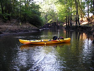
| Deskripsyon | Big Cypress Creek near Jefferson, TX upstream from Hwy 59 | ||
| Petsa | Taken on 3 Hulyo 2009 | ||
| Gigikanan | https://web.archive.org/web/20161013211953/http://www.panoramio.com/photo/28540369 | ||
| Tagsulat | rgriff3471 | ||
| Pagtugot (Paggamit pag-usab niini nga file) |
This file is licensed under the Creative Commons Attribution 3.0 Unported license. Attribution: rgriff3471
|
||
| Tags (from Panoramio photo page) | Jefferson, Big Cypress Bayou, Jefferson, Kayak |
| Camera location | | View this and other nearby images on: OpenStreetMap |
|---|
Kaagi sa payl
I-klik ang petsa/oras aron makit-an ang hulagway sa payl niadtong panahona.
| Petsa/Takna | Thumbnail | Mga dimensyon | Tiggamit | Komento | |
|---|---|---|---|---|---|
| kasamtangan | 06:03, 5 Disyembre 2016 | | 3,264 × 2,448 (2.65 MB) | Panoramio upload bot | == {{int:filedesc}} == {{Information |description=Big Cypress Creek near Jefferson, TX upstream from Hwy 59 |date={{Taken on|2009-07-03}} |source=http://www.panoramio.com/photo/28540369 |author=[http://www.panoramio.com/user/3828888?with_photo_id=28540... |
Mga paggamit sa payl
Ang mosunod nga mga panid misumpay niining payl:
Global nga paggamit sa payl
Kining ubang wiki naggamit ning maong payl:
- Paggamit sa en.wikipedia.org
- Paggamit sa www.wikidata.org