
Payl:Bishop Rock Lighthouse - Isles of Scilly.jpg
Walay mas taas nga resolusyon.
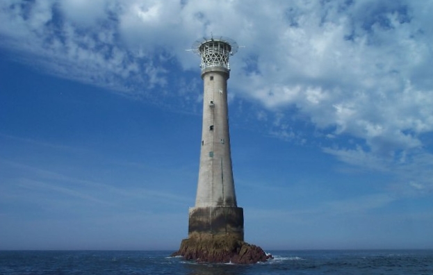
Bishop_Rock_Lighthouse_-_Isles_of_Scilly.jpg (623 × 396 pixels, size sa payl: 115 KB, MIME type: image/jpeg)
| Deskripsyon | These rocks are one of the most western parts of Britain. The lighthouse is famous for marking the end of transatlantic boat challenges. |
| Petsa | 2005-07-29T13:17:26+00:00 |
| Gigikanan |
This file was derived from: Bishop Rock lighthouse - Isles of Scilly - geograph.org.uk - 31517.jpg |
| Tagsulat | Richard Knights |
| Pagtugot (Paggamit pag-usab niini nga file) |
Creative Commons Attribution Share-alike license 2.0 |
| Camera location | | View this and other nearby images on: OpenStreetMap |
|---|
This file is licensed under the Creative Commons Attribution-Share Alike 2.0 Generic license.
Attribution: Richard Knights
- Libre ka:
- sa pagsabwag – sa pagkopya, pag-apod-apod ug pagsabwag sa hinimo
- sa pag-remix – sa pag-adap sa binuhat
- Ubos sa mosunod nga mga kondisyon:
- atribusyon – Kinahanglan nimo nga hatagan ang angay nga kredito, maghatag usa ka link sa lisensya, ug ipakita kung adunay mga pagbag-o. Mahimo nimo kini buhaton sa bisan unsang makatarunganon nga paagi, apan dili sa bisan unsang paagi nga nagsugyot nga gi-endorso ka sa licensor o ang imong paggamit.
- share parehas – Kung imong gi-remix, gibag-o, o gibase sa materyal, kinahanglan nimo nga iapod-apod ang imong mga kontribusyon sa ilawom sa parehas o katugma nga lisensya sama sa orihinal.
Kaagi sa payl
I-klik ang petsa/oras aron makit-an ang hulagway sa payl niadtong panahona.
| Petsa/Takna | Thumbnail | Mga dimensyon | Tiggamit | Komento | |
|---|---|---|---|---|---|
| kasamtangan | 13:10, 15 Marso 2009 | | 623 × 396 (115 KB) | Wutsje | Same file, rotated 2.05 degrees and cropped |
| 13:17, 18 Abril 2008 |  | 640 × 425 (42 KB) | Sarkana | {{Information |Description=These rocks are one of the most western parts of Britain. The lighthouse is famous for marking the end of transatlantic boat challenges. |Source=From [http://www.geograph.org.uk/photo/31517 geograph.co.uk] |Date=2005-07-29T13:17 |
Mga paggamit sa payl
Ang mosunod nga mga panid misumpay niining payl:
Global nga paggamit sa payl
Kining ubang wiki naggamit ning maong payl:
- Paggamit sa da.wikipedia.org
- Paggamit sa de.wikipedia.org
- Paggamit sa en.wikipedia.org
- Paggamit sa fr.wikipedia.org
- Paggamit sa gd.wikipedia.org
- Paggamit sa hy.wikipedia.org
- Paggamit sa it.wikipedia.org
- Paggamit sa ja.wikipedia.org
- Paggamit sa ko.wikipedia.org
- Paggamit sa kw.wikipedia.org
- Paggamit sa la.wikipedia.org
- Paggamit sa ml.wikipedia.org
- Paggamit sa nl.wikipedia.org
- Paggamit sa nn.wikipedia.org
- Paggamit sa no.wikipedia.org
- Paggamit sa pl.wikipedia.org
- Paggamit sa pt.wikipedia.org
- Paggamit sa ru.wikipedia.org
- Paggamit sa sv.wikipedia.org
- Paggamit sa uk.wikipedia.org
- Paggamit sa www.wikidata.org
- Paggamit sa zh.wikipedia.org