
Payl:Bolivia location map.svg

Size of this PNG preview of this SVG file: 541 x 600 ka mga piksel. Uban pang mga resoluyon: 216 x 240 ka mga piksel | 433 x 480 ka mga piksel | 693 x 768 ka mga piksel | 924 x 1,024 ka mga piksel | 1,847 x 2,048 ka mga piksel | 1,343 x 1,489 ka mga piksel.
Tibuok resolusyon (SVG nga payl, nominally 1,343 × 1,489 pixels, size sa payl: 415 KB)
Mubong sugid:
| Deskripsyon |
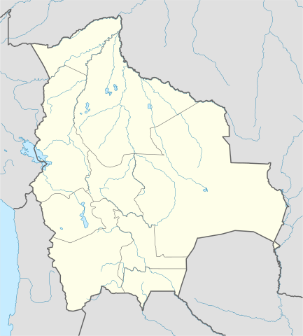
Deutsch: Positionskarte von Bolivien
Quadratische Plattkarte, N-S-Streckung 105 %. Geographische Begrenzung der Karte:
English: Location map of Bolivia
Equirectangular projection, N/S stretching 105 %. Geographic limits of the map:
|
||
| Petsa | |||
| Gigikanan |
Own work using:
|
||
| Tagsulat | NordNordWest | ||
| Other versions |
Derivative works of this file: |
||
| SVG genesis |
|

Pagtugot
I, the copyright holder of this work, hereby publish it under the following licenses:

|
Gitugot ang pagkopya, pag-apud-apod o/ug pag-usab ning maong dokumento ubos sa mga termino sa GNU Free Documentation License, Version 1.2 o mas bag-ong bersiyon nga gimantala sa Free Software Foundation; nga walay Invariant Sections, walay Front-Cover Texts, ug walay Back-Cover Texts. Ang kopya sa lisensiya gilakip sa bahin nga giulohang GNU Free Documentation License. |
This file is licensed under the Creative Commons Attribution-Share Alike 3.0 Unported license.
- Libre ka:
- sa pagsabwag – sa pagkopya, pag-apod-apod ug pagsabwag sa hinimo
- sa pag-remix – sa pag-adap sa binuhat
- Ubos sa mosunod nga mga kondisyon:
- atribusyon – Kinahanglan nimo nga hatagan ang angay nga kredito, maghatag usa ka link sa lisensya, ug ipakita kung adunay mga pagbag-o. Mahimo nimo kini buhaton sa bisan unsang makatarunganon nga paagi, apan dili sa bisan unsang paagi nga nagsugyot nga gi-endorso ka sa licensor o ang imong paggamit.
- share parehas – Kung imong gi-remix, gibag-o, o gibase sa materyal, kinahanglan nimo nga iapod-apod ang imong mga kontribusyon sa ilawom sa parehas o katugma nga lisensya sama sa orihinal.
You may select the license of your choice.
Kaagi sa payl
I-klik ang petsa/oras aron makit-an ang hulagway sa payl niadtong panahona.
| Petsa/Takna | Thumbnail | Mga dimensyon | Tiggamit | Komento | |
|---|---|---|---|---|---|
| kasamtangan | 12:39, 14 Nobiyembre 2008 | | 1,343 × 1,489 (415 KB) | NordNordWest | {{Information |Description= {{de|Positionskarte von Bolivien}} Quadratische Plattkarte, N-S-Streckung 105 %. Geographische Begrenzung der Karte: * N: 9.0° S * S: 24.0° S * W: 71.0° W * O: 56.8° W {{en|Location map of [[:en:Bolivia|Bol |
Mga paggamit sa payl
More than 100 pages use this file. The following list shows the first 100 pages that use this file only. A full list is available.
- Belen
- Belén
- Buenos Aires (pagklaro)
- Cerro Aguas Calientes
- Cerro Blanco
- Cerro Bonito
- Cerro Buena Vista
- Cerro Buenos Aires
- Cerro Chato
- Cerro Colorado
- Cerro El Carmen
- Cerro El Castillo
- Cerro El Dorado
- Cerro El Mojon
- Cerro El Mojón
- Cerro El Morado
- Cerro El Picacho
- Cerro El Rosario
- Cerro El Volcan
- Cerro El Volcán
- Cerro Grande
- Cerro La Joya
- Cerro La Mina
- Cerro Negro
- Cerro Pena Blanca
- Cerro Peña Blanca
- Cerro Punta
- Cerro San Cristobal
- Cerro San Lorenzo
- Cerro San Rafael
- Cerro San Salvador
- Cerro Santa Ana
- Cerro Santa Cruz
- Cerro Verde
- Concepción
- Crucero
- El Carmen
- El Cerro
- Isla Grande
- Isla Santa Rosa
- La Cueva
- La Paz
- Laguna Blanca
- Laguna Grande
- Laguna Seca
- Laguna Verde
- Magdalena (pagklaro)
- Mina Santa Rosa
- Potosi
- Potosí
- Quebrada Grande
- Quebrada San Antonio
- Quebrada San Juan
- Quebrada San Lorenzo
- Quebrada San Pablo
- Quebrada Santa Rita
- Quebrada Santa Rosa
- Quebrada Seca
- Rio Agua Caliente
- Rio Blanco
- Rio El Dorado
- Rio Grande
- Rio Mataca
- Rio Negro
- Rio Rosario
- Rio Sambo
- Rio San Antonio
- Rio San Jose
- Rio San Juan
- Rio San Lorenzo
- Rio San Ramon
- Rio Santa Rita
- Rio Seco
- Rio Viejo
- Río Aguas Calientes
- Río Blanco
- Río El Naranjo
- Río Franco
- Río Grande
- Río Hondo
- Río Negro
- Río San Antonio
- Río San José
- Río San Juan
- Río San Lorenzo
- Río San Pablo
- Río Santa Ana
- Río Santa Clara
- Río Sasama
- Río Seco
- Río Silva
- Río Viejo
- Río Yara
- San Carlos
- San Francisco
- San Lorenzo (pagklaro)
- San Lucas
- San Pedro (pagklaro)
- San Ramon
- San Ramón
View more links to this file.
Global nga paggamit sa payl
Kining ubang wiki naggamit ning maong payl:
- Paggamit sa af.wikipedia.org
- Paggamit sa an.wikipedia.org
- Paggamit sa ar.wikipedia.org
- Paggamit sa ay.wikipedia.org
- Paggamit sa az.wikipedia.org
- Paggamit sa ba.wikipedia.org
- Paggamit sa be-tarask.wikipedia.org
- Paggamit sa be.wikipedia.org
- Paggamit sa bg.wikipedia.org
- Paggamit sa bn.wikipedia.org
- Paggamit sa bs.wikipedia.org
- Paggamit sa ca.wikipedia.org
- Paggamit sa ce.wikipedia.org
- Paggamit sa ckb.wikipedia.org
- Paggamit sa cs.wikipedia.org
View more global usage of this file.