
Payl:Bulgaria location map.svg

Size of this PNG preview of this SVG file: 800 x 505 ka mga piksel. Uban pang mga resoluyon: 320 x 202 ka mga piksel | 640 x 404 ka mga piksel | 1,024 x 646 ka mga piksel | 1,280 x 808 ka mga piksel | 2,560 x 1,615 ka mga piksel | 1,642 x 1,036 ka mga piksel.
Tibuok resolusyon (SVG nga payl, nominally 1,642 × 1,036 pixels, size sa payl: 275 KB)
Mubong sugid:
| Deskripsyon |
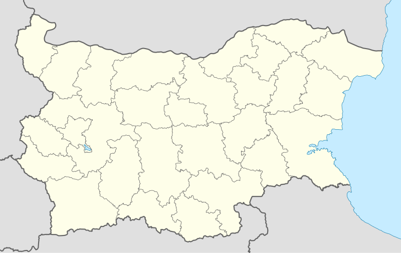
Deutsch: Positionskarte von Bulgarien
Quadratische Plattkarte, N-S-Streckung 130 %. Geographische Begrenzung der Karte:
English: Location map of Bulgaria
Equirectangular projection, N/S stretching 130 %. Geographic limits of the map:
|
| Petsa | 05-08-2008 |
| Gigikanan |
own work, using
|
| Tagsulat | NordNordWest |
| Other versions |
Derivative works of this file:
|
.svg)

|
This map has been made or improved in the German Kartenwerkstatt (Map Lab). You can propose maps to improve as well.
|
Pagtugot
I, the copyright holder of this work, hereby publish it under the following licenses:

|
Gitugot ang pagkopya, pag-apud-apod o/ug pag-usab ning maong dokumento ubos sa mga termino sa GNU Free Documentation License, Version 1.2 o mas bag-ong bersiyon nga gimantala sa Free Software Foundation; nga walay Invariant Sections, walay Front-Cover Texts, ug walay Back-Cover Texts. Ang kopya sa lisensiya gilakip sa bahin nga giulohang GNU Free Documentation License. |
This file is licensed under the Creative Commons Attribution-Share Alike 3.0 Unported license.
- Libre ka:
- sa pagsabwag – sa pagkopya, pag-apod-apod ug pagsabwag sa hinimo
- sa pag-remix – sa pag-adap sa binuhat
- Ubos sa mosunod nga mga kondisyon:
- atribusyon – Kinahanglan nimo nga hatagan ang angay nga kredito, maghatag usa ka link sa lisensya, ug ipakita kung adunay mga pagbag-o. Mahimo nimo kini buhaton sa bisan unsang makatarunganon nga paagi, apan dili sa bisan unsang paagi nga nagsugyot nga gi-endorso ka sa licensor o ang imong paggamit.
- share parehas – Kung imong gi-remix, gibag-o, o gibase sa materyal, kinahanglan nimo nga iapod-apod ang imong mga kontribusyon sa ilawom sa parehas o katugma nga lisensya sama sa orihinal.
You may select the license of your choice.
Kaagi sa payl
I-klik ang petsa/oras aron makit-an ang hulagway sa payl niadtong panahona.
| Petsa/Takna | Thumbnail | Mga dimensyon | Tiggamit | Komento | |
|---|---|---|---|---|---|
| kasamtangan | 18:28, 6 Oktubre 2010 | | 1,642 × 1,036 (275 KB) | NordNordWest | upd |
| 18:23, 12 Agosto 2009 |  | 1,536 × 970 (204 KB) | Пакко | fixed Iskar Lake | |
| 18:12, 3 Agosto 2009 |  | 1,534 × 967 (207 KB) | Пакко | fixed some borders according to current administrative division | |
| 18:52, 25 Agosto 2008 |  | 1,645 × 1,038 (297 KB) | NordNordWest | size correction | |
| 12:25, 12 Agosto 2008 |  | 548 × 346 (291 KB) | NordNordWest | corrected | |
| 20:30, 5 Agosto 2008 |  | 548 × 346 (289 KB) | NordNordWest | {{Information |Description= {{de|Positionskarte von Bulgarien}} Quadratische Plattkarte, N-S-Streckung 130 %. Geographische Begrenzung der Karte: * N: 44.4° N * S: 41.1° N * W: 22.1° O * O: 28.9° O {{en|Location map of [[:en:Bulgaria |
Mga paggamit sa payl
More than 100 pages use this file. The following list shows the first 100 pages that use this file only. A full list is available.
- Baba
- Balvan
- Bandera (pagklaro)
- Banja
- Bara (pagklaro)
- Belica
- Bilo
- Bistrica
- Blato
- Brest (pagklaro)
- Brod
- Butan (pagklaro)
- Crn Kamen
- German
- Glogovo
- Golak
- Golo Brdo
- Gorica
- Gradec
- Gradište
- Greben
- Hisar
- Izvor
- Jablanica
- Jankovo
- Jasen
- Jastreb
- Kale
- Kamen
- Kameno
- Kanara
- Kazan
- Kitka
- Klepalo
- Klisura
- Koren (pagklaro)
- Kosara
- Kosovo (pagklaro)
- Kosovska Reka
- Kozjak
- Kremen
- Kriva
- Kuka
- Kula
- Leska
- Lisec
- Lom
- Lomnica
- Marin Kamen
- Martin
- Mramor
- Novo Selo
- Orisare
- Orljak
- Orlov Kamen
- Ostrec
- Ostrika
- Ostrovica
- Perunika
- Planinica
- Popovica
- Preseka
- Reka
- Ribarica
- Ribnica
- Rudina
- Rudnik
- Senokos
- Slatina
- Sokol
- Sokolica
- Sopot
- Stara Reka
- Studena
- Studena Voda
- Studenec
- Studenica
- Trn
- Tumba
- Tumbata
- Vetren
- Vlahinja
- Vlaina
- Voden
- Vodica
- Vraca
- Vranjak
- Vrbica
- Vrelo
- Vrv
- Vršec
- Wit
- Yablanitsa
- Венец
- Ветрен
- Ветрушка
- Враца
- Тумба
- Тумбата
- Ушите
View more links to this file.
Global nga paggamit sa payl
Kining ubang wiki naggamit ning maong payl:
- Paggamit sa af.wikipedia.org
- Paggamit sa als.wikipedia.org
- Paggamit sa am.wikipedia.org
- Paggamit sa an.wikipedia.org
- Paggamit sa ar.wikipedia.org
- Paggamit sa arz.wikipedia.org
- Paggamit sa ast.wikipedia.org
- Burgas
- Sofía
- Varna
- Plovdiv
- Veliko Tarnovo
- Stara Zagora
- Pleven
- Vidin
- Asenovgrad
- Montes Rila
- Sredna Gora
- Ruse
- Catedral d'Alexandre Nevski de Sofía
- Módulu:Mapa de llocalización/datos/Bulgaria
- Aeropuertu de Burgas
- Aeropuertu de Plovdiv
- Aeropuertu de Sofía
- Aeropuertu de Varna
- Puertu de Burgas
- Puertu de Varna
- Módulu:Mapa de llocalización/datos/Bulgaria/usu
- Paggamit sa azb.wikipedia.org
View more global usage of this file.