
Payl:C71198s1 Ant.Map Daniels Range.jpg

Gidak-on ning maong paunang tan-aw: 556 x 599 ka mga piksel. Uban pang mga resoluyon: 223 x 240 ka mga piksel | 445 x 480 ka mga piksel | 712 x 768 ka mga piksel | 950 x 1,024 ka mga piksel | 1,900 x 2,048 ka mga piksel | 3,021 x 3,257 ka mga piksel.
Tibuok resolusyon (3,021 × 3,257 pixels, size sa payl: 1.09 MB, MIME type: image/jpeg)
Mubong sugid:
| Deskripsyon |
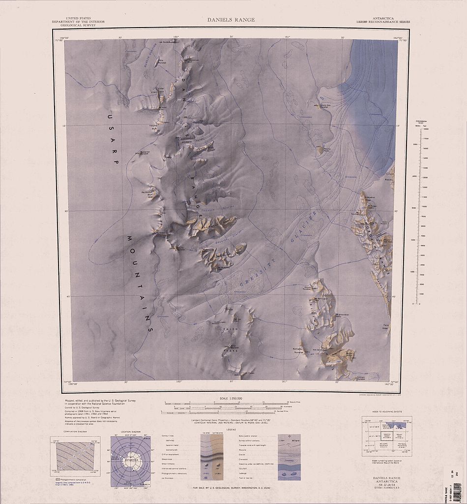
English: 1:250,000-scale topographic reconnaissance map of the Daniels Range area from 159°-162°E to 71°-72°S in Antarctica, including the central parts of Usarp Mountains and the Gressitt Glacier. Mapped, edited and published by the U.S. Geological Survey in cooperation with the National Science Foundation. |
|||
| Petsa | ||||
| Gigikanan | http://usarc.usgs.gov/drg_dload.shtml | |||
| Tagsulat | United States Geological Survey | |||
| Pagtugot (Paggamit pag-usab niini nga file) |
|
Kaagi sa payl
I-klik ang petsa/oras aron makit-an ang hulagway sa payl niadtong panahona.
| Petsa/Takna | Thumbnail | Mga dimensyon | Tiggamit | Komento | |
|---|---|---|---|---|---|
| kasamtangan | 17:23, 3 Abril 2005 | | 3,021 × 3,257 (1.09 MB) | Achim Raschka | Map of Antarctica by the United States Antarctic Ressource Center of the US Geological Society. {{PD-US}} Copyrights and Trademarks USGS-authored or produced data and information are in the public domain. While the content of most USGS web pages is in th |
Mga paggamit sa payl
Ang mosunod nga 3 panid misumpay niining payl:
Global nga paggamit sa payl
Kining ubang wiki naggamit ning maong payl:
- Paggamit sa de.wikipedia.org
- Paggamit sa en.wikipedia.org
- Paggamit sa es.wikipedia.org
- Paggamit sa he.wikipedia.org
- Paggamit sa it.wikipedia.org
- Paggamit sa nn.wikipedia.org
- Paggamit sa www.wikidata.org
- Paggamit sa zh.wikipedia.org