
Payl:C86120s1 Ant.Map Caloplaca Hills.jpg
Gidak-on ning maong paunang tan-aw: 537 x 599 ka mga piksel. Uban pang mga resoluyon: 215 x 240 ka mga piksel | 430 x 480 ka mga piksel | 688 x 768 ka mga piksel | 918 x 1,024 ka mga piksel | 1,836 x 2,048 ka mga piksel | 3,362 x 3,750 ka mga piksel.
Tibuok resolusyon (3,362 × 3,750 pixels, size sa payl: 1.53 MB, MIME type: image/jpeg)
| Deskripsyon |
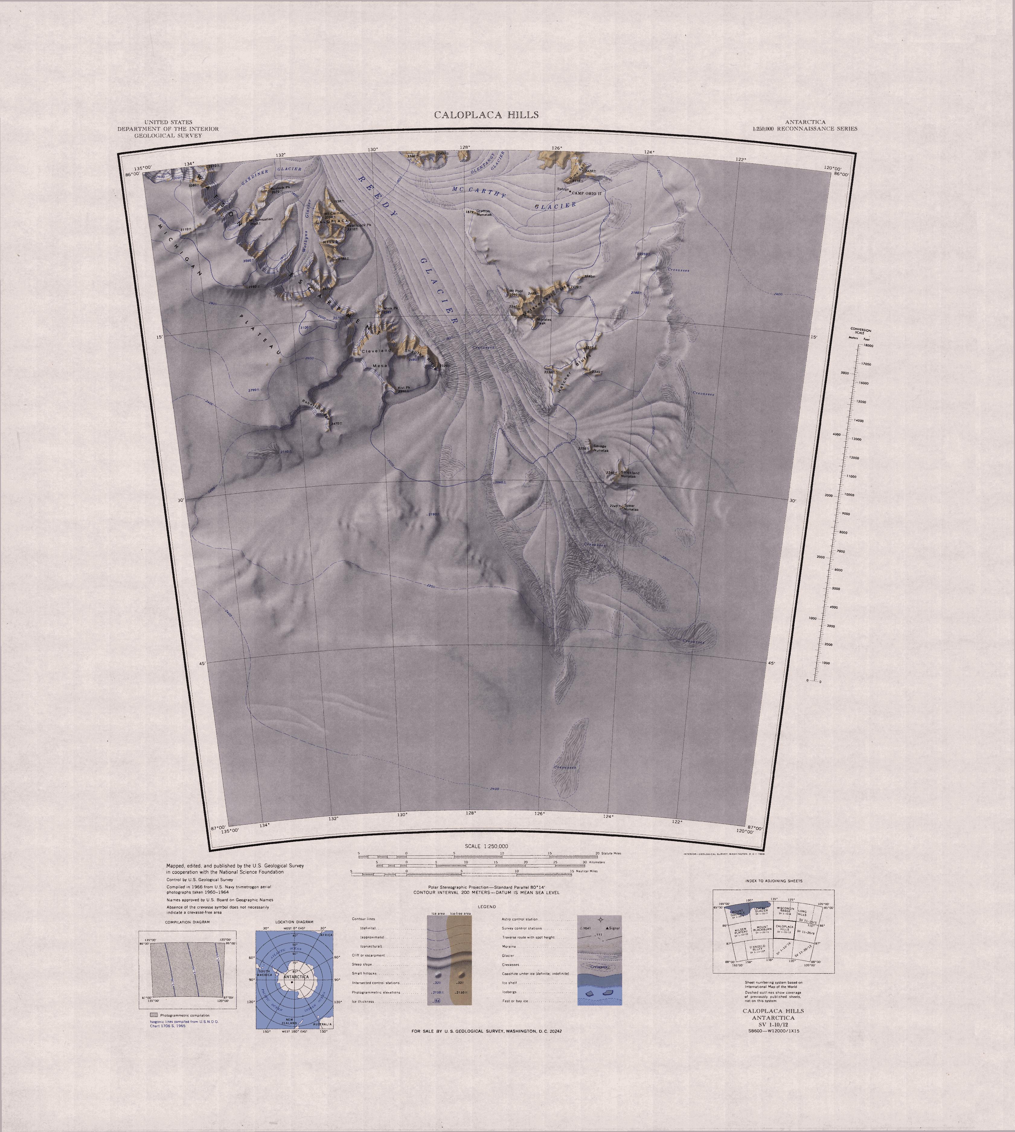
English: Map of Antarctica by the United States Antarctic Resource Center of the US Geological Society. |
| Gigikanan | USGS |
| Tagsulat | USGS |
This image is in the public domain in the United States because it only contains materials that originally came from the United States Geological Survey, an agency of the United States Department of the Interior. For more information, see the official USGS copyright policy.
|
Kaagi sa payl
I-klik ang petsa/oras aron makit-an ang hulagway sa payl niadtong panahona.
| Petsa/Takna | Thumbnail | Mga dimensyon | Tiggamit | Komento | |
|---|---|---|---|---|---|
| kasamtangan | 16:33, 3 Abril 2005 | | 3,362 × 3,750 (1.53 MB) | Achim Raschka | Map of Antarctica by the United States Antarctic Ressource Center of the US Geological Society. {{PD-US}} Copyrights and Trademarks USGS-authored or produced data and information are in the public domain. While the content of most USGS web pages is in th |
Mga paggamit sa payl
Ang mosunod nga mga panid misumpay niining payl:
Global nga paggamit sa payl
Kining ubang wiki naggamit ning maong payl:
- Paggamit sa bg.wikipedia.org
- Paggamit sa de.wikipedia.org
- Paggamit sa en.wikipedia.org
- Paggamit sa it.wikipedia.org
- Paggamit sa nn.wikipedia.org
- Paggamit sa www.wikidata.org