
Payl:Hopkins-mo-map.gif
Walay mas taas nga resolusyon.
Hopkins-mo-map.gif (575 × 425 pixels, size sa payl: 22 KB, MIME type: image/gif)
Mubong sugid:

|
This file was moved to Wikimedia Commons from en.wikipedia using a bot script. All source information is still present. It requires review. Additionally, there may be errors in any or all of the information fields; information on this file should not be considered reliable and the file should not be used until it has been reviewed and any needed corrections have been made. Once the review has been completed, this template should be removed. For details about this file, see below. Check now! |
| Deskripsyon | |
| Petsa | |
| Gigikanan | http://factfinder.census.gov |
| Tagsulat | United States Census Bureau |
| Pagtugot (Paggamit pag-usab niini nga file) |
Public domain |
Pagtugot
This image or file is a work of a United States Census Bureau employee, taken or made as part of that person's official duties. As a work of the U.S. federal government, the image is in the public domain.
|
 |
Original upload log
Transferred from en.wikipedia to Commons by Milicevic01 using CommonsHelper.
The original description page was here. All following user names refer to en.wikipedia.
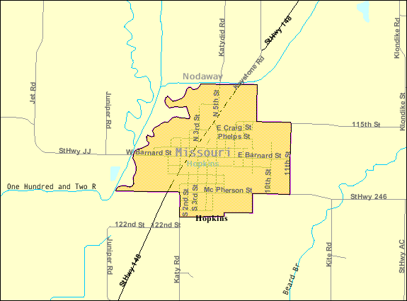
- 2007-10-23 19:19 Americasroof 575×425× (22264 bytes) [[Hopkins, Missouri]] map from U.S. Census
Kaagi sa payl
I-klik ang petsa/oras aron makit-an ang hulagway sa payl niadtong panahona.
| Petsa/Takna | Thumbnail | Mga dimensyon | Tiggamit | Komento | |
|---|---|---|---|---|---|
| kasamtangan | 13:37, 23 Agosto 2013 | | 575 × 425 (22 KB) | File Upload Bot (Magnus Manske) | Transfered from en.wikipedia by User:Milicevic01 using CommonsHelper |
Mga paggamit sa payl
Ang mosunod nga mga panid misumpay niining payl:
Global nga paggamit sa payl
Kining ubang wiki naggamit ning maong payl:
- Paggamit sa ar.wikipedia.org
- Paggamit sa arz.wikipedia.org
- Paggamit sa azb.wikipedia.org
- Paggamit sa ca.wikipedia.org
- Paggamit sa ce.wikipedia.org
- Paggamit sa cy.wikipedia.org
- Paggamit sa en.wikipedia.org
- Paggamit sa es.wikipedia.org
- Paggamit sa eu.wikipedia.org
- Paggamit sa fa.wikipedia.org
- Paggamit sa fr.wikipedia.org
- Paggamit sa ht.wikipedia.org
- Paggamit sa it.wikipedia.org
- Paggamit sa ky.wikipedia.org
- Paggamit sa lld.wikipedia.org
- Paggamit sa pl.wikipedia.org
- Paggamit sa pt.wikipedia.org
- Paggamit sa sh.wikipedia.org
- Paggamit sa sr.wikipedia.org
- Paggamit sa tr.wikipedia.org
- Paggamit sa tt.wikipedia.org
- Paggamit sa uk.wikipedia.org
- Paggamit sa uz.wikipedia.org
- Paggamit sa www.wikidata.org
- Paggamit sa zh-min-nan.wikipedia.org