
Payl:India Nagaland location map.svg

Size of this PNG preview of this SVG file: 649 x 599 ka mga piksel. Uban pang mga resoluyon: 260 x 240 ka mga piksel | 520 x 480 ka mga piksel | 832 x 768 ka mga piksel | 1,109 x 1,024 ka mga piksel | 2,218 x 2,048 ka mga piksel | 889 x 821 ka mga piksel.
Tibuok resolusyon (SVG nga payl, nominally 889 × 821 pixels, size sa payl: 192 KB)
Mubong sugid:
| Deskripsyon |
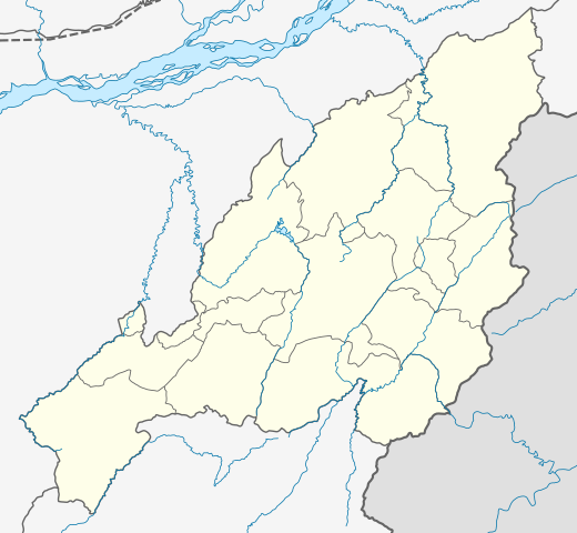
Location map of Nagaland Geographic limits of the map:
|
| Petsa | |
| Gigikanan | |
| Tagsulat |
|
| Other versions |
|

Pagtugot
I, the copyright holder of this work, hereby publish it under the following license:
This file is licensed under the Creative Commons Attribution-Share Alike 3.0 Unported license.
- Libre ka:
- sa pagsabwag – sa pagkopya, pag-apod-apod ug pagsabwag sa hinimo
- sa pag-remix – sa pag-adap sa binuhat
- Ubos sa mosunod nga mga kondisyon:
- atribusyon – Kinahanglan nimo nga hatagan ang angay nga kredito, maghatag usa ka link sa lisensya, ug ipakita kung adunay mga pagbag-o. Mahimo nimo kini buhaton sa bisan unsang makatarunganon nga paagi, apan dili sa bisan unsang paagi nga nagsugyot nga gi-endorso ka sa licensor o ang imong paggamit.
- share parehas – Kung imong gi-remix, gibag-o, o gibase sa materyal, kinahanglan nimo nga iapod-apod ang imong mga kontribusyon sa ilawom sa parehas o katugma nga lisensya sama sa orihinal.
Kaagi sa payl
I-klik ang petsa/oras aron makit-an ang hulagway sa payl niadtong panahona.
| Petsa/Takna | Thumbnail | Mga dimensyon | Tiggamit | Komento | |
|---|---|---|---|---|---|
| kasamtangan | 04:14, 17 Abril 2022 | | 889 × 821 (192 KB) | C1MM | Added four new districts |
| 05:02, 21 Mayo 2021 |  | 889 × 821 (267 KB) | C1MM | Fixed borders and rivers, changed line weight | |
| 06:45, 23 Pebrero 2021 |  | 731 × 675 (187 KB) | C1MM | Fixed borders of districts and rivers | |
| 00:44, 13 Abril 2020 |  | 646 × 669 (88 KB) | C1MM | Updated districts | |
| 18:13, 6 Hulyo 2014 |  | 646 × 669 (87 KB) | Milenioscuro | User created page with UploadWizard |
Mga paggamit sa payl
There are no pages that use this file.
Global nga paggamit sa payl
Kining ubang wiki naggamit ning maong payl:
- Paggamit sa azb.wikipedia.org
- Paggamit sa bh.wikipedia.org
- Paggamit sa bn.wikipedia.org
- Paggamit sa de.wikipedia.org
- Paggamit sa en.wikipedia.org
View more global usage of this file.