
Payl:Linkinhorne Parish Church - geograph.org.uk - 404867.jpg
Gidak-on ning maong paunang tan-aw: 403 x 600 ka mga piksel. Uban pang mga resoluyon: 161 x 240 ka mga piksel | 430 x 640 ka mga piksel.
Tibuok resolusyon (430 × 640 pixels, size sa payl: 87 KB, MIME type: image/jpeg)
Mubong sugid:
| Deskripsyon |
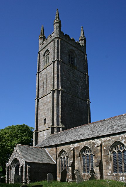
English: Linkinhorne Parish Church This church has a very tall four stage tower. It is dedicated to St Mellor. The church does not sit in a substantial village but in a "Churchtown" which is really a hamlet. |
| Petsa | |
| Gigikanan | From geograph.org.uk |
| Tagsulat | Tony Atkin |
| Attribution (required by the license) | Tony Atkin / Linkinhorne Parish Church / |
| Camera location | | View this and other nearby images on: OpenStreetMap |
|---|
_heading:315.00&language=ceb)
| Object location | | View this and other nearby images on: OpenStreetMap |
|---|
_heading:315.00&language=ceb)
Pagtugot

|
This image was taken from the Geograph project collection. See this photograph's page on the Geograph website for the photographer's contact details. The copyright on this image is owned by Tony Atkin and is licensed for reuse under the Creative Commons Attribution-ShareAlike 2.0 license.
|
This file is licensed under the Creative Commons Attribution-Share Alike 2.0 Generic license.
Attribution: Tony Atkin
- Libre ka:
- sa pagsabwag – sa pagkopya, pag-apod-apod ug pagsabwag sa hinimo
- sa pag-remix – sa pag-adap sa binuhat
- Ubos sa mosunod nga mga kondisyon:
- atribusyon – Kinahanglan nimo nga hatagan ang angay nga kredito, maghatag usa ka link sa lisensya, ug ipakita kung adunay mga pagbag-o. Mahimo nimo kini buhaton sa bisan unsang makatarunganon nga paagi, apan dili sa bisan unsang paagi nga nagsugyot nga gi-endorso ka sa licensor o ang imong paggamit.
- share parehas – Kung imong gi-remix, gibag-o, o gibase sa materyal, kinahanglan nimo nga iapod-apod ang imong mga kontribusyon sa ilawom sa parehas o katugma nga lisensya sama sa orihinal.
Kaagi sa payl
I-klik ang petsa/oras aron makit-an ang hulagway sa payl niadtong panahona.
| Petsa/Takna | Thumbnail | Mga dimensyon | Tiggamit | Komento | |
|---|---|---|---|---|---|
| kasamtangan | 04:47, 29 Disyembre 2011 | | 430 × 640 (87 KB) | Rotatebot | Bot: Reset EXIF-specified Orientation of image (EXIF-Orientation set from 8 to 1, rotated 0°) |
| 22:00, 3 Pebrero 2011 |  | 640 × 430 (87 KB) | GeographBot | == {{int:filedesc}} == {{Information |description={{en|1=Linkinhorne Parish Church This church has a very tall four stage tower. It is dedicated to St Mellor. The church does not sit in a substantial village but in a "Churchtown" which is really a hamle |
Mga paggamit sa payl
Ang mosunod nga mga panid misumpay niining payl:
Global nga paggamit sa payl
Kining ubang wiki naggamit ning maong payl:
- Paggamit sa cy.wikipedia.org
- Paggamit sa dag.wikipedia.org
- Paggamit sa en.wikipedia.org
- Paggamit sa eu.wikipedia.org
- Paggamit sa fr.wikipedia.org
- Paggamit sa lld.wikipedia.org
- Paggamit sa pl.wikipedia.org
- Paggamit sa simple.wikipedia.org
- Paggamit sa sv.wikipedia.org
- Paggamit sa www.wikidata.org
- Paggamit sa zh-min-nan.wikipedia.org