
Payl:Location map of Ogle County, Illinois.svg

Size of this PNG preview of this SVG file: 600 x 600 ka mga piksel. Uban pang mga resoluyon: 240 x 240 ka mga piksel | 480 x 480 ka mga piksel | 768 x 768 ka mga piksel | 1,024 x 1,024 ka mga piksel | 2,048 x 2,048 ka mga piksel.
Tibuok resolusyon (SVG nga payl, nominally 768 × 768 pixels, size sa payl: 236 KB)
Mubong sugid:
| Deskripsyon |
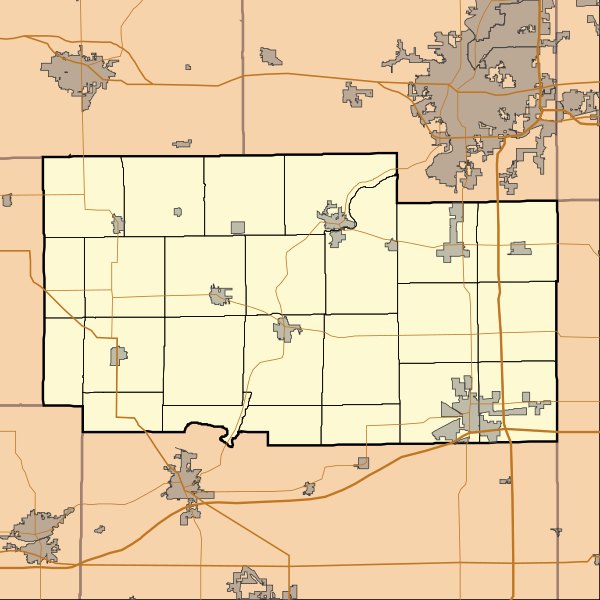
English: This is a map of Ogle County, Illinois, USA which includes township borders. |
| Petsa | |
| Gigikanan | My own work, using custom-written MapScript applications with National Atlas and United States Census Bureau data |
| Tagsulat | Omnedon |
Pagtugot
| I, the copyright holder of this work, release this work into the public domain. This applies worldwide. In some countries this may not be legally possible; if so: I grant anyone the right to use this work for any purpose, without any conditions, unless such conditions are required by law. |
Kaagi sa payl
I-klik ang petsa/oras aron makit-an ang hulagway sa payl niadtong panahona.
| Petsa/Takna | Thumbnail | Mga dimensyon | Tiggamit | Komento | |
|---|---|---|---|---|---|
| kasamtangan | 14:34, 23 Nobiyembre 2010 | | 768 × 768 (236 KB) | Omnedon | == {{int:filedesc}} == {{Information |Description={{en|This is a map of Ogle County, Illinois, USA which includes township borders.}} |Source=My own work, using custom-written MapScript applications with [http://www.nationalat |
Mga paggamit sa payl
Ang mosunod nga 2 panid misumpay niining payl:
Global nga paggamit sa payl
Kining ubang wiki naggamit ning maong payl:
- Paggamit sa ar.wikipedia.org
- Paggamit sa azb.wikipedia.org
- Paggamit sa de.wikipedia.org
- Paggamit sa en.wikipedia.org
- Adeline, Illinois
- Byron, Illinois
- Creston, Illinois
- Davis Junction, Illinois
- Forreston, Illinois
- Hillcrest, Illinois
- Leaf River, Illinois
- Mount Morris, Illinois
- Oregon, Illinois
- Polo, Illinois
- Rochelle, Illinois
- Stillman Valley, Illinois
- Grand Detour, Illinois
- Monroe Center, Illinois
- Baileyville, Illinois
- Chana, Illinois
- Kings, Ogle County, Illinois
- Lindenwood, Illinois
- Woosung, Illinois
- Daysville, Illinois
- Egan, Illinois
- Paynes Point, Illinois
- Buffalo Grove, Ogle County, Illinois
- Flagg, Illinois
- Brookville, Illinois
- Module:Location map/data/USA Illinois Ogle County/doc
- Ogle County Airport
- Rochelle Municipal Airport
- Module:Location map/data/USA Illinois Ogle County
- User:CMadeo (WMF)/sandbox
- User:CMadeo (WMF)/grand detour
- Paggamit sa fa.wikipedia.org
View more global usage of this file.