
Payl:Lune Halton village 6105.JPG
Gidak-on ning maong paunang tan-aw: 800 x 600 ka mga piksel. Uban pang mga resoluyon: 320 x 240 ka mga piksel | 640 x 480 ka mga piksel | 1,024 x 768 ka mga piksel | 1,280 x 960 ka mga piksel | 2,560 x 1,920 ka mga piksel | 3,264 x 2,448 ka mga piksel.
Tibuok resolusyon (3,264 × 2,448 pixels, size sa payl: 3.32 MB, MIME type: image/jpeg)
Mubong sugid:
| Deskripsyon |
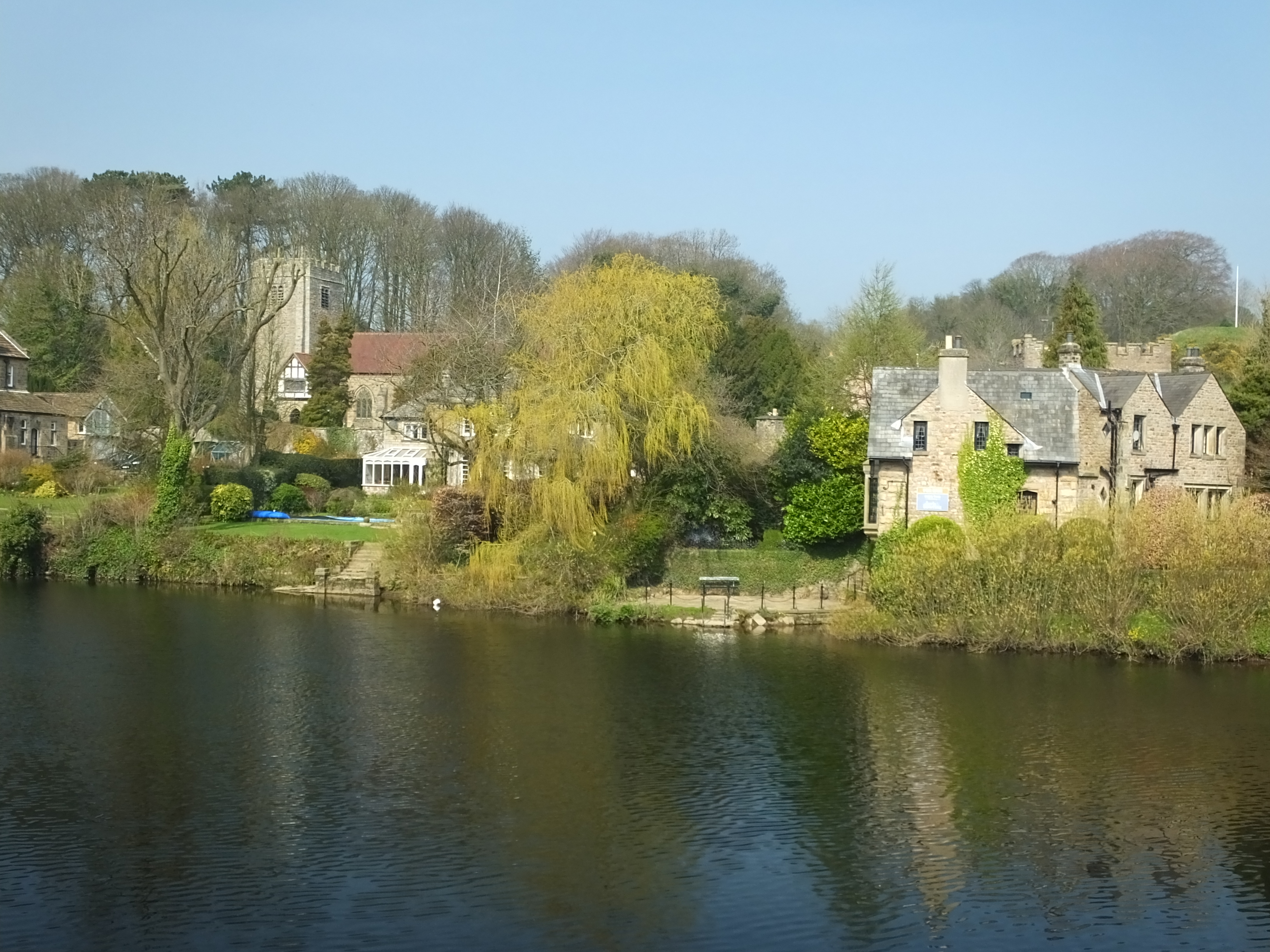
English: The River Lune flows 47 miles (71 km) from Ravenstonedalein Cumbria to the Irish sea at Plover Scar near Lancaster.It becomes tidal at Skerton weir. This is the stretch above that wier. Halton-on-Lune from the cycleway on the other bank. |
|
| Petsa | ||
| Gigikanan | Kaugalingong trabaho | |
| Tagsulat | Photograph by Clem Rutter, Rochester, Kent. (www.clemrutter.net). | |
| Pagtugot (Paggamit pag-usab niini nga file) |
|
| Camera location | | View this and other nearby images on: OpenStreetMap |
|---|
Pagtugot
This file is licensed under the Creative Commons Attribution-Share Alike 3.0 Unported license.
- Libre ka:
- sa pagsabwag – sa pagkopya, pag-apod-apod ug pagsabwag sa hinimo
- sa pag-remix – sa pag-adap sa binuhat
- Ubos sa mosunod nga mga kondisyon:
- atribusyon – Kinahanglan nimo nga hatagan ang angay nga kredito, maghatag usa ka link sa lisensya, ug ipakita kung adunay mga pagbag-o. Mahimo nimo kini buhaton sa bisan unsang makatarunganon nga paagi, apan dili sa bisan unsang paagi nga nagsugyot nga gi-endorso ka sa licensor o ang imong paggamit.
- share parehas – Kung imong gi-remix, gibag-o, o gibase sa materyal, kinahanglan nimo nga iapod-apod ang imong mga kontribusyon sa ilawom sa parehas o katugma nga lisensya sama sa orihinal.
Kaagi sa payl
I-klik ang petsa/oras aron makit-an ang hulagway sa payl niadtong panahona.
| Petsa/Takna | Thumbnail | Mga dimensyon | Tiggamit | Komento | |
|---|---|---|---|---|---|
| kasamtangan | 09:38, 14 Abril 2015 | | 3,264 × 2,448 (3.32 MB) | ClemRutter |
Mga paggamit sa payl
Ang mosunod nga mga panid misumpay niining payl:
Global nga paggamit sa payl
Kining ubang wiki naggamit ning maong payl:
- Paggamit sa cy.wikipedia.org
- Paggamit sa en.wikipedia.org
- Paggamit sa fr.wikipedia.org
- Paggamit sa www.wikidata.org