
Payl:Moscow Map of Zamoskvorechye 1760s small.jpg
Gidak-on ning maong paunang tan-aw: 656 x 599 ka mga piksel. Uban pang mga resoluyon: 263 x 240 ka mga piksel | 526 x 480 ka mga piksel | 841 x 768 ka mga piksel | 1,200 x 1,096 ka mga piksel.
Tibuok resolusyon (1,200 × 1,096 pixels, size sa payl: 634 KB, MIME type: image/jpeg)
Mubong sugid:
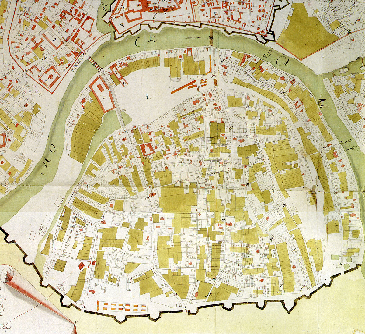
| Deskripsyon | Map of southern Moscow (Yakimanka, Zamoskvorechye districts). 1760-1768. |
| Petsa | 1760 - 1768 |
| Gigikanan | Scan from Памятники архитектуры Москвы. Замоскворечье — М.: Искусство, 1994. ISBN 5-210-02548-9 |
| Tagsulat | State topographers, editor: Pyotr Gorikhvostov |
| Pagtugot (Paggamit pag-usab niini nga file) |
PD, 240 years old |
Pagtugot
|
This work is in the public domain in its country of origin and other countries and areas where the copyright term is the author's life plus 100 years or fewer. | |
| This file has been identified as being free of known restrictions under copyright law, including all related and neighboring rights. | |
Kaagi sa payl
I-klik ang petsa/oras aron makit-an ang hulagway sa payl niadtong panahona.
| Petsa/Takna | Thumbnail | Mga dimensyon | Tiggamit | Komento | |
|---|---|---|---|---|---|
| kasamtangan | 19:27, 16 Pebrero 2008 | | 1,200 × 1,096 (634 KB) | NVO | == Summary == {{Information |Description=Map of southern Moscow (Yakimanka, Zamoskvorechye districts). 1760-1768. |Source=1999 edition of Памятники архитектуры Москвы. Замоскворечье. |Date=1760-1768 |Author=State to |
Mga paggamit sa payl
Ang mosunod nga mga panid misumpay niining payl:
Global nga paggamit sa payl
Kining ubang wiki naggamit ning maong payl:
- Paggamit sa ru.wikipedia.org
- Paggamit sa www.wikidata.org