
Payl:New Zealand location map.svg

Size of this PNG preview of this SVG file: 475 x 599 ka mga piksel. Uban pang mga resoluyon: 190 x 240 ka mga piksel | 380 x 480 ka mga piksel | 609 x 768 ka mga piksel | 812 x 1,024 ka mga piksel | 1,623 x 2,048 ka mga piksel | 1,928 x 2,432 ka mga piksel.
Tibuok resolusyon (SVG nga payl, nominally 1,928 × 2,432 pixels, size sa payl: 220 KB)
Mubong sugid:
| Deskripsyon |
Deutsch: Positionskarte von Neuseeland
Quadratische Plattkarte, N-S-Streckung 120 %. Geographische Begrenzung der Karte:
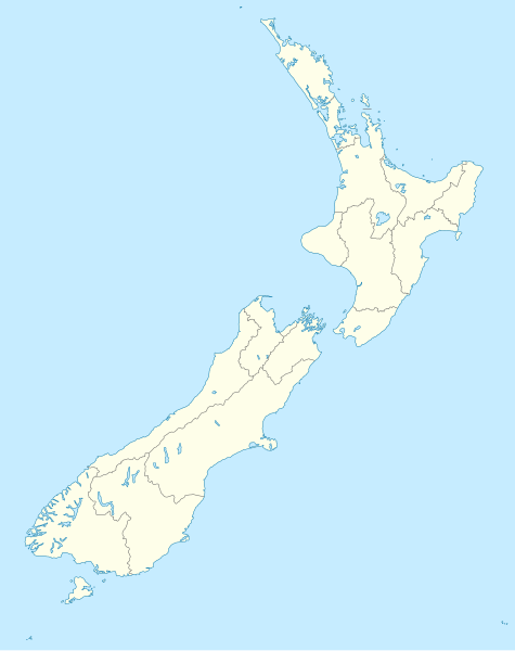
English: Location map of New Zealand
Equirectangular projection, N/S stretching 120 %. Geographic limits of the map:
Svenska: Plats karta över Nya Zeeland
Equirectangular projektion, N/S sträcker sig 120%. Geografiska gränser för kartan:
|
||
| Petsa | |||
| Gigikanan |
own work, using
|
||
| Tagsulat | NordNordWest | ||
| Other versions |
Derivative works of this file: |
||
| SVG genesis |
|

Pagtugot
I, the copyright holder of this work, hereby publish it under the following licenses:

|
Gitugot ang pagkopya, pag-apud-apod o/ug pag-usab ning maong dokumento ubos sa mga termino sa GNU Free Documentation License, Version 1.2 o mas bag-ong bersiyon nga gimantala sa Free Software Foundation; nga walay Invariant Sections, walay Front-Cover Texts, ug walay Back-Cover Texts. Ang kopya sa lisensiya gilakip sa bahin nga giulohang GNU Free Documentation License. |
This file is licensed under the Creative Commons Attribution-Share Alike 3.0 Unported license.
- Libre ka:
- sa pagsabwag – sa pagkopya, pag-apod-apod ug pagsabwag sa hinimo
- sa pag-remix – sa pag-adap sa binuhat
- Ubos sa mosunod nga mga kondisyon:
- atribusyon – Kinahanglan nimo nga hatagan ang angay nga kredito, maghatag usa ka link sa lisensya, ug ipakita kung adunay mga pagbag-o. Mahimo nimo kini buhaton sa bisan unsang makatarunganon nga paagi, apan dili sa bisan unsang paagi nga nagsugyot nga gi-endorso ka sa licensor o ang imong paggamit.
- share parehas – Kung imong gi-remix, gibag-o, o gibase sa materyal, kinahanglan nimo nga iapod-apod ang imong mga kontribusyon sa ilawom sa parehas o katugma nga lisensya sama sa orihinal.
You may select the license of your choice.
Kaagi sa payl
I-klik ang petsa/oras aron makit-an ang hulagway sa payl niadtong panahona.
| Petsa/Takna | Thumbnail | Mga dimensyon | Tiggamit | Komento | |
|---|---|---|---|---|---|
| kasamtangan | 16:05, 18 Hulyo 2023 | | 1,928 × 2,432 (220 KB) | NordNordWest | Auckland corr |
| 17:15, 13 Agosto 2009 |  | 1,928 × 2,432 (376 KB) | NordNordWest | ||
| 20:22, 2 Septiyembre 2008 |  | 1,928 × 2,432 (376 KB) | NordNordWest | {{Information |Description= {{de|Positionskarte von Neuseeland}} Quadratische Plattkarte, N-S-Streckung 120 %. Geographische Begrenzung der Karte: * N: 34.0° S * S: 48.3° S * W: 165.8° O * O: 179.4° O {{en|Location map of [[:en:New |
Mga paggamit sa payl
More than 100 pages use this file. The following list shows the first 100 pages that use this file only. A full list is available.
- Arete
- Avon
- Beaumont
- Bell Island
- Bird Island
- Bird Islet
- Black Mountain
- Black Point
- Black Rock
- Castle Hill
- Castle Rock
- Dagon (pagklaro)
- Deep Bay
- Devils Bridge
- Devils Point
- East Point
- Egg Island
- Flat Point
- Flat Top Hill
- Goat Island
- Goat Point
- Gog
- Green Bay
- Green Island
- Half Moon Bay
- Harry Island
- Harvey Bay
- Henry Island
- High Point
- High Rock
- Johnson Point
- Kaka (pagklaro)
- Kara
- Korito
- Little Island
- Long Bay
- Long Island
- Long Point
- Marble Hill
- Matene
- Middle Point
- Moe
- Mount Misery
- Mount Pleasant
- Mount Thomas
- North Beach
- North Channel
- North Rock
- Pembroke
- Pig Point
- Pillar Rock
- Pinnacle Rock
- Piripiri (pagklaro)
- Pori
- Rabbit Island
- Rat Island
- Red Head Island
- Rock Peak
- Rocky Point
- Rose Island
- Saddle Hill
- Sail Rock
- Saint Paul
- Sandy Creek
- Sandy Island
- Sandy Point
- Scotts Hill
- Scrubby Hill
- Shoal Bay
- Shoal Point
- Signal Hill
- Smith Island
- Snapper Point
- South Beach
- South Channel
- South Head
- South Passage
- South Point
- Table Hill
- Table Mountain
- The Bluff
- The Narrows
- The Pinnacle
- The Sisters
- Thompson Bay
- Three Sisters
- Timber Creek
- Titi
- Toru
- Tueri
- Twins
- Victoria
- Wedge Point
- West Bay
- West Point
- White Point
- White Rock
- William Point
- Wilson Point
- Wood Hill
View more links to this file.
Global nga paggamit sa payl
Kining ubang wiki naggamit ning maong payl:
- Paggamit sa af.wikipedia.org
- Paggamit sa als.wikipedia.org
- Paggamit sa an.wikipedia.org
- Plantilla:Mapa de localización Nueva Zelanda
- Auckland
- Queenstown (Nueva Zelanda)
- Arrowtown
- Rotorua
- Wanaka
- Matamata
- Mount Cook Village
- Christchurch
- Cambridge (Nueva Zelanda)
- Lake Tekapo
- Sky Tower (Auckland)
- Nelson (Nueva Zelanda)
- Tarras
- Te Anau
- Geraldine (Nueva Zelanda)
- Cardrona (Nueva Zelanda)
- Puent d'a badía d'Auckland
- Seu d'a Santisma Trinidat d'Auckland
- Seu de Cartón de Christchurch
- Puent penchau d'a foz d'o Kawarau
- Seu de Christchurch
- Seu d'o Santísmo Sacramento de Christchurch
- Wellington
- Paggamit sa ar.wikipedia.org
View more global usage of this file.