
Payl:Nilgiri Tahr Adult.jpg
Gidak-on ning maong paunang tan-aw: 399 x 600 ka mga piksel. Uban pang mga resoluyon: 160 x 240 ka mga piksel | 319 x 480 ka mga piksel | 511 x 768 ka mga piksel | 681 x 1,024 ka mga piksel | 1,363 x 2,048 ka mga piksel.
Tibuok resolusyon (1,363 × 2,048 pixels, size sa payl: 2.6 MB, MIME type: image/jpeg)
|
Mubong sugid:
| Deskripsyon |
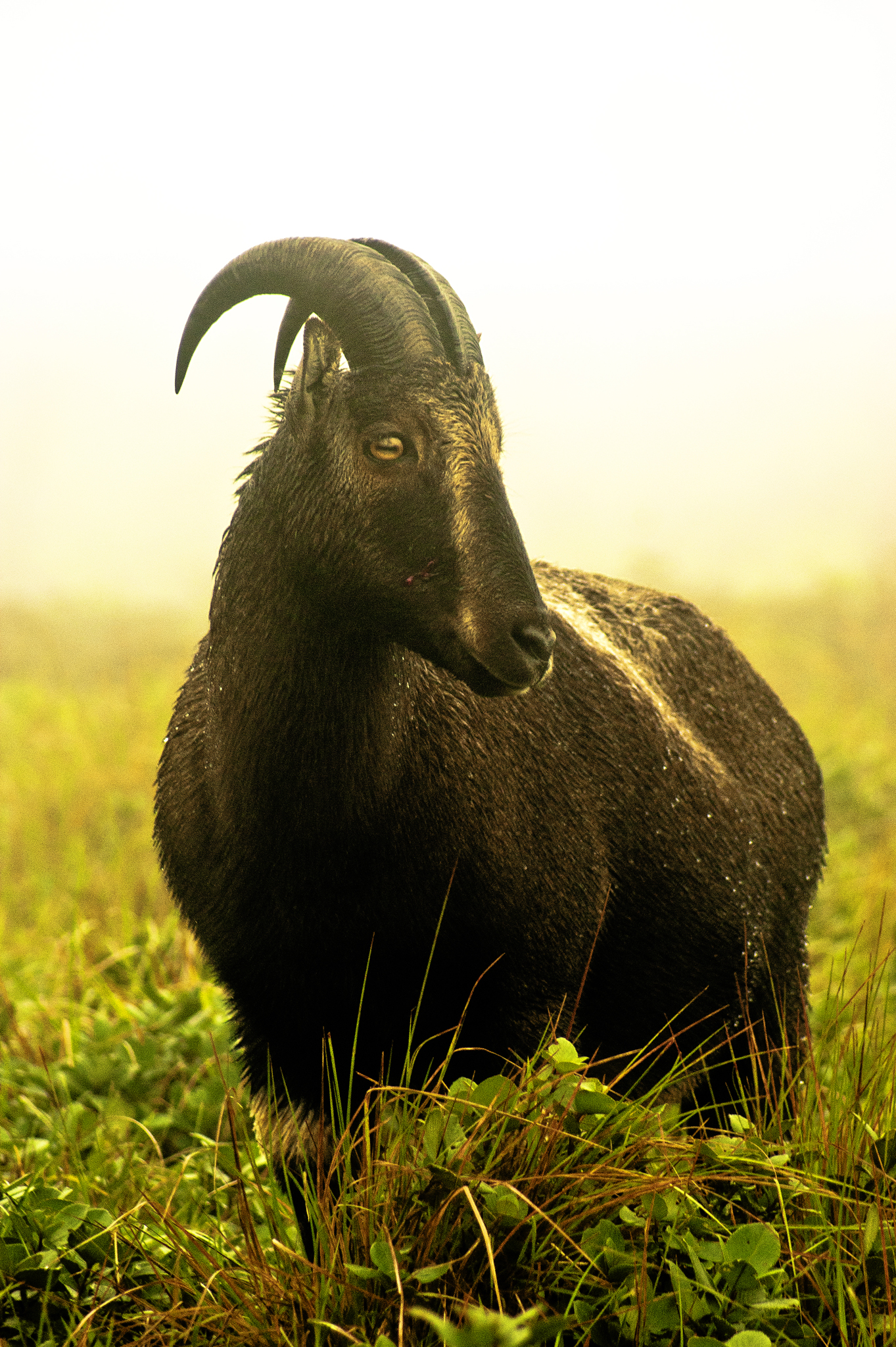
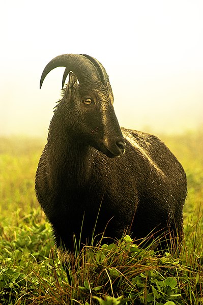
മലയാളം: നീലഗിരി താർ English: An adult Nilgiri Tahr. |
| Petsa | |
| Gigikanan | Kaugalingong trabaho |
| Tagsulat | Sreeraj PS aka Ezhuttukari |
| Camera location | | View this and other nearby images on: OpenStreetMap |
|---|
Pagtugot
I, the copyright holder of this work, hereby publish it under the following license:
This file is licensed under the Creative Commons Attribution-Share Alike 3.0 Unported license.
- Libre ka:
- sa pagsabwag – sa pagkopya, pag-apod-apod ug pagsabwag sa hinimo
- sa pag-remix – sa pag-adap sa binuhat
- Ubos sa mosunod nga mga kondisyon:
- atribusyon – Kinahanglan nimo nga hatagan ang angay nga kredito, maghatag usa ka link sa lisensya, ug ipakita kung adunay mga pagbag-o. Mahimo nimo kini buhaton sa bisan unsang makatarunganon nga paagi, apan dili sa bisan unsang paagi nga nagsugyot nga gi-endorso ka sa licensor o ang imong paggamit.
- share parehas – Kung imong gi-remix, gibag-o, o gibase sa materyal, kinahanglan nimo nga iapod-apod ang imong mga kontribusyon sa ilawom sa parehas o katugma nga lisensya sama sa orihinal.
Kaagi sa payl
I-klik ang petsa/oras aron makit-an ang hulagway sa payl niadtong panahona.
| Petsa/Takna | Thumbnail | Mga dimensyon | Tiggamit | Komento | |
|---|---|---|---|---|---|
| kasamtangan | 03:59, 19 Disyembre 2011 | | 1,363 × 2,048 (2.6 MB) | Ezhuttukari |
Mga paggamit sa payl
There are no pages that use this file.
Global nga paggamit sa payl
Kining ubang wiki naggamit ning maong payl:
- Paggamit sa ar.wikipedia.org
- Paggamit sa en.wikipedia.org
- Paggamit sa en.wikivoyage.org
- Paggamit sa en.wiktionary.org
- Paggamit sa eu.wikipedia.org
- Paggamit sa fa.wikipedia.org
- Paggamit sa fi.wikipedia.org
- Paggamit sa he.wikipedia.org
- Paggamit sa ja.wikipedia.org
- Paggamit sa ko.wikipedia.org
- Paggamit sa ml.wikipedia.org
- വരയാട്
- ഉപയോക്താവ്:Ezhuttukari/ചിത്രങ്ങൾ
- വിക്കിപീഡിയ:തിരഞ്ഞെടുത്ത ചിത്രങ്ങൾ/ഡിസംബർ 2011
- വിക്കിപീഡിയ:തിരഞ്ഞെടുക്കാവുന്ന ചിത്രങ്ങൾ/നിലവറ 12
- വിക്കിപീഡിയ:തിരഞ്ഞെടുത്ത ചിത്രങ്ങൾ/27-12-2011
- വിക്കിപീഡിയ:തിരഞ്ഞെടുത്ത ചിത്രങ്ങൾ/28-12-2011
- വിക്കിപീഡിയ:തിരഞ്ഞെടുത്ത ചിത്രങ്ങൾ/29-12-2011
- വിക്കിപീഡിയ:തിരഞ്ഞെടുത്ത ചിത്രങ്ങൾ/30-12-2011
- വിക്കിപീഡിയ:തിരഞ്ഞെടുത്ത ചിത്രങ്ങൾ/31-12-2011
- Paggamit sa pnb.wikipedia.org
- Paggamit sa ta.wikipedia.org
- Paggamit sa uk.wikipedia.org
- Paggamit sa ur.wikipedia.org
- Paggamit sa vi.wikipedia.org