
Payl:Norfolk UK location map.svg

Size of this PNG preview of this SVG file: 800 x 497 ka mga piksel. Uban pang mga resoluyon: 320 x 199 ka mga piksel | 640 x 398 ka mga piksel | 1,024 x 637 ka mga piksel | 1,280 x 796 ka mga piksel | 2,560 x 1,592 ka mga piksel | 1,425 x 886 ka mga piksel.
Tibuok resolusyon (SVG nga payl, nominally 1,425 × 886 pixels, size sa payl: 1.93 MB)
| Deskripsyon |
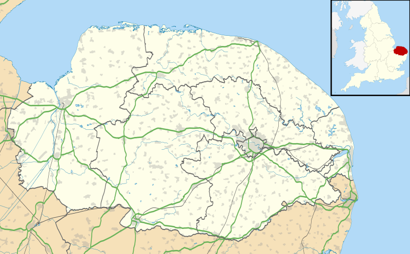
Map of Norfolk, UK with the following information shown:
Equirectangular map projection on WGS 84 datum, with N/S stretched 160% Geographic limits:
|
| Petsa | |
| Gigikanan |
|
| Tagsulat | Nilfanion, created using Ordnance Survey data |
| Pagtugot (Paggamit pag-usab niini nga file) |
This file is licensed under the Creative Commons Attribution-Share Alike 3.0 Unported license. Attribution: Contains Ordnance Survey data © Crown copyright and database right
|
| Other versions | File:Norfolk UK district map (blank).svg - Blank map |
.svg)
Kaagi sa payl
I-klik ang petsa/oras aron makit-an ang hulagway sa payl niadtong panahona.
| Petsa/Takna | Thumbnail | Mga dimensyon | Tiggamit | Komento | |
|---|---|---|---|---|---|
| kasamtangan | 19:05, 26 Septiyembre 2010 | | 1,425 × 886 (1.93 MB) | Nilfanion | {{Information |Description=Map of Norfolk, UK with the following information shown: *Administrative borders *Coastline, lakes and rivers *Roads and railways *Urban areas Equirectangular map projection on WGS 84 datum, with N/S stretched 160 |
Mga paggamit sa payl
Ang mosunod nga mga panid misumpay niining payl:
Global nga paggamit sa payl
Kining ubang wiki naggamit ning maong payl:
- Paggamit sa af.wikipedia.org
- Paggamit sa ar.wikipedia.org
- Paggamit sa bg.wikipedia.org
- Paggamit sa cs.wikipedia.org
- Paggamit sa en.wikipedia.org
- Barton Turf
- Great Yarmouth
- Wroxham
- Ingham, Norfolk
- Burgh Castle
- Horning
- Ranworth
- Blakeney, Norfolk
- Cley next the Sea
- Reedham, Norfolk
- Wayford Bridge
- Coltishall
- Dilham
- Neatishead
- Belaugh
- Woodbastwick
- South Walsham
- Martham
- Thurne
- Potter Heigham
- Caister-on-Sea
- Hunstanton
- King's Lynn
- Swaffham
- Sheringham
- St Benet's Abbey
- Loddon, Norfolk
- St Olaves
- Ditchingham
- Halvergate Marshes
- Strumpshaw
- Halvergate
- Wymondham
- Sheringham Park
- Snettisham
- Hoveton
- Salhouse
- Holt, Norfolk
View more global usage of this file.