
Payl:PUTNAM MEMORIAL STATE PARK.jpg
Gidak-on ning maong paunang tan-aw: 396 x 599 ka mga piksel. Uban pang mga resoluyon: 158 x 240 ka mga piksel | 317 x 480 ka mga piksel | 508 x 768 ka mga piksel | 677 x 1,024 ka mga piksel | 1,354 x 2,048 ka mga piksel | 3,464 x 5,240 ka mga piksel.
Tibuok resolusyon (3,464 × 5,240 pixels, size sa payl: 2.15 MB, MIME type: image/jpeg)
Mubong sugid:
| Deskripsyon |
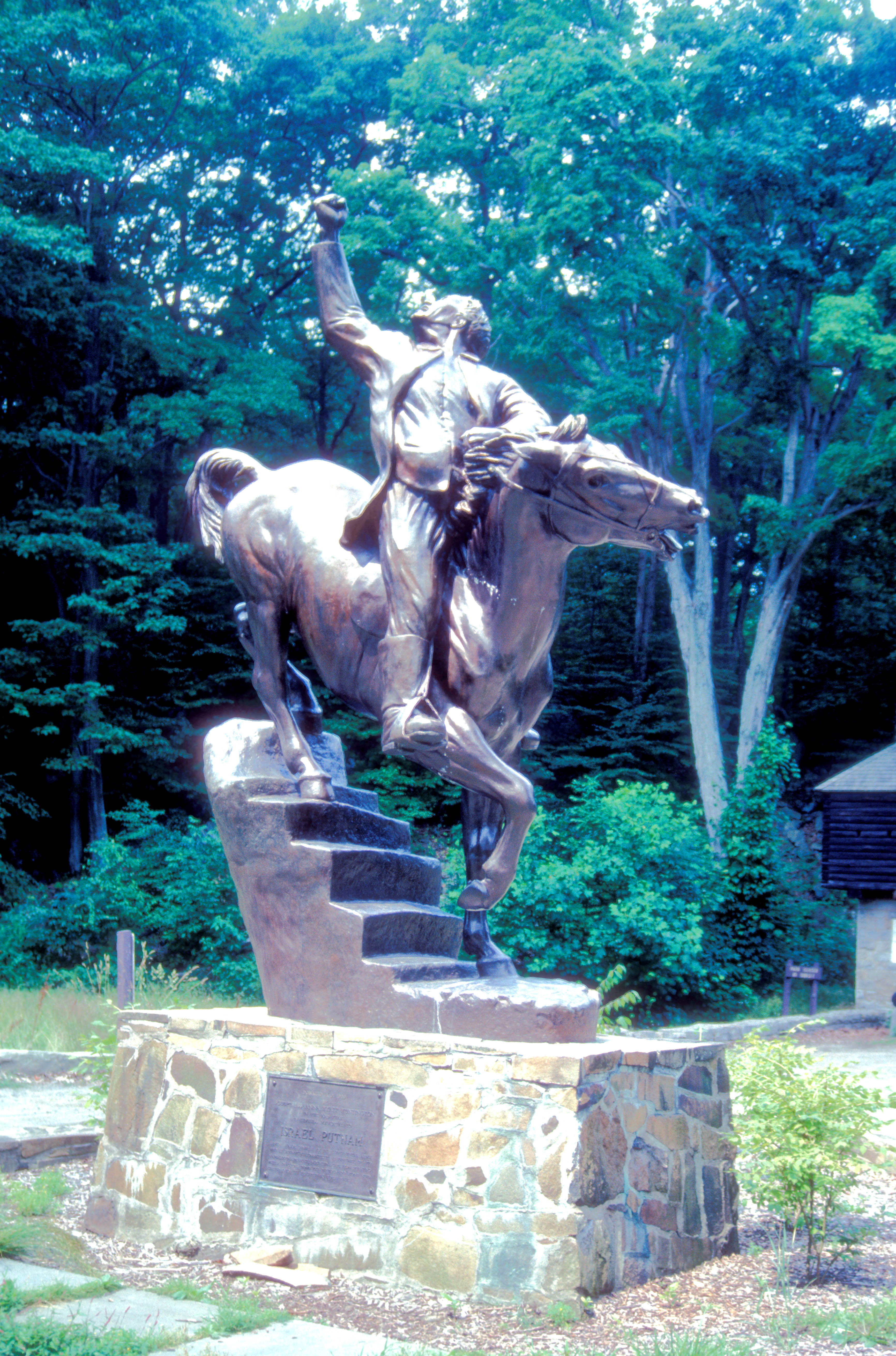
English: THIS STATUE DEPICTS PUTNAM ESCAPING BRITISH CAPTURE BY RIDING HIS HORSE DOWN A FLIGHT OF STAIRS DURING THE REVOLUTIONARY WAR
|
||
| Petsa | |||
| Gigikanan | Kaugalingong trabaho | ||
| Tagsulat | ROY KLOTZ M.D. |
| Camera location | | View this and other nearby images on: OpenStreetMap |
|---|
Pagtugot
This work is in the public domain in the United States because it was published in the United States between 1929 and 1977, inclusive, without a copyright notice. For further explanation, see Commons:Hirtle chart as well as a detailed definition of "publication" for public art. Note that it may still be copyrighted in jurisdictions that do not apply the rule of the shorter term for US works (depending on the date of the author's death), such as Canada (50 p.m.a.), Mainland China (50 p.m.a., not Hong Kong or Macao), Germany (70 p.m.a.), Mexico (100 p.m.a.), Switzerland (70 p.m.a.), and other countries with individual treaties.
|
 |
I, the copyright holder of this work, hereby publish it under the following license:
This file is licensed under the Creative Commons Attribution-Share Alike 3.0 Unported license.
- Libre ka:
- sa pagsabwag – sa pagkopya, pag-apod-apod ug pagsabwag sa hinimo
- sa pag-remix – sa pag-adap sa binuhat
- Ubos sa mosunod nga mga kondisyon:
- atribusyon – Kinahanglan nimo nga hatagan ang angay nga kredito, maghatag usa ka link sa lisensya, ug ipakita kung adunay mga pagbag-o. Mahimo nimo kini buhaton sa bisan unsang makatarunganon nga paagi, apan dili sa bisan unsang paagi nga nagsugyot nga gi-endorso ka sa licensor o ang imong paggamit.
- share parehas – Kung imong gi-remix, gibag-o, o gibase sa materyal, kinahanglan nimo nga iapod-apod ang imong mga kontribusyon sa ilawom sa parehas o katugma nga lisensya sama sa orihinal.
Kaagi sa payl
I-klik ang petsa/oras aron makit-an ang hulagway sa payl niadtong panahona.
| Petsa/Takna | Thumbnail | Mga dimensyon | Tiggamit | Komento | |
|---|---|---|---|---|---|
| kasamtangan | 17:14, 17 Nobiyembre 2012 | | 3,464 × 5,240 (2.15 MB) | Ras67 | losslessly cropped with Jpegcrop, GPS data added |
| 00:24, 11 Oktubre 2012 |  | 3,946 × 5,782 (2.5 MB) | KLOTZ | User created page with UploadWizard |
Mga paggamit sa payl
Ang mosunod nga mga panid misumpay niining payl:
Global nga paggamit sa payl
Kining ubang wiki naggamit ning maong payl:
- Paggamit sa de.wikipedia.org
- Paggamit sa en.wikipedia.org
- Paggamit sa es.wikipedia.org
- Paggamit sa www.wikidata.org