
Payl:Polebrook Village - geograph.org.uk - 108265.jpg
Walay mas taas nga resolusyon.
Polebrook_Village_-_geograph.org.uk_-_108265.jpg (640 × 480 pixels, size sa payl: 50 KB, MIME type: image/jpeg)
Mubong sugid:
| Deskripsyon |
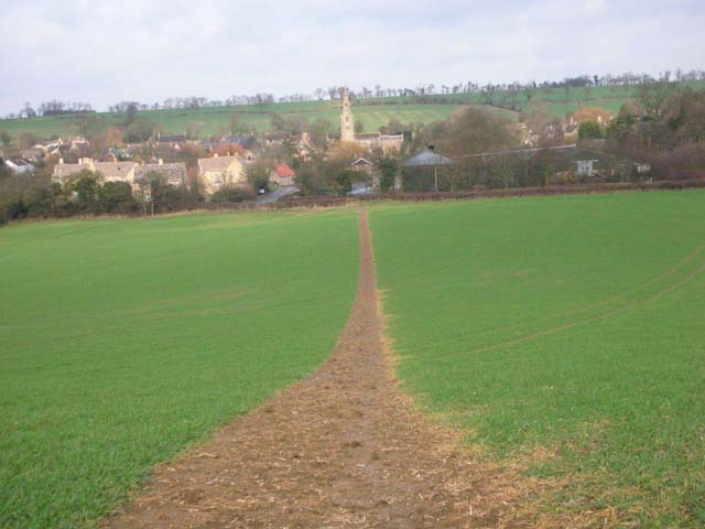
English: Polebrook Village. Looking north down the hill to Polebrook. The nearest part of the village is in TL0686 but the Church is just over the grid line in TL 0687. The farmer here always restores his footpaths promptly. The crop is winter wheat. |
| Petsa | |
| Gigikanan | From geograph.org.uk |
| Tagsulat | Will Lovell |
| Attribution (required by the license) | Will Lovell / Polebrook Village / |
| Object location | | View this and other nearby images on: OpenStreetMap |
|---|
_&language=ceb)
Pagtugot

|
This image was taken from the Geograph project collection. See this photograph's page on the Geograph website for the photographer's contact details. The copyright on this image is owned by Will Lovell and is licensed for reuse under the Creative Commons Attribution-ShareAlike 2.0 license.
|
This file is licensed under the Creative Commons Attribution-Share Alike 2.0 Generic license.
Attribution: Will Lovell
- Libre ka:
- sa pagsabwag – sa pagkopya, pag-apod-apod ug pagsabwag sa hinimo
- sa pag-remix – sa pag-adap sa binuhat
- Ubos sa mosunod nga mga kondisyon:
- atribusyon – Kinahanglan nimo nga hatagan ang angay nga kredito, maghatag usa ka link sa lisensya, ug ipakita kung adunay mga pagbag-o. Mahimo nimo kini buhaton sa bisan unsang makatarunganon nga paagi, apan dili sa bisan unsang paagi nga nagsugyot nga gi-endorso ka sa licensor o ang imong paggamit.
- share parehas – Kung imong gi-remix, gibag-o, o gibase sa materyal, kinahanglan nimo nga iapod-apod ang imong mga kontribusyon sa ilawom sa parehas o katugma nga lisensya sama sa orihinal.
Kaagi sa payl
I-klik ang petsa/oras aron makit-an ang hulagway sa payl niadtong panahona.
| Petsa/Takna | Thumbnail | Mga dimensyon | Tiggamit | Komento | |
|---|---|---|---|---|---|
| kasamtangan | 01:06, 31 Enero 2010 | | 640 × 480 (50 KB) | GeographBot | == {{int:filedesc}} == {{Information |description={{en|1=Polebrook Village. Looking north down the hill to Polebrook. The nearest part of the village is in TL0686 but the Church is just over the grid line in TL 0687. The farmer here always restores his fo |
Mga paggamit sa payl
There are no pages that use this file.
Global nga paggamit sa payl
Kining ubang wiki naggamit ning maong payl:
- Paggamit sa en.wikipedia.org
- Paggamit sa fa.wikipedia.org